Category: Nepal


Dudh Kund Pokhari

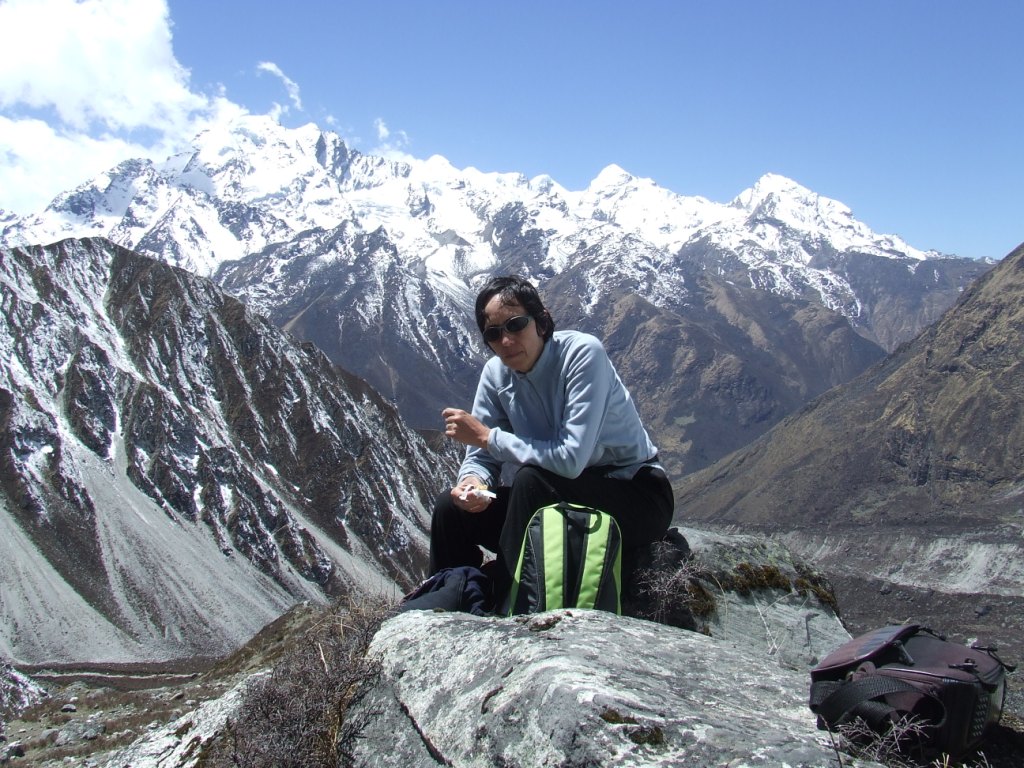
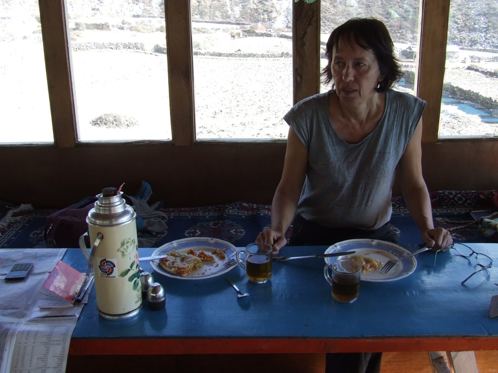
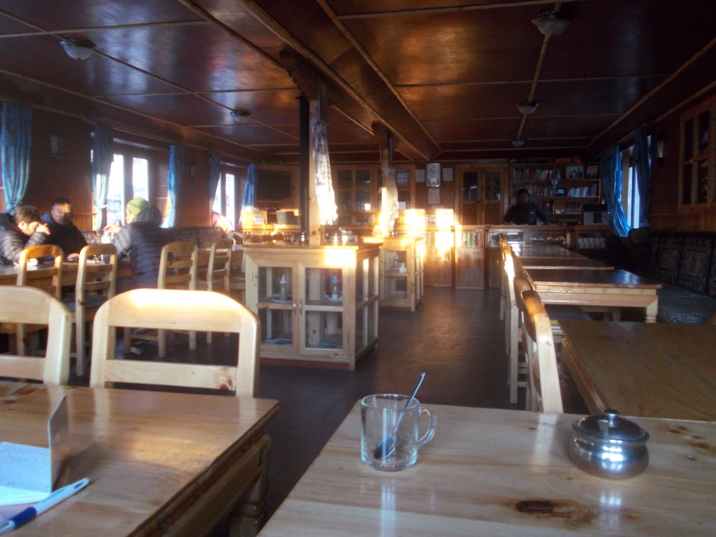
Click on photos to enlarge them

From 13  to 27 May 2016
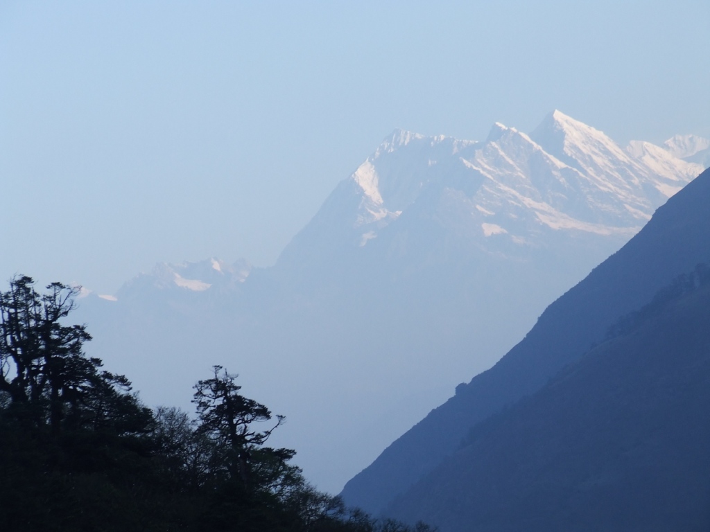
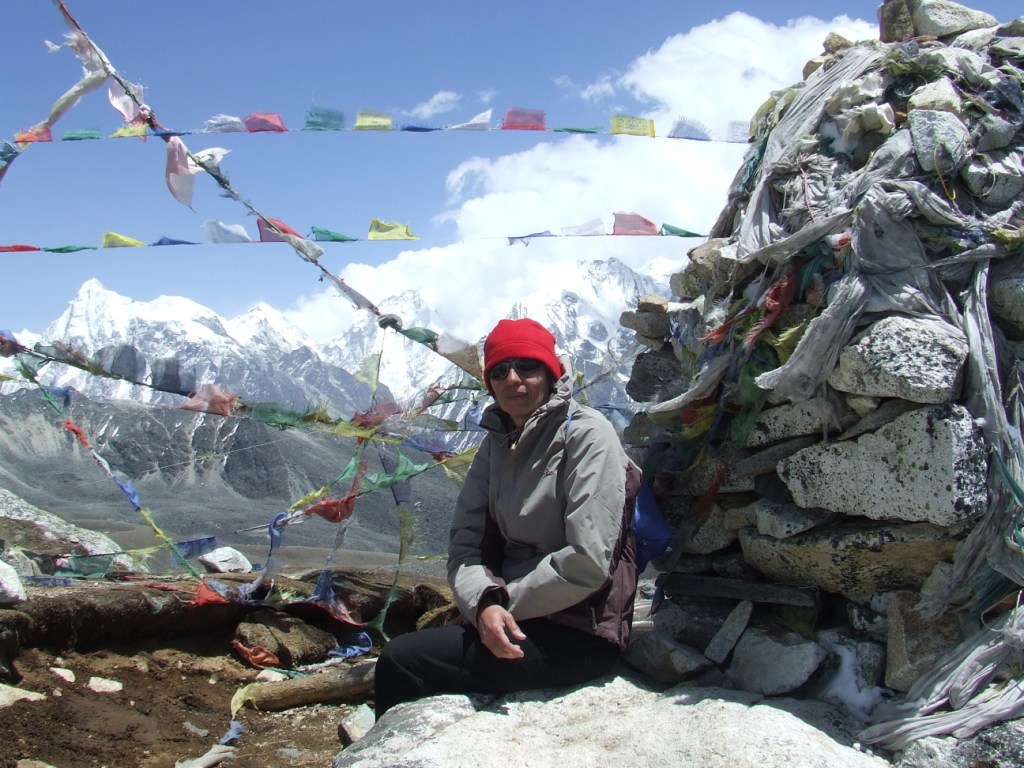
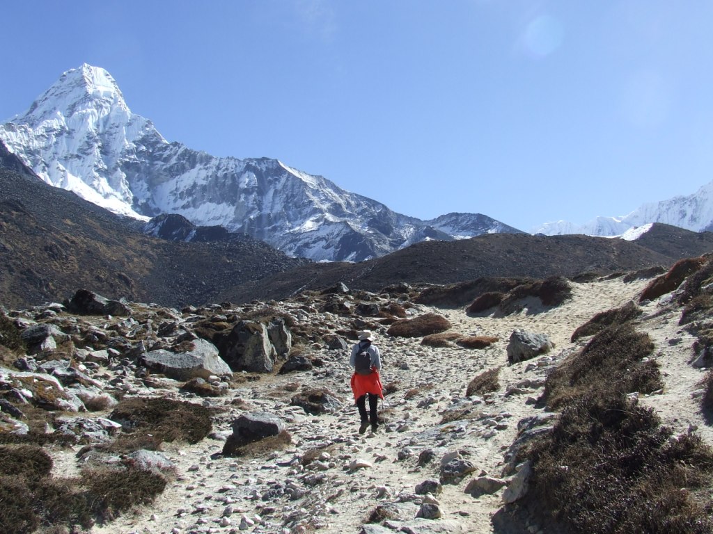
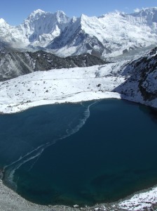
General feelings

This adventure in the mountains had some ambitions:

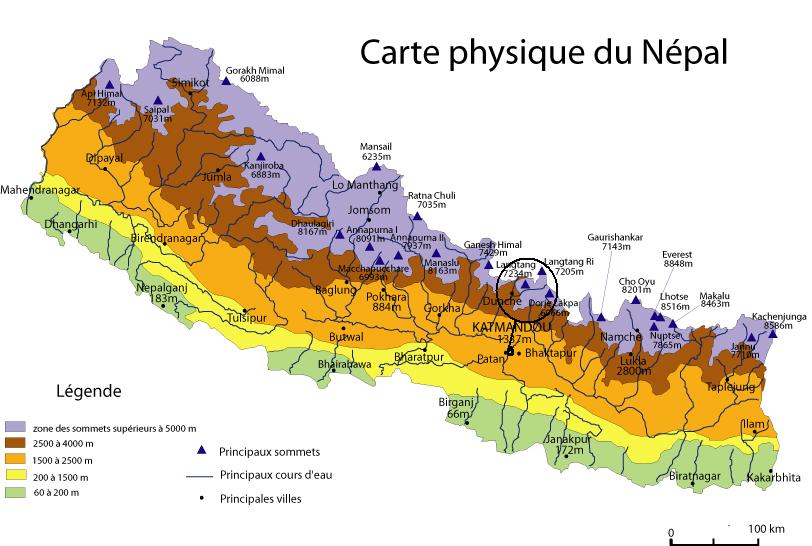
  • To leave Khanbari, the big city of the Sankuwasabha district in the northeast of Nepal, joining the Solu to return to Kathmandu by Salleri in jeep.
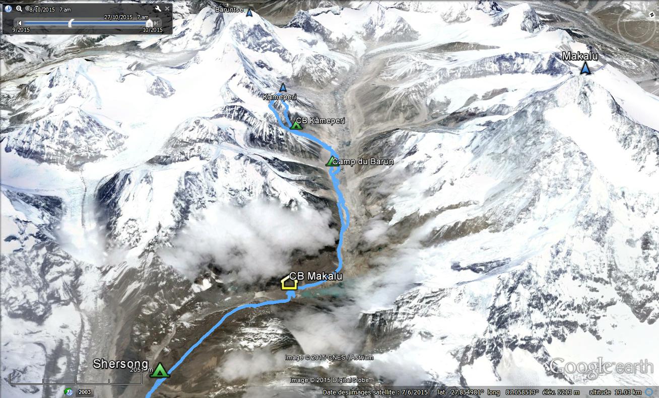
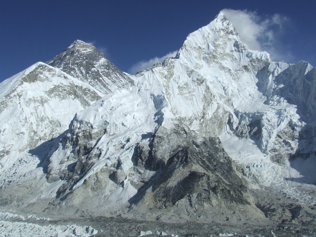
  • To go, according to our physical fitness, towards Kongde and Dudh Kund and try the ascent of a small 6000.

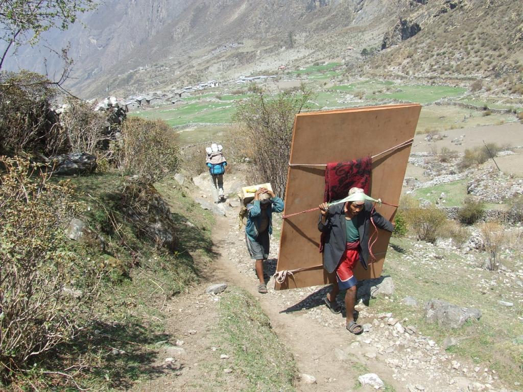
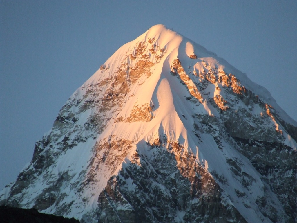
But it is necessary for it to accumulate the numerous ascents: 13 877 meters, more than 44 Eiffel Towers and descents, sometimes vertiginous. We had neglected the necessary efforts to enter into the Solukhumbu, at the heart of the Sherpa Country .

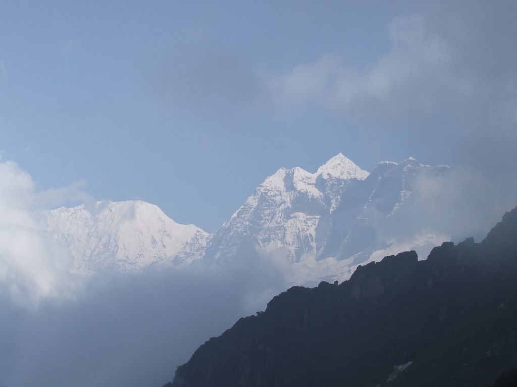
The good weather will not be there everytime and the rain will prevent us from benefiting, sometimes, from the beautiful panoramas.

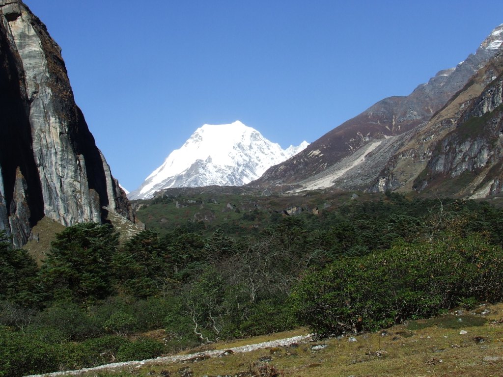
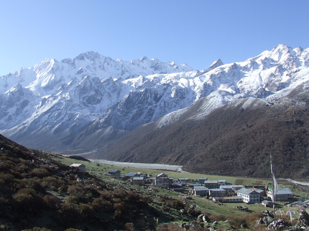
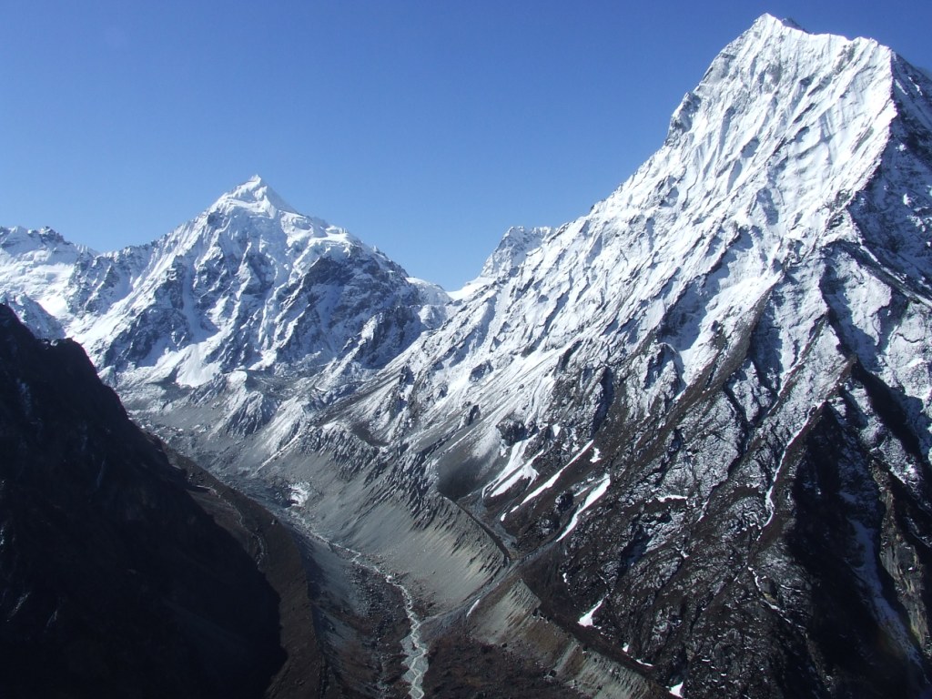
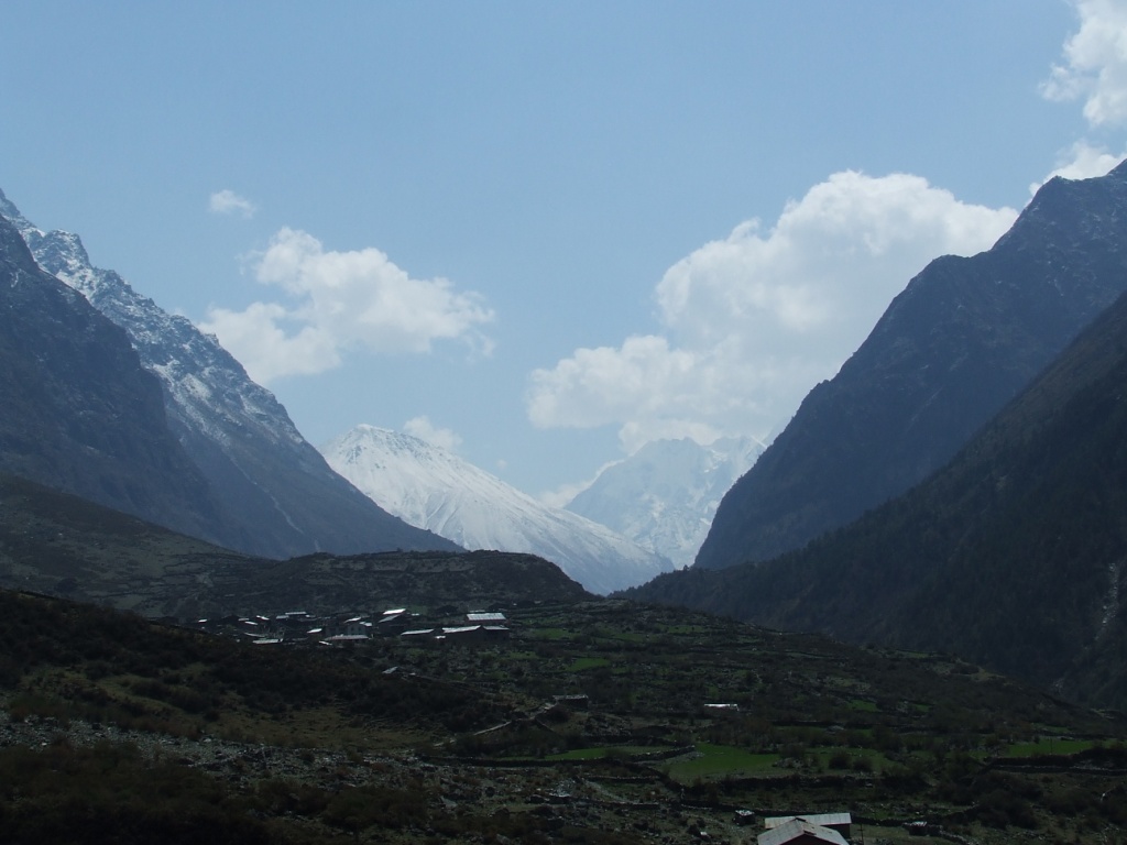
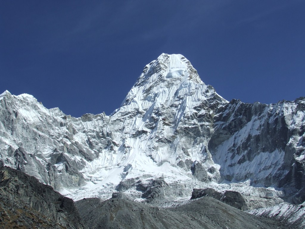
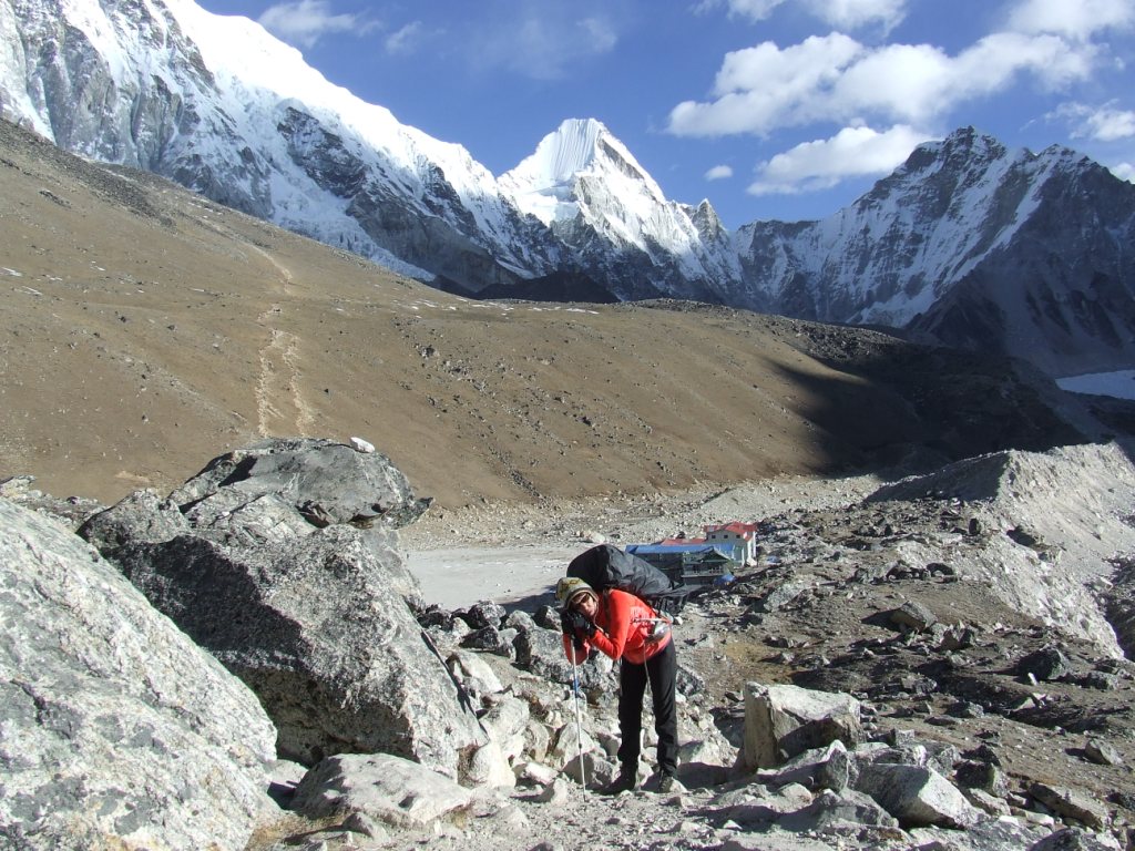
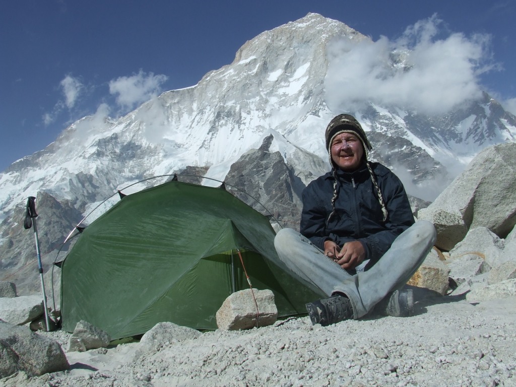
Carrying the tent, the burner, petrol and the food all the route for three small days of autonomy is to pay an heavy tribe. The freedom has its price and we will be rewarded by the magnificent landscapes of Dudh Kund. The low cloud ceiling will unfortunately condemn any attempt of ascent. That will happen another time!

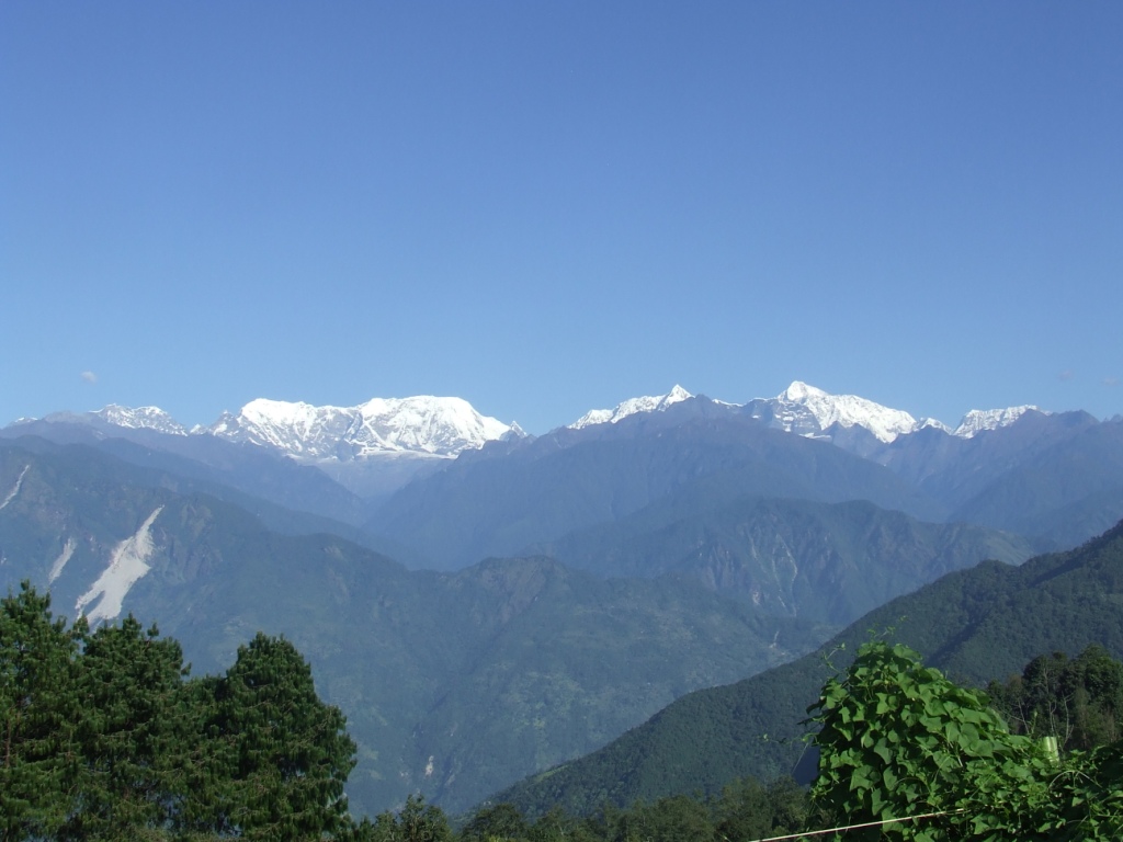
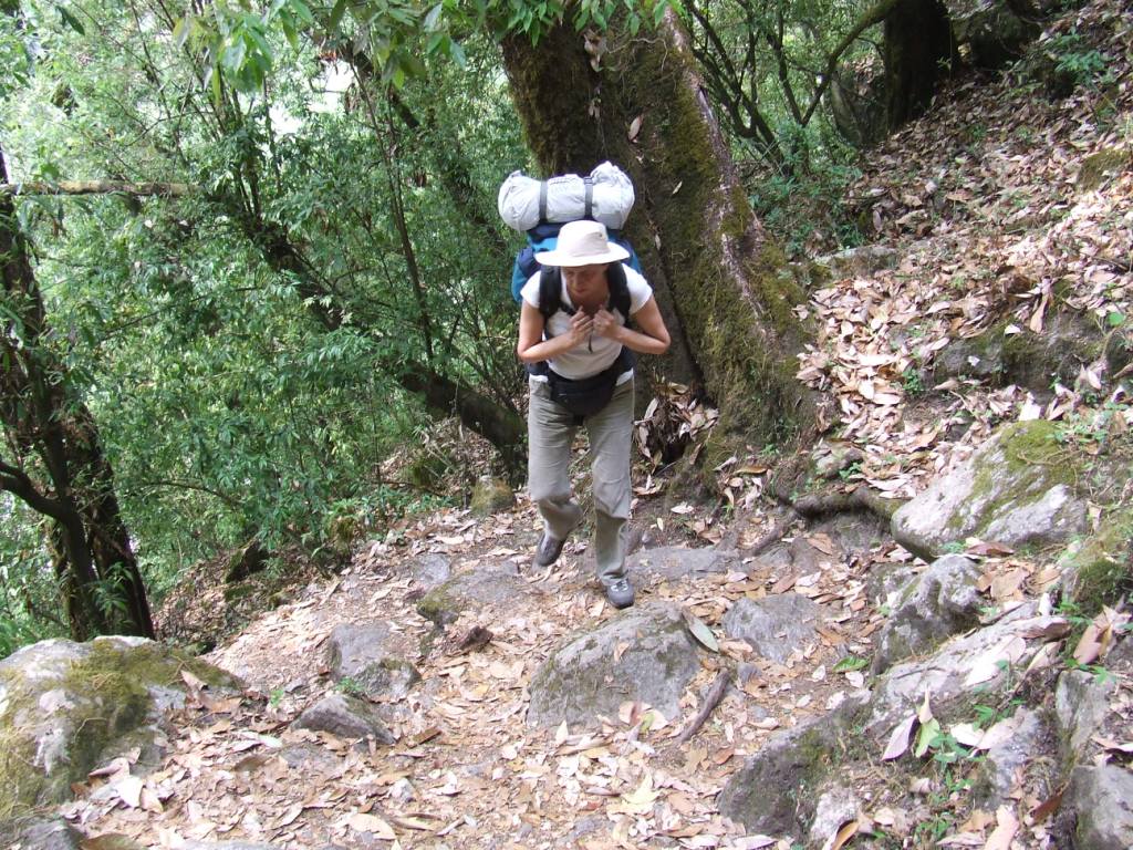
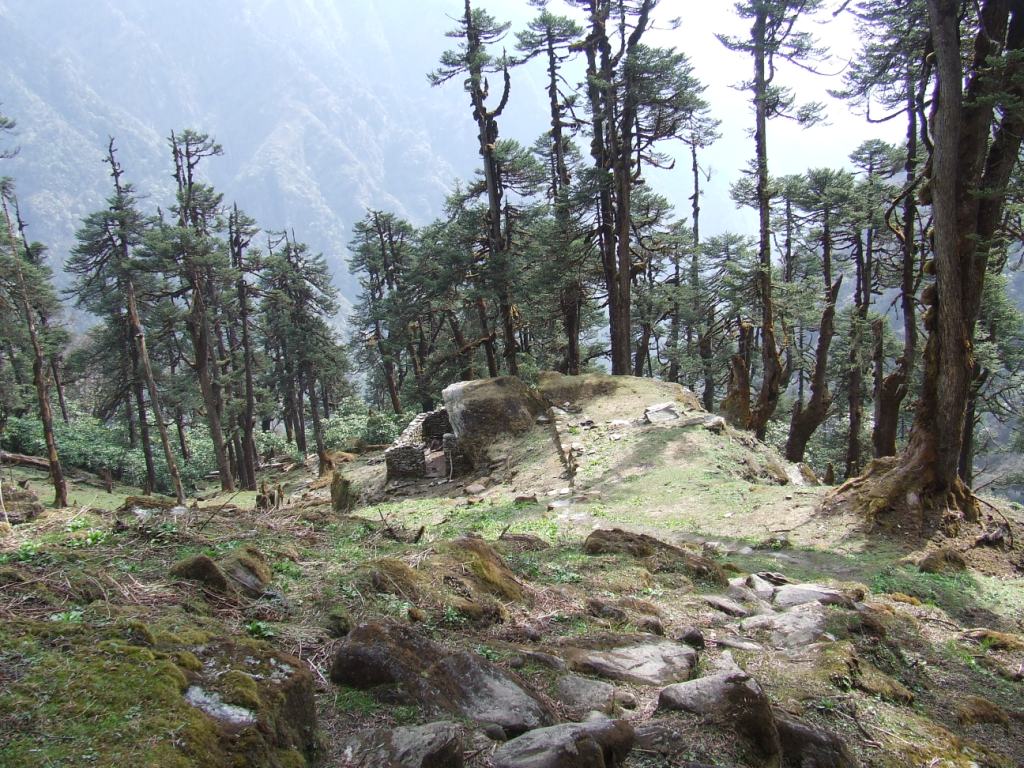
The numerous rhododendrons forests let expect multicolored sights at spring. This period is to be favored without hesitation!

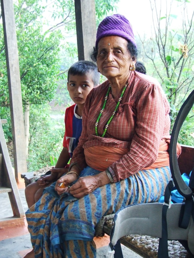
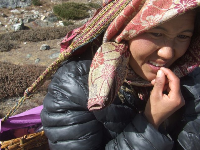
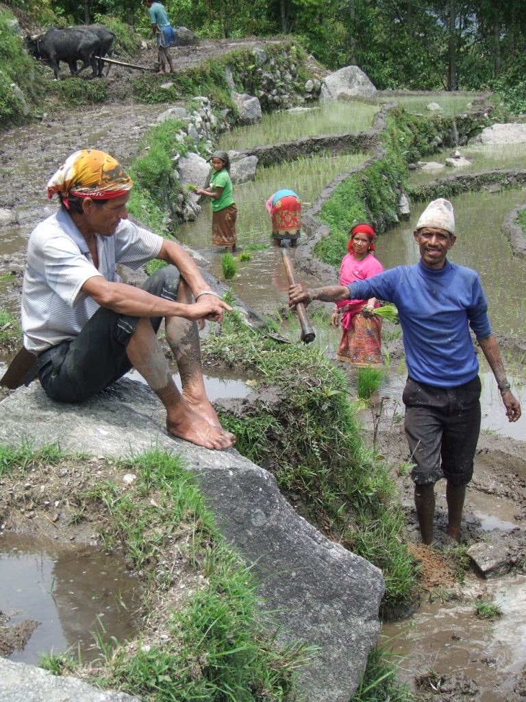
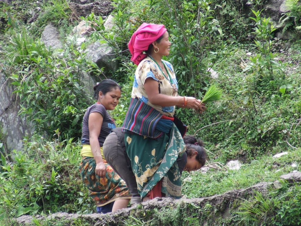
However, these 15 days will have allowed us to discover magnificent villages, outside main roads, in basic conditions sometimes, but always welcomed with broad smiles and this sense of hospitality from people who do not know the superfluous.

Preparation:

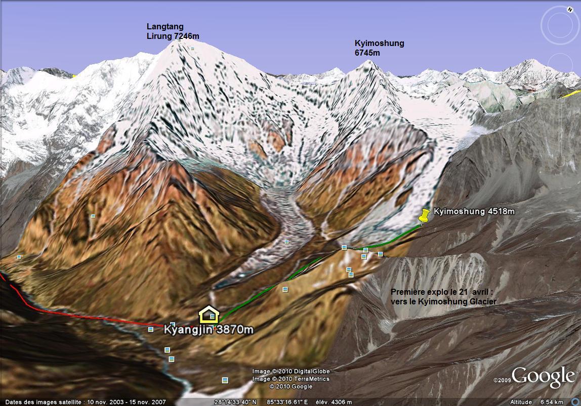
On Google Earth, with Lonely Planet and Voyage Forum. A question did not receive any answer: how to go towards the Kongde base camp is a mystery for us to be clarified. If you know, we would be pleased to learn!

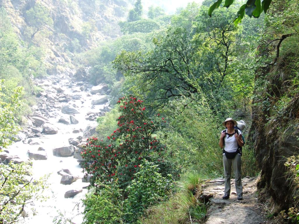
Bags are less loaded that usually because we take a minimum of food (2.25Kg). We plan to get supplies at the closest places from the segments where we will be in complete autonomy. We will not find cheese in the various shops. We will content ourselves with Chinese noodle soups and with biscuits.

15.6 Kg for me and 9.5 kg for Sylvie, including the Easton 1Kg tent which will hang on during the snowstorm on Camp 1: it held correctly but ties on the double roof unstucked with the humidity, the next day in Dudh Kund! evident manufacturing defect! We will see how  the retailer reacts… Because of this defect, we would have to give up going farther!

Stove MSR XGK EX: the pump was replaced after the breakdown of October, 2015 at 5473 m. With 500ml of gasoline given in Khandbari (take care, gasoline is sold only in Tumlingtar).

Shall we eventually find reliable equipments? High prices and marks do not seem to be the panacea.

Mattress: Thermarest Néoair XLIT – Very useful

Sleeping bags: Valandré Bloody mary

Access and Budget

Oman Air is the best  and  lowest offer this year with a round trip for 475€  with a good service and short stopovers.

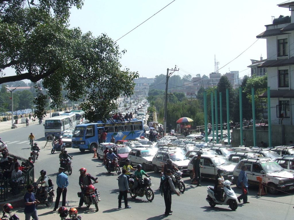
Internal flight to Tumlingtar with Yeti Airlines at 123 USD the one-way trip. With no problem at all. Return to Kathmandu from Phaplu in jeep. 11 hours, 1500Rs / person. Departure at 5:30am. Purchase of places in the lodges close to the Phaplu airport. The road is very beautiful on a long part of the route. We arrive (we have to leave also the same place) to the point 27.718078 85.347132, close to the Tribhuvan airport and to the Buddhanath. Advise: buy 1 additional place to avoid being 4 on a seat for 3.

Less than 900€ spent on 30 days, included souvenirs. Between 1500 and 4000Rs a day for two. The prices indicated in the logbook will be generally given for two people.
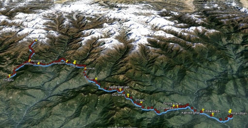
Situation

Situation trek Khandbari Phaplu

Timetable

agenda trek Khandbari Phaplu

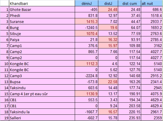
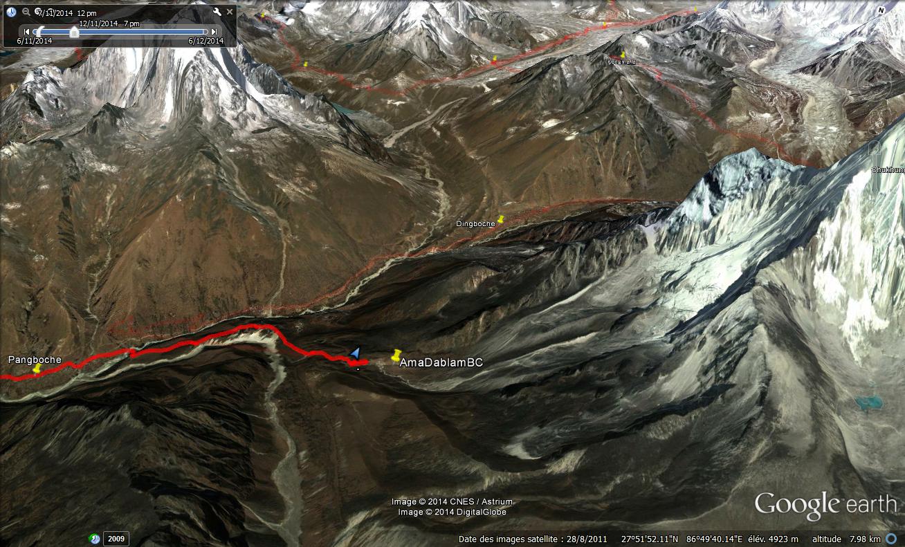
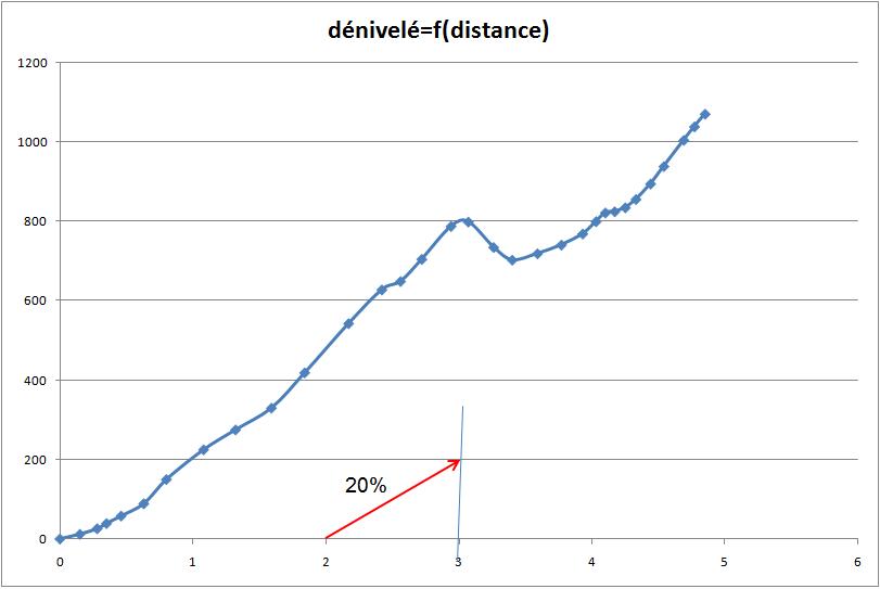
Altitude depending on distance

altitude distance trek Khandbari Phaplu

Altitude at Night

altitude soir trek Khandbari Phaplu

Daily Height Difference 
dénivelés jour trek Khandbari Phaplu

This year, the daily cumulated altitude differences are calculated from the GPS traces. The main difficulty of this trek consists in the ascents and descents for crossing the valleys.

GPS Traces et waypoints:

Traces are defined with a point for 30m to avoid the saturation of the GPS memory. They are in free access on Wikiloc, with some significant waypoints, indicated in this logbook. All Waypoints are given in an Excel sheet  in GPS/tableur Spreadsheets

Our new GPS GARMIN ETREX 10 is great. It uses fewer batteries than the precedent: 2 AA approximately every 5-6 days. It can be linked with the computer to copy the traces and waypoints.

The waypoints on the excel sheet were corrected after the trek, where it was necessary. The distances between waypoints are on the other hand approximate. The daily distances are exact. Finally, and as usual, our paths are not necessarily the best. They can change in time, the collapses and the construction of new roads. All trekkers remain responsible for their own routes.

To be noted:

The new road after Kattike Ghat go by an unnecessary pass. It must be possible to by-pass it by going along the Irkhuwa valley,  as it is indicated on the map (Jiri Pikey Peak 1:125 000).
We voluntarily avoided the center of Bung, by-passing it by the right.
We followed the indications on the map by going from Panggom to Taksindu via Bupsa. It’s a big mistake because this route requires half an additional day of walking in inconfortable ascent. Unless going to Lukla, the best is to come down directly towards Karikhola from Panggom. The track is physically visible, but absent on the map!

Logbook:

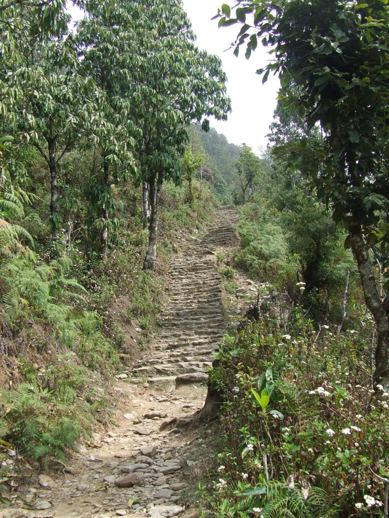
Friday 13th May, From Khandbari to Chalise (970m) wp K14

Awake 5h15, t=21°c, departure 7h15, Arrived 17h, 22km in 9h45, cumul ascent 1160 m, cumul descent 1398 m

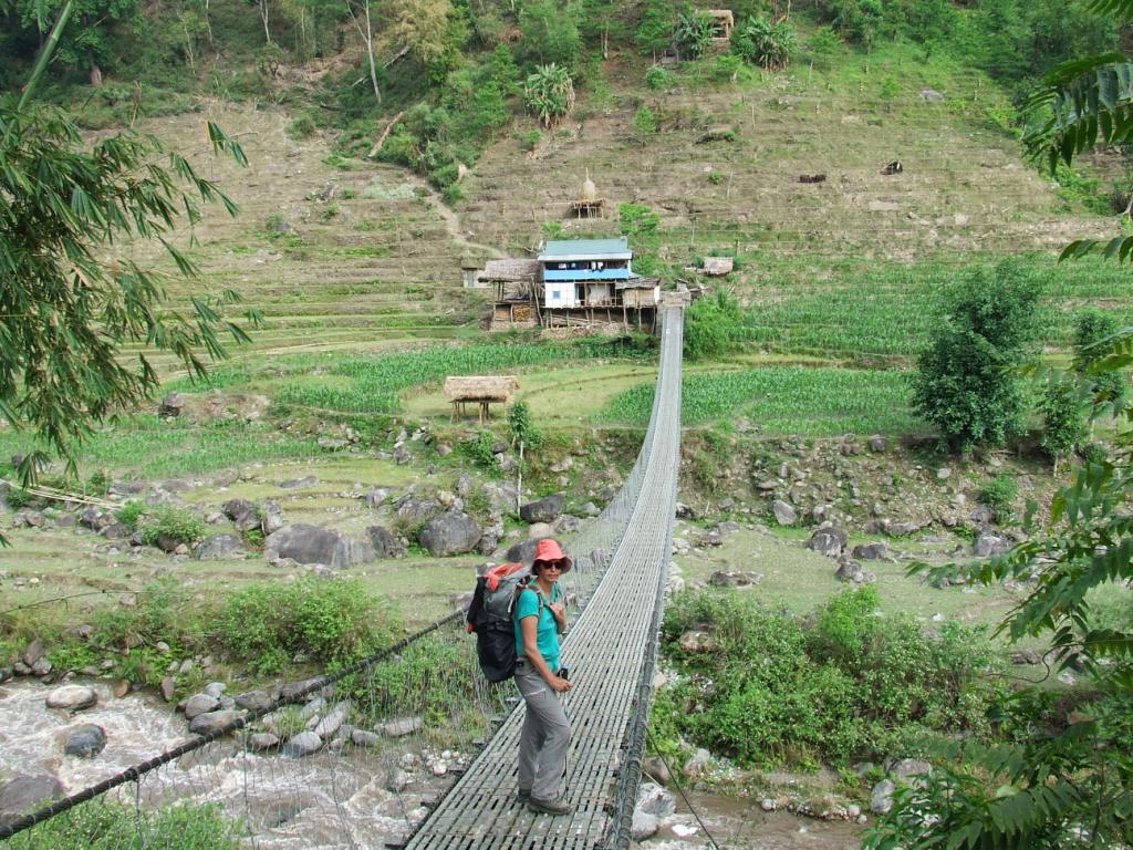
This is not so simple to go out of a city by foot from a small track, even with the GPS. Our friends in Khandbari suggested  to putting us on the good path. But it is a question of pride… We also want to escape in the early hours to walk as much as possible without rain. After some hesitations, we begin the big descent towards the Arun river. We join a track which has to connect Tumlingtar to the upstream of Arun (probably on the bank, opposite to Kattike, just before the monkey bridge which drives to this village).
Solu 2016 joli maison vers Kattike

We cross very beautiful villages and find sometimes small restaurants. A drizzle begins to fall by 9:30 am which stops also quickly. The way is pleasant and we lunch in Kattike, on the other bank of the Arun. We understand there would be 3 jeeps a day until Ghote bazar (one-way trip at 500 Rs ?). The only jeeps we see have their hoods wide open and they seem to have given up their ghost. We don’t moreover know from where they can come. We continue by foot and, as usual when a new road has been opened, the track is difficult to find. To follow the road would mean making considerable detours. Solu 2016 descente vers l'Arun
Solu 2016 rizière vers Chalise

We cross an unforeseen pass at 928m. We did not find any alternative, that one, in particular, which was to follow the left bank of the Arun then of the Irkuwa khola. We stop at Chalise. The first house, in the entrance of the small village, offers the hospitality. There is no guesthouse here. We take a basic shower with the small water pipe, in the garden. And this evening, it will be dalbath, of course. (800Rs with the overnight stay and Tibetan tea)

Solu 2016 incontournable dalbath à Chalise       Solu 2016 proprio de Chalise

Saturday 14th May, from Chalise to Tendo (1372 m)

Awake 5h30, t=20°c, depart 6h30, Arrived 17h, 16.5km in 10h30, cumul ascent 1194 m, cumul descent 617 m

Solu 2016 vers Tendo

It rained a large part of the night and it is only at dawn that the drumming of drops on the roof sheet steel stopped. The weather is clear at the sunrise. We have a Tibetan tea for the breakfast and we finish the rests of the day before: bananas and rootis. The way rises at first regularly. It is necessary to be careful to cut the new road at the good moment to avoid endless detours. We quickly arrive to the village preceding Gothe bazar, Tabutar. This is, in fact, the terminus of the 4-wheeled vehicles. We are happy to leave this kind of civilization. There is a nice guesthouse in Gothe bazar, the first one since Kattike. After Gothe bazar, the way becomes a narrow track. We stop several times to take a tea or a mango juice in small taverns.

Solu 2016 vers Tendo 3Solu 2016 vers Tendo 2Solu 2016 vers Tendo 4

We arrive to Tendo under a flood of rain. Fortunately, we find a kind soul to welcome us: there is not of guesthouse in this village and before Phedi.

Sunday 15th May, from Tendo to Djobari (2215 m) wp62

Awake 5:50, t=18°c, departure 7:10, Arrival 12h, 4.2km in 4:50, cumul ascent 931 m, cumul descent 75 m

It rained all night long and it’s always raining upon awakening. We do not hurry. Furthermore, we are tired by the previous two days of walking. The rain stops during the breakfast (tea and biscuits). It takes less than one hour and a half to join Phedi where there is two lodges in the entrance of the village. We do not take the precaution to fill our bottles of water before the big ascent and we will have to beg water on the way. We arrive at Djobari early but we decide to take some rest in a small lodge the owner of which it is necessary to find before being able to settle down. We are rewarded for the efforts of the morning with a beer and biscuits for the lunch.

The school is in reconstruction close to the lodge. The damages are probably a consequence of the April, 2015 earthquake. Many houses are damaged, padlocked or in reconstruction on the road. The villagers assemble its frame while the children attend their class in a temporary building. The class is disrupted by our arrival and we are transformed into local and improvised entertainment.


Solu 2016 vers Djobari 1

Solu 2016 vers Djobari 2Solu 2016 vers Djobari 3

Monday 16 May, from Djobari to Salpa (3357m) wp67

Awake 5:40, t=15°c, departure 7:20, Arrival 3:45, 8.4 km en 8h30, cumul ascent 1394 m, cumul descent 247 m

Solu 2016 vers Salpa 1

First change of batteries for the GPS. The weather is correct this morning and we take our time for the breakfast with tea and biscuits bought to the store of the lodge. I pay 1800Rs for all: night, beer, dalbath, apple spirit, biscuits, mango juice and tea.

The village extends in height and we discover another lodge, more centered, with a real restaurant. We’ll not find more water before Salpa as we pass by long crests and the soil becomes sandy.

Solu 2016 vers Salpa 3

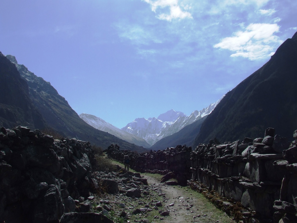
At middle way (place called Kharka on the map), we go on by the right, according to the advice of several locals and against the indication of the GPS. This detour makes us pass by the lake while the map indicates a main way directly to Salpa. It has maybe disappeared in a collapse? A thunderstorm surprises us at the beginning of the detour and we just have time to protect ourselves in a hut-cowshed. We hesitate to return towards the abandoned village (Kharka) or to try our luck towards the lake to camp, less than a kilometer from there in theory. We cross an impressive rhododendrons forest. Some are still in bloom. The view must be magic in spring.

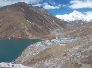
We have no more than one liter of water when we discover, instead of a lake, a totally dry basin on a sandy bed with some huts (WP65). It is almost 3 am. Impossible to stay. A local indicates that Salpa is just on the other side of an almost vertical pass. We decide to go. The sacred lake is on the other side of the pass, reached in half an hour. It is incised and offers no panorama. Some workers work on the arrangement of its sacred banks. The lack is invaded by mists and does not tempt us to establish a camp there.

Solu 2016 vers Salpa 4 Solu 2016 vers Salpa 5

We discover Salpa, based on a crest. The village seems abandoned and there is no tap water. Salpa seems to have for only vocation to welcome the pilgrims. There is fortunately an open building. The owner offers us the shelter in a very basic shed where will pile up porters and her family during the night.

Tuesday 17th May, from Salpa to Gudel (1975 m) wp70

Awake 5:45, t=6°c, departture 7:15, Arrival 3:45pm, 14.7 km in 8h30, cumul ascent 337 m, cumul descent 1691 mSolu 2016 vers Gudel

The night was interrupted by noisy arrivals of porters. We gave up blanquets, openly sticky. The owner, remaining a businesswoman, asks us 1800Rs of which 1200Rs for the dalbath!

Alerted in the early hours by more or less harmonious sounds, we attend a procession leaving from the big gompa in front of our shelter, led by a young man who wears a feathers headdress . I am surprised, seeing the pilgrims taking him in video and in photos (I make nothing else).

Long life to all religiosities when they do not incite either to the hatred or to the violence!

It was not question of the slightest toiletry in Salpa and we stop near a torrent to wash ourselves and for a small laundry. Wp68. The sun is with us for our happiness. This hillside is also very bucolic, papered with rhododendrons.

Solu 2016 vers Gudel 2

Solu 2016 vers Gudel 1

A rusty panel indicates Sanam and an inhabitant recommends us to continue in this direction. We prefer to go on by the valley to avoid a new useless pass. The way in the valley is less taken and sometime more difficult to find. The weather remains clear until 2:30 pm, as a Chilean doubles us as a racing car. It is our first trekker in 4 days and even the first one since we are in Solu and Makalu.

A thunderstorm arrives while we discuss. Panchos, frequently used up to there, areuseless because of the violent wind. It is time to arrive to Gudel before being dipped. The lodge which opens to us, Kopila Guesthouse, is perfectly clean. Never seen at this point before!

Wednesday 18th May from Gudel to Khiraule (2539 m) wp72

Awake 5:30, t=14°c, departure 6:40, Arrival 5:30pm, 9.4 km in 10h50, cumul ascent 1264 m, cumul descent 712 m

Solu 2016 vers Kiraule 5

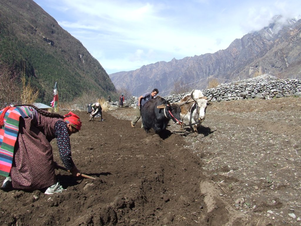
Everything began correctly with a breakfast as worthy as in Khumbu. Sylvie is brutally struck by a tourista while we begin the descent. We stop in emergency for half an hour. The rhythm of the walking will feel the effects of it during the day. We abandon the main path to avoid the center of Gudel by going on the left (would be better to try by the right). The crossing of the small hamlets is very nice but the path often gets lost in the terraces of the fields. We ask several times for our direction to the inhabitants, a little bit surprised seeing us walking there…

Solu 2016 vers Kiraule 1Solu 2016 vers Kiraule 4

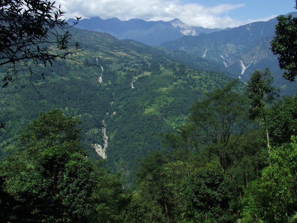
We stop for the lunch in a magnificent lodge: Panch Pokhari Lodge wp71. We take our time (1:30) to appreciate this luxurious place. We are far from the Makalu basic stopping places. We complete our endless rise towards Khiraule, slowly and by enjoying the tranquillity and the bucolic charm of the region. A small paradise opens to us and we stop more often than to get back our breath, to take advantage of what the way offers.

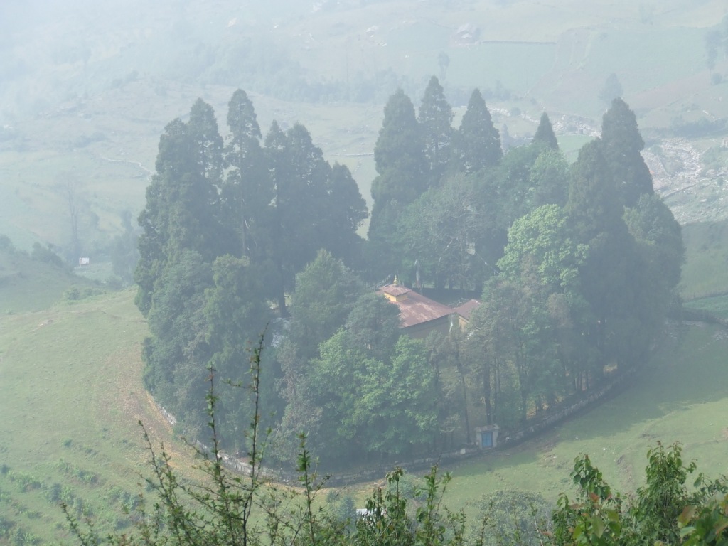
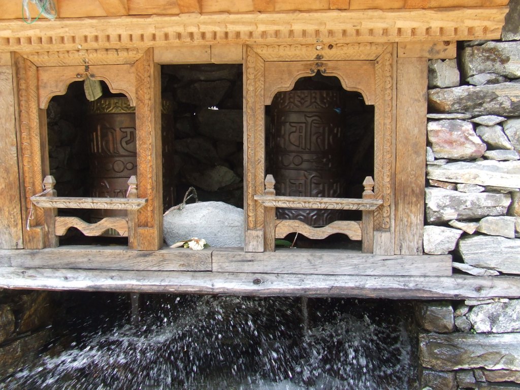
We arrive late at the lodge. it is adjacent to a temple in the circular temenos, composed of manis and lined with old pines. Magnificent!

Solu 2016 vers Kiraule 6

The night has felt when we go out of the dining room, fed of dalbath and raksi. The panorama, as far as go our looks, is papered with small lights, so many houses, as stars, uncountable. The place is silent and inhale the serenity. We didn’t rose for nothing.

The night is a bit expensive, 500Rs, but as we are near the Paradise, it doesn’t matter.

thursday 19th May, from Khiraule to Inkhu khola (1982 m) wp74

Awake 6am, t=8°c, departure 8am, Arrival 3:15pm, 8.3 km en 7h15, cumul ascent 615 m, cumul descent 1136 m

Solu 2016 vers Inkhu khola 1

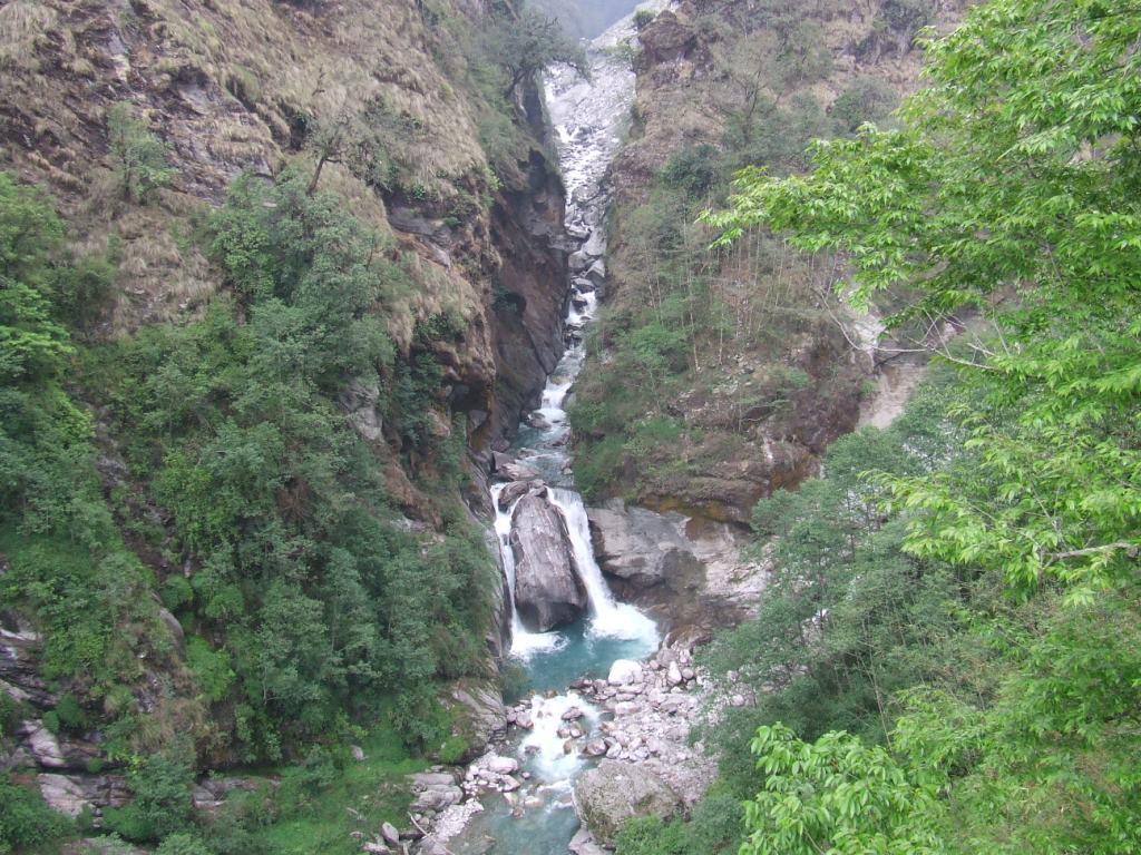
It rained a large part of the night after the sunny day of yesterday. This morning is cloudy and we have to join two impressive stupas which guard the pass. We cross fog patches. The descent towards Inkhu khola is difficult. We cross Nadjingsur, in a plateau, which possesses three correct lodges. We arrive to the bridge at about 3 pm and we have no courage to raise the 700m reaching Sibuje. We find a rustic lodge just after the bridge possessing a shower! (1800Rs for dinner, bed and breakfast)

Solu 2016 vers Inkhu khola 2Solu 2016 vers Inkhu khola 3

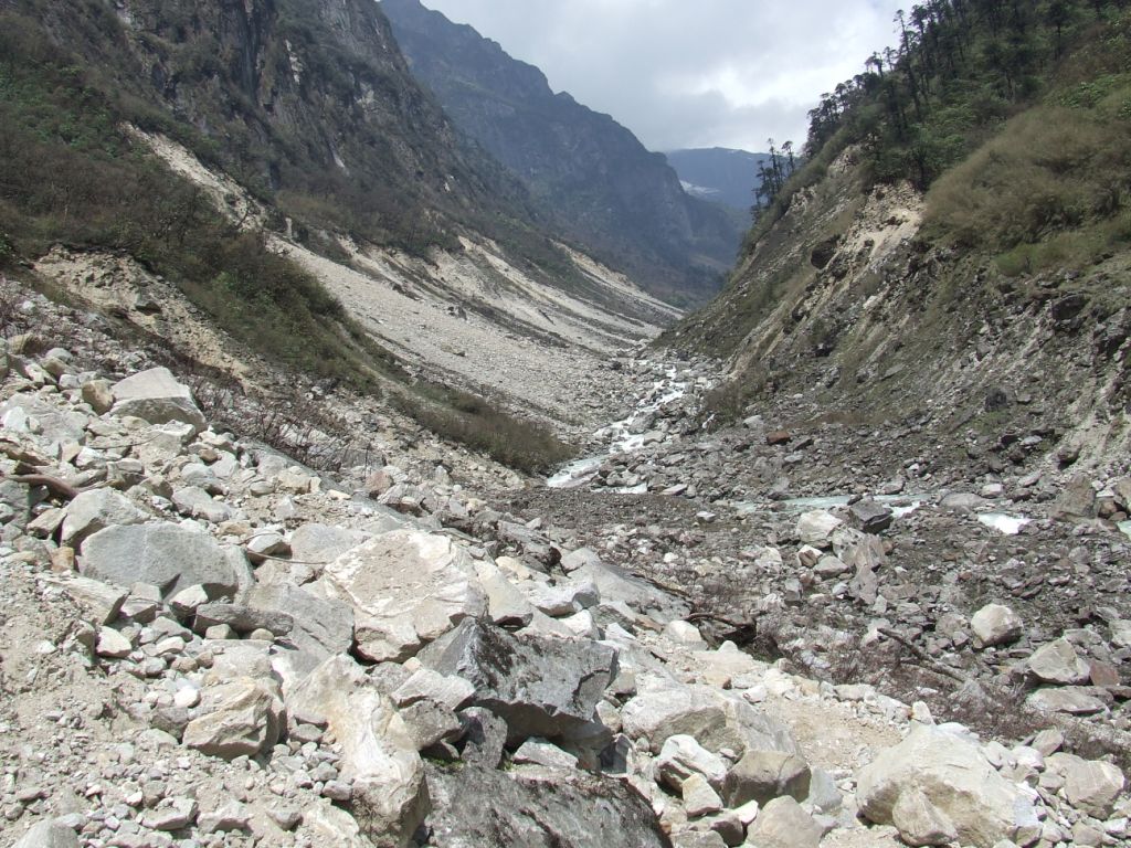
The Inkhu khola gorges are spectacular. The weather is unfortunately very cloudy and showers begin to fall at 4pm.

Solu 2016 vers Inkhu khola 4

Friday 20th May, from Inkhu khola to Panggom (2900m) wp78

Awake 6am, t=15°c, departure 7:30, Arrival 5:20pm, 7.1 km in 7h50, cumul ascent 1234 m, cumul descent 365 m

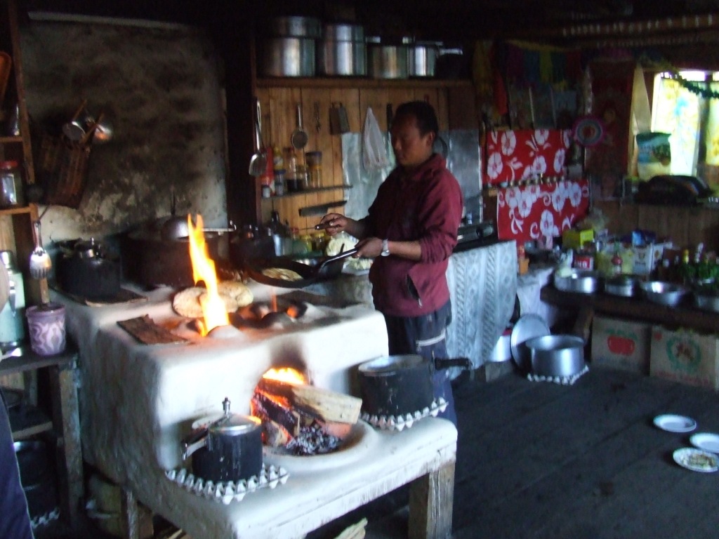
It rained all night long and it go on in the morning. Ponchos have never served so much! We stop to Sibuje in the fog ( wp75 ) for the lunch at 10:50 am. The ascent exhausted us while we are only at the middle of the way to the top. We refuel with a soup in noodles, an omelet and a tea (800Rs. These stops are so many opportunities to share the everyday life of the Nepalese families. A shower sticks us more than one hour. We leave in the fog. There are good lodges there ( wp76 ).

A shower surprises us again and we continue under the ponchos…

Solu 2016 vers Panggom 1

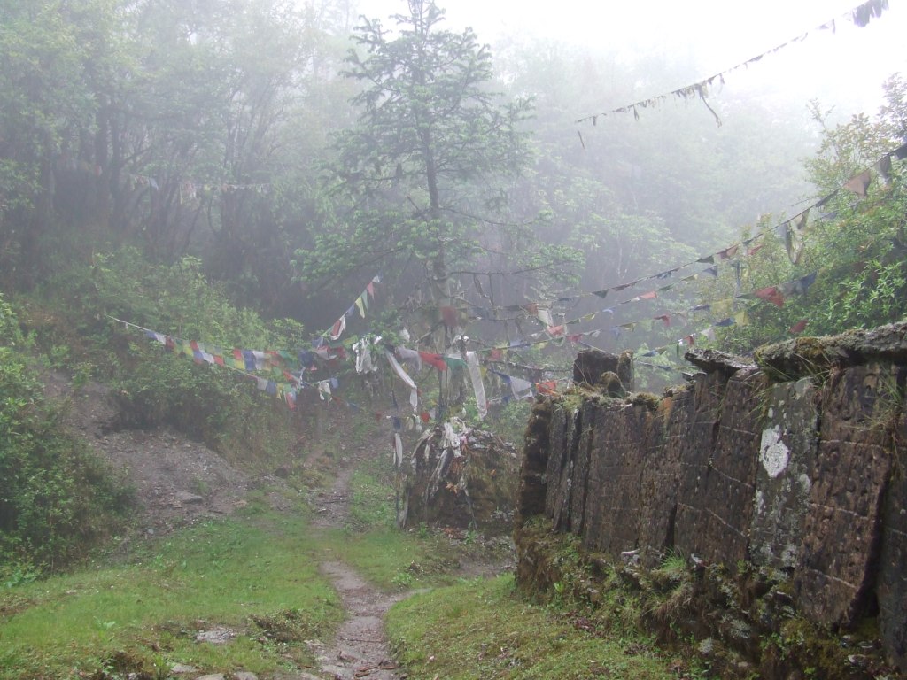
A panel indicates « Pangome Gompa » and we try to go there, against the indications of the GPS. We turn back because we have no idea where it can lead us. We will discover this Gompa on a height by arriving at Panggom. As the deviation leads to it, it was possible to go on the fork to pass by the gompa on the way to join Panggom.

Solu 2016 vers Panggom 2

The lodge (Himalaya Trekkers) which welcomes us is new and well maintained. It possesses even a hot shower! We are served with a correct dalbath and an excellent raksi with millet,  » barli  » and quince? Diuretic in any case! 2000Rs for the dinner the overnight stay and the breakfast.

A dance gets ready with brash young girls. We are informed but not invited 😉 In a so small village, a such concentration seems surprising. These girls are probably living in a hostel adjacent to the lodge. It would mean that they go to an Hillary school?  His foundation created a lot of these schools in the region. In this case, we could assert that it is a big success.

 Saturday 21th May, from Panggom to Jubhing (1656 m) wp 79

Awake 6:30, departure 7:30, Arrival 5pm, 13.1 km in 9h30, cumul ascent 1115 m, cumul descent 2416 m

Solu 2016 vers Jubhing 1

We pick in our reserves for the breakfast because the manager has messages to send and does not have too much time for taking care of us … While we are already on the way towards Bupsa, she shows from a window, that another way go towards Taksindu. We do not take this advice into account because the map indicates only one way, passing through Bupsa. The descent is soon transformed into rather stiff, illogical ascent as we have to join the valley. Sylvie takes one foot in a root while she is sliding. All her leg holds her weight and that of her bag in twisting. The first pain blurred, all the leg remains painful. She decides to leave slowly and by limping. I take her bag. We are fortunately close to Bupsa.

Solu 2016 vers Jubhing 2Solu 2016 vers Jubhing 3

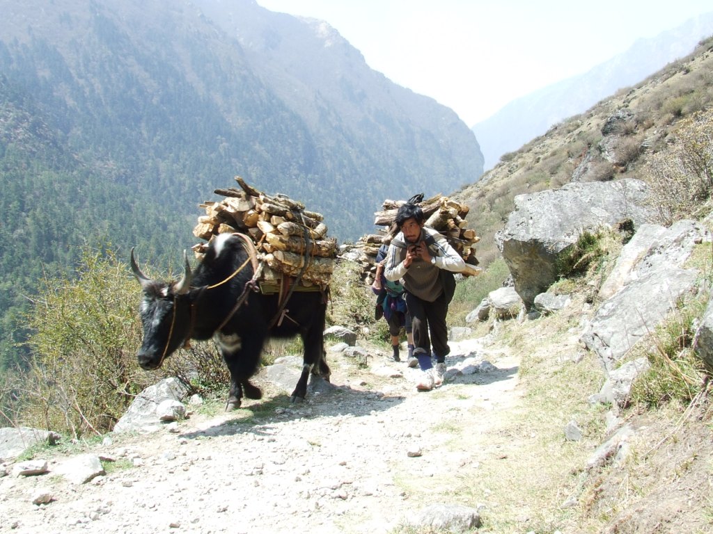
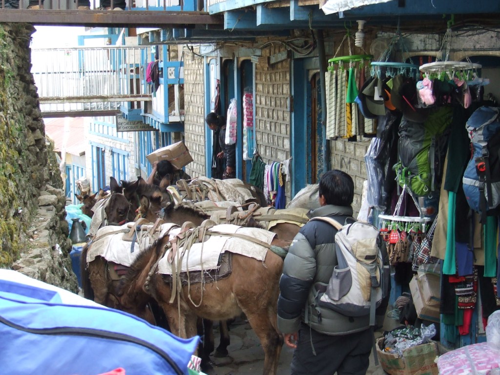
The road towards Bupsa leads to Lukla and Namche. It is a big bend to go towards Taksindu because it is pointedly necessary to dive into the valley of Kharikhola. We stop in the first lodge, very clean. The owner gives us an anti inflammatory cream and recommends not to make anymore effort today. Meal 850Rs. Sylvie getting better, we leave towards Taksindu on the important track linking Jiri and Phaplu to Namche. The convoys of mules pass almost continously. The way is papered with stinking and slippery dung. It is sometimes necessary to push away animals with the stick not to be pushed aside. To complete the pleasure, it’s a Buddhist national holiday today. Repetitive speeches, spread by loudspeakers, accompany us a big part of the afternoon. We stop to Jubhing. Lodges, here, has no more the quality of those met since a few days.

Solu 2016 vers Jubhing 4

Sunday 22 May, from Jubhing to Nunthala (2198 m) wp80

Awake 5:45, t= 17°c, departure 7:20, Arrivl noon, 5.7 km in 5h40, cumul ascent 741 m, cumul descente 192 m

Solu 2016 vers Nunthala 2

The previous day cost us  1250 Rs for lunch and  1650 Rs for bed and dinner. The average of the spending is in average 25 – 26€/day

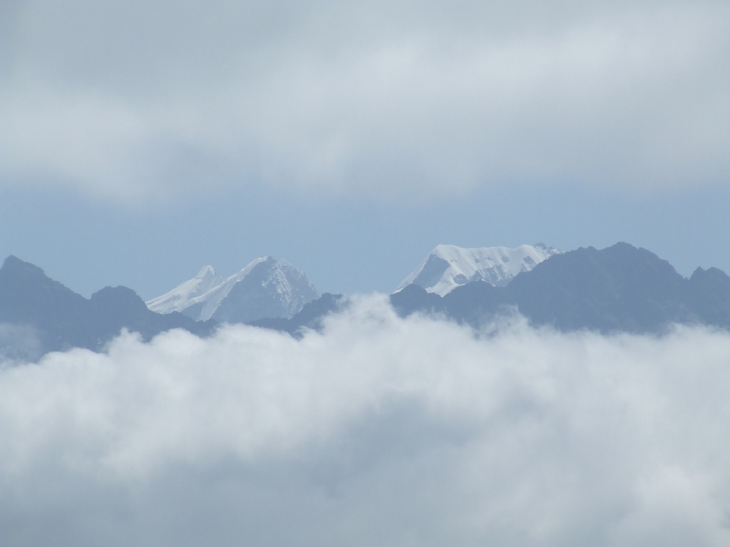
The sky is clear this morning and we can perceive some high summits of Khumbu. The walking begins with a little convenient descent in the dung of mules towards the Dudh khola. Then begin the ascent, under the sun, sawing our legs. But Sylvie’s knees gets better.

The batteries of the GPS are changed for the second time at 11:10 am.

Solu 2016 vers Nunthala 3

Solu 2016 vers Nunthala 5

We arrive to Nunthala for the lunch (magnificent Himalayan Trekker Lodge). The village is particularly beautiful and clean. We would almost imagine we are in Switzerland. People are smiling and it tempts us to stay. The decision is taken during the lunch: after noon will be a resting time before the next 4 days of ascent. We are go about in the main street and take back our strengths.

Solu 2016 vers Nunthala 6

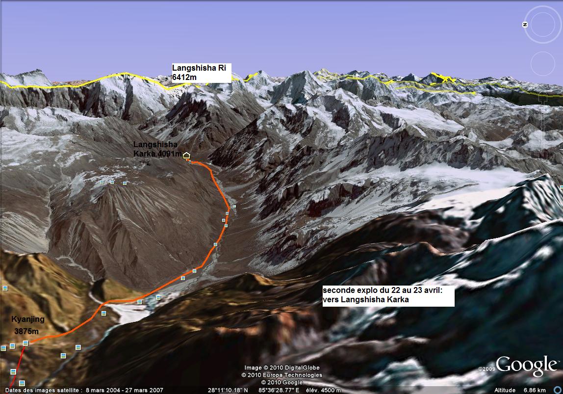
Monday 23th May, from Nunthala to Taksindu la (3053 m) wp DK01

Awake 5:30, t= 16°c, departure 6:50, Arrival 11:15, 5.7 km in 4h35, cumul ascent 926 m, cumul descent 70 m

Solu 2016 vers Taksindu la 3

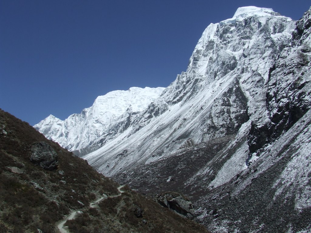
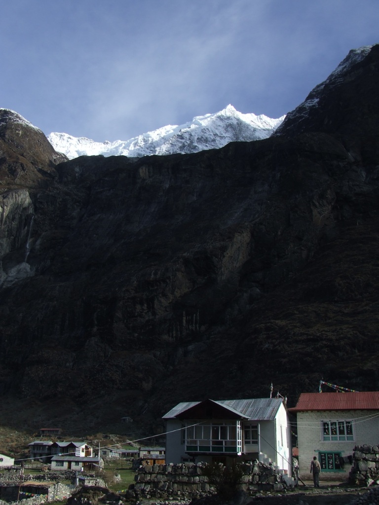
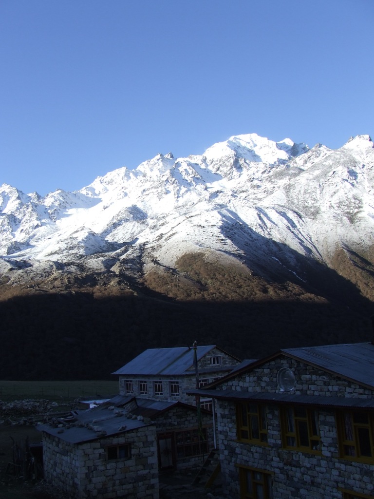
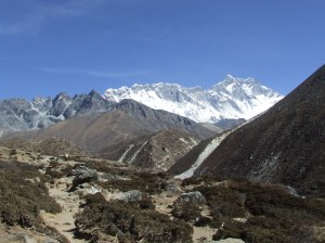
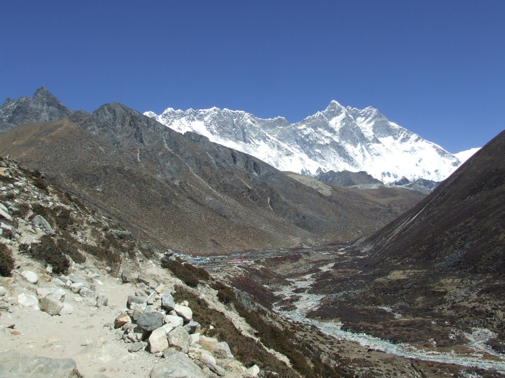
Is Nunthala endowed of an Hillary School? Big buildings overhang the village, as we had seen in Panggom. We go up without any trouble by comparison with yesterday. The sun is softened by a light mist. The panorama is unfortunately partially filled by clouds. The view remains magnificent. After investigation in Taksindu, we decide to continue until Taksindu la where is a recent lodge and the starting point for Dudh Kund, the Milky Lake.

Solu 2016 vers Taksindu la 1

We are now in the mist and Sylvie would eat a chicken with her feathers (she says). A new free afternoon for rest  in a very comfortable lodge.

Solu 2016 vers Taksindu la 4        Solu 2016 vers Taksindu la 2

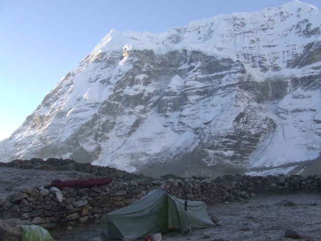
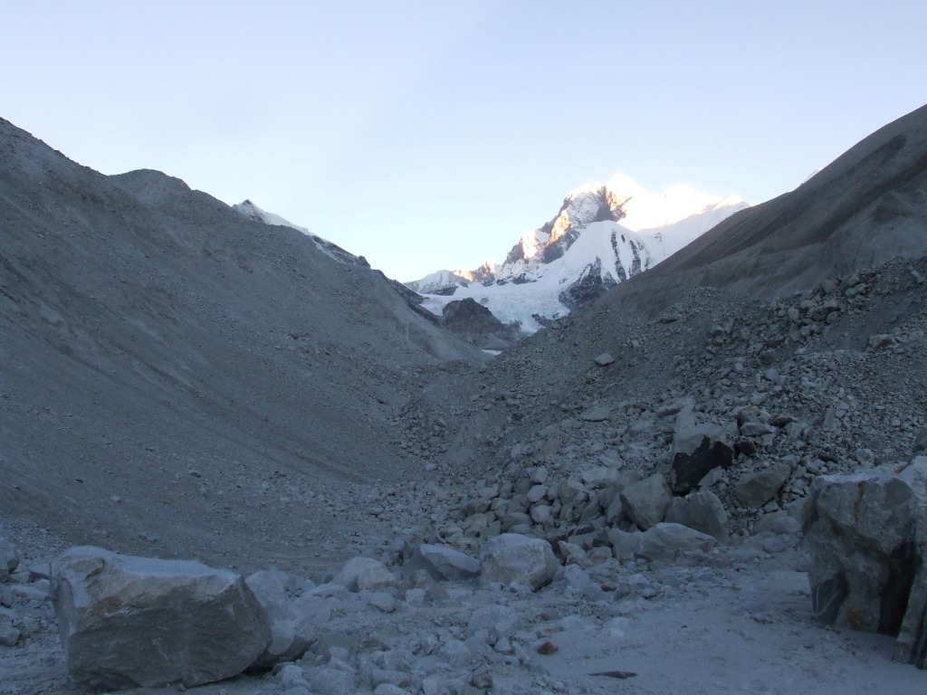
Tuesday 24th May, from Taksindu la to Camp 1 (3884 m) wp 81

Awake 5:30, t= 9°c, departure 7:30, Arrival 15h15, 8.3 km en 7h45, cumul ascension 1037 m, cumul descent 210 m

Solu 2016 vers camp 1 1JPG

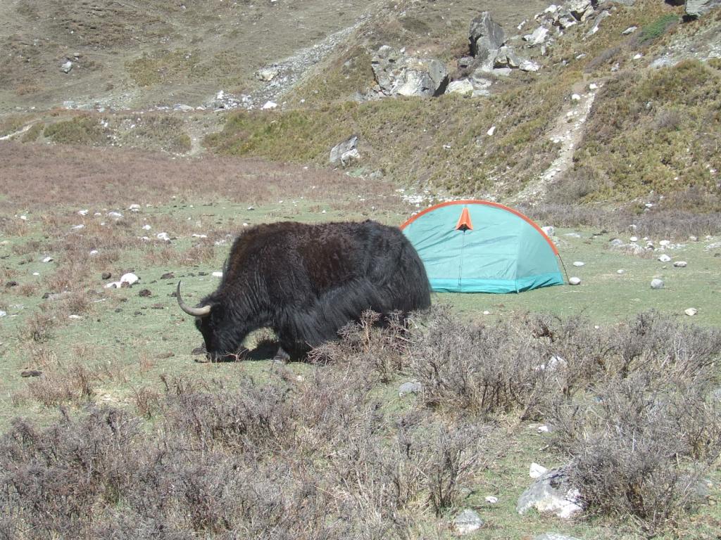
The departure is in the fog. Sylvie grumbles because she don’t want to leave in this bad weather. I hope that it will get up with the ascent. The way is very bucolic and well marked . It crosses a beautiful rhododendrons forest in the first part which becomes mixed after. We have a lunch when two young Nepalese double us: they join a camp of high pastures. They are the only human beings that we’ll meet during these three days. Rain begins by 2 pm.

Solu 2016 vers camp 1 2

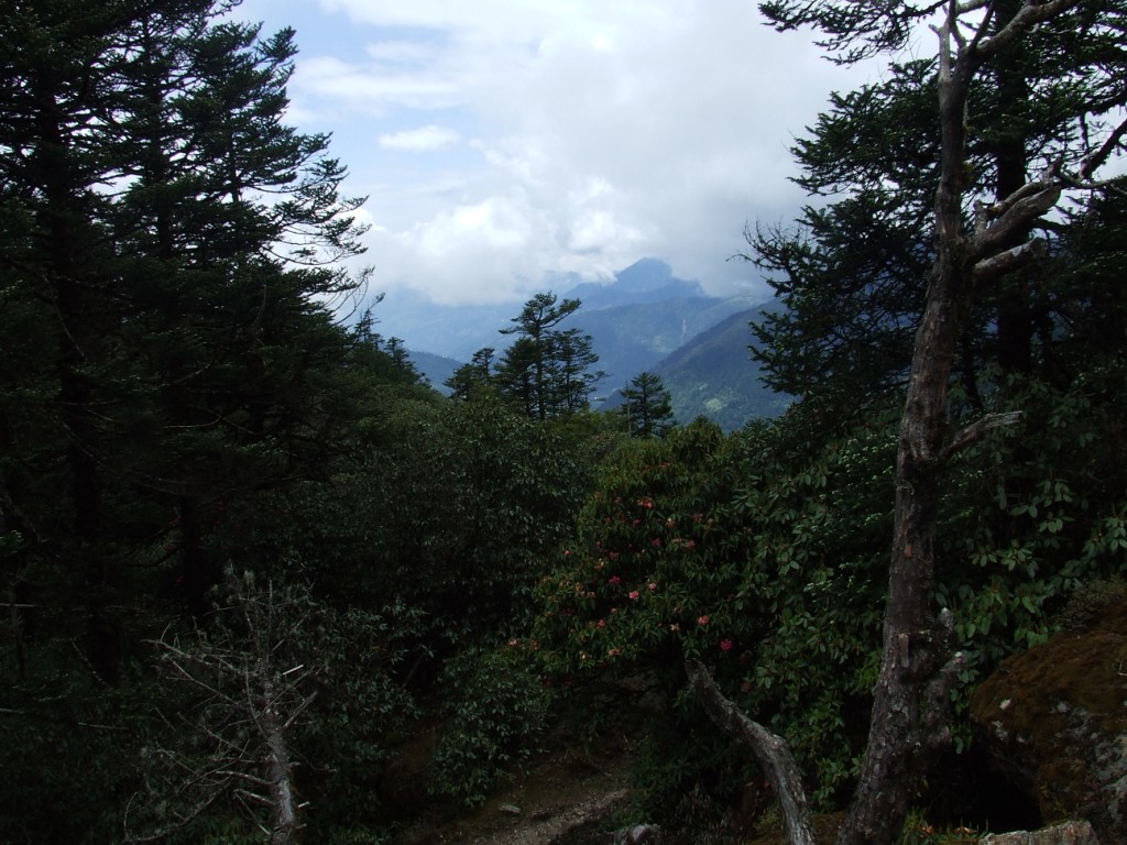
We see beautiful massifs of yellow rhododendrons, still with beautiful flowers at these altitudes.

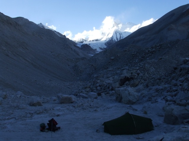
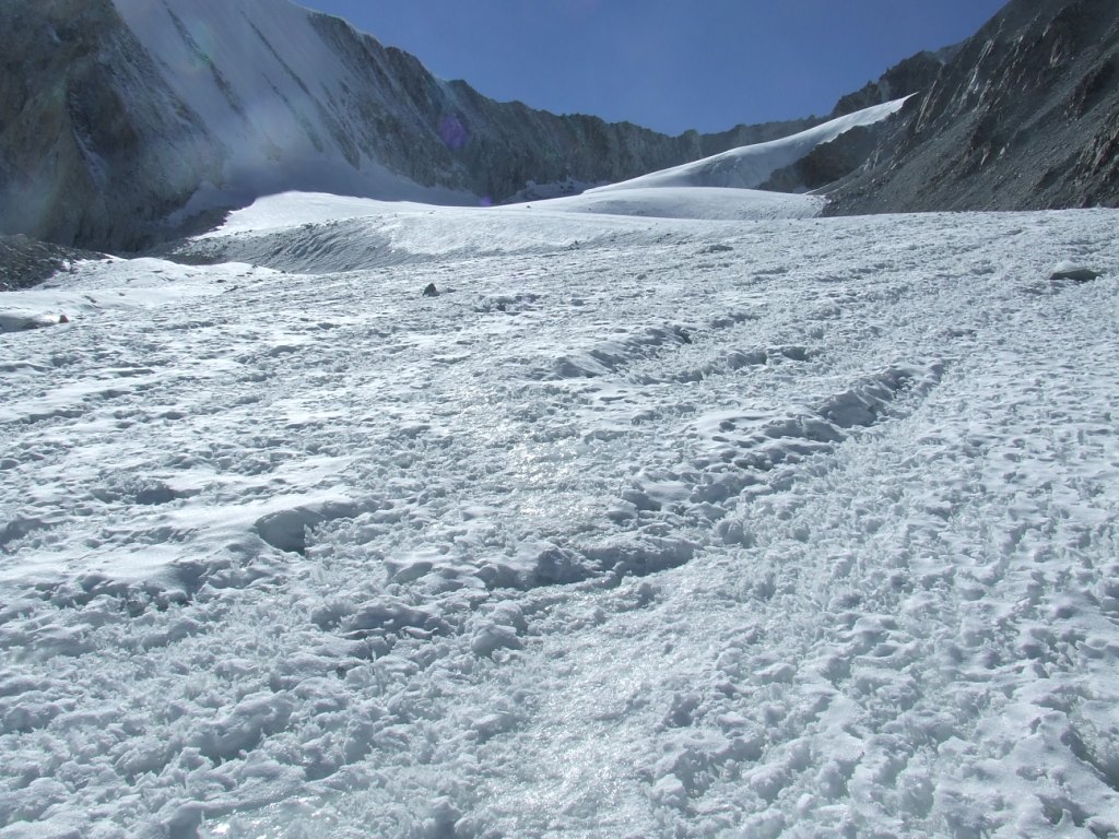
We made more or less half of the path to Dudh Kund when we find a correct place for a camp. It is always raining and we settle the tent in these difficult conditions. It will be necessary to content ourselves with the remaining water from Taksindu la because we haven’t found any source on the path.

Solu 2016 vers camp 1 3

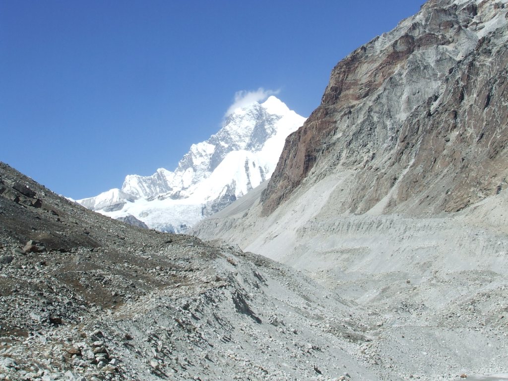
Wednesday 25th May, from Camp 1 to Dudh Kund pokhari (4626 m) wp 83

Awake 6am, t= 0°c, departure 7:30, Arrival 3:20pm, 9.7 km in 8h15, cumul ascent 954 m, cumul descent 237 m

Solu 2016 vers Dudh Kund 1

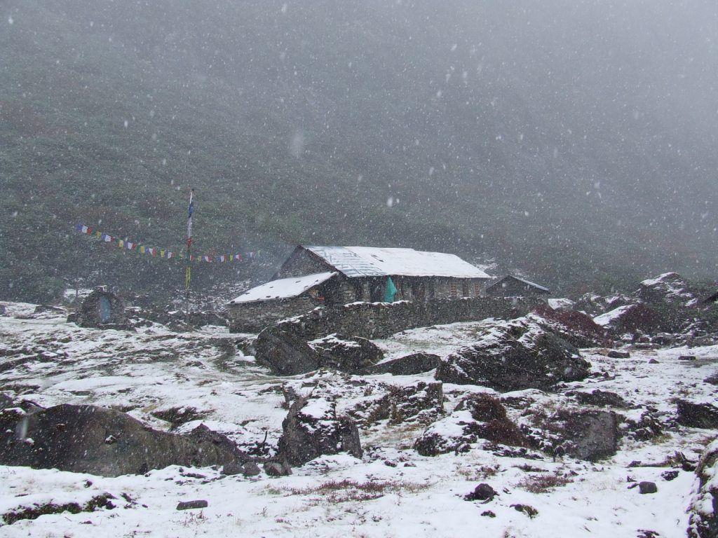
The rain had stopped at night to start up again with renewed vigor. It is accompanied with gusts of wind then snow. This is the big storm. The temperature falls brutally. We are afraid that the tent flies away and that bags, protected by ponchos, fall in the ravine. I get up before the day rise to verify the installation. The spectacle is Dantesque with a moon quarter and some visible stars in patches of clear sky, and, far off, with the cleared big massifs, overhung by a strange black coat. I remove the snow accumulating on the double roof, making both walls contact themself. I go back to bed hoping that the storm will quickly stop.

When the weather calms down, the sky is totally cleaned. A carpet of snow recovers the surroundings. After the breakfast, Sylvie is not convinced to continue. I decide anyways to go on at all costs, now so close to the goal. She should come down easily to Taksindu. The perspective of the forest crossing makes her have a change of mind.

Solu 2016 vers Dudh Kund 3

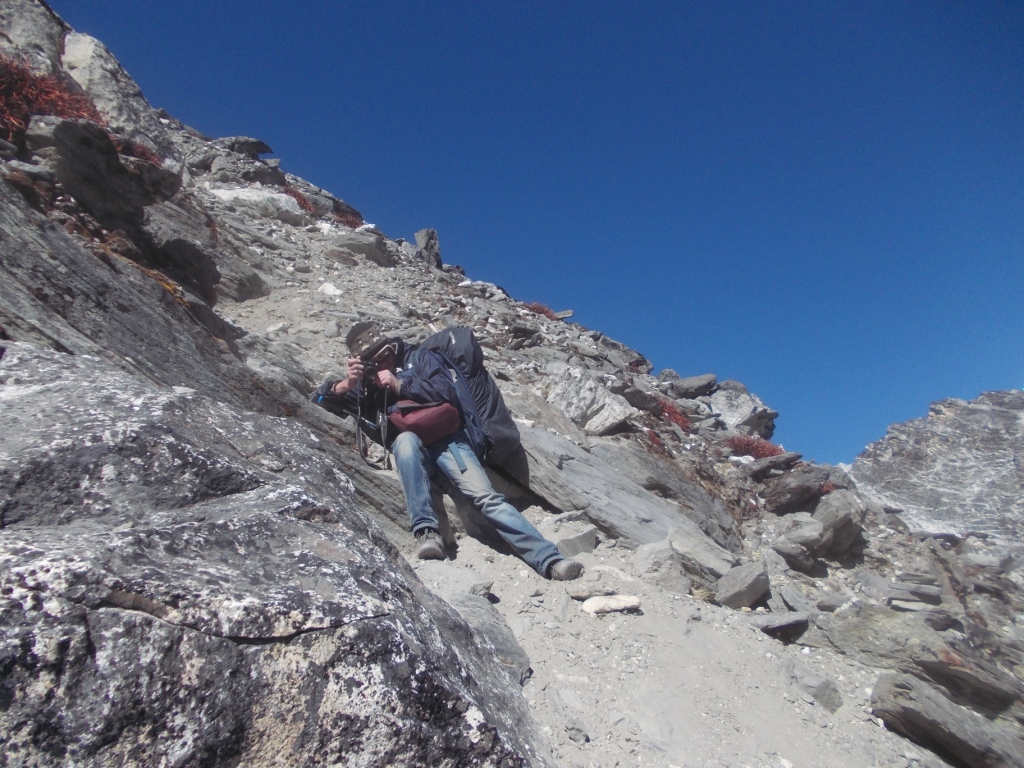
First water source at wp 82. Sylvie is particularly slow and I begin to doubt our capacities to reach to the lake today. I decide to carry her bag. I ascent on approximately 500m  with 28 kg and some cramps will make me suffer at the stage!

Solu 2016 vers Dudh Kund 4

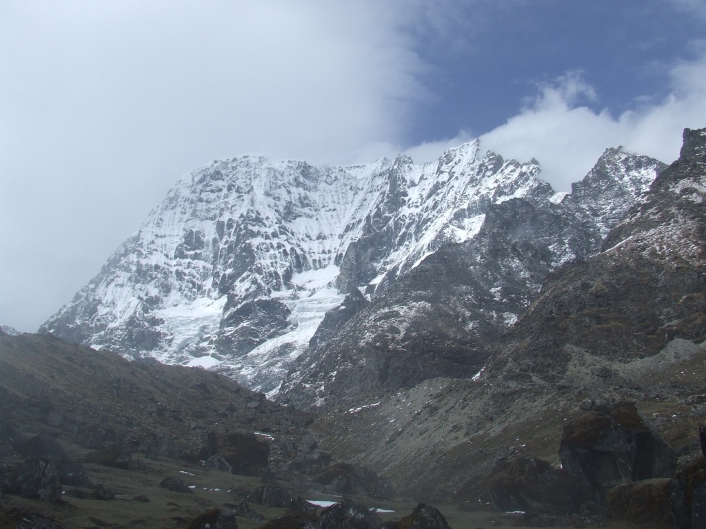
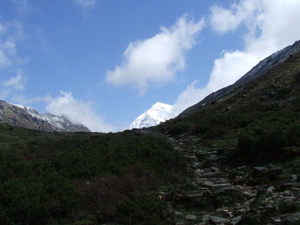
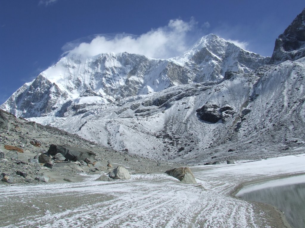
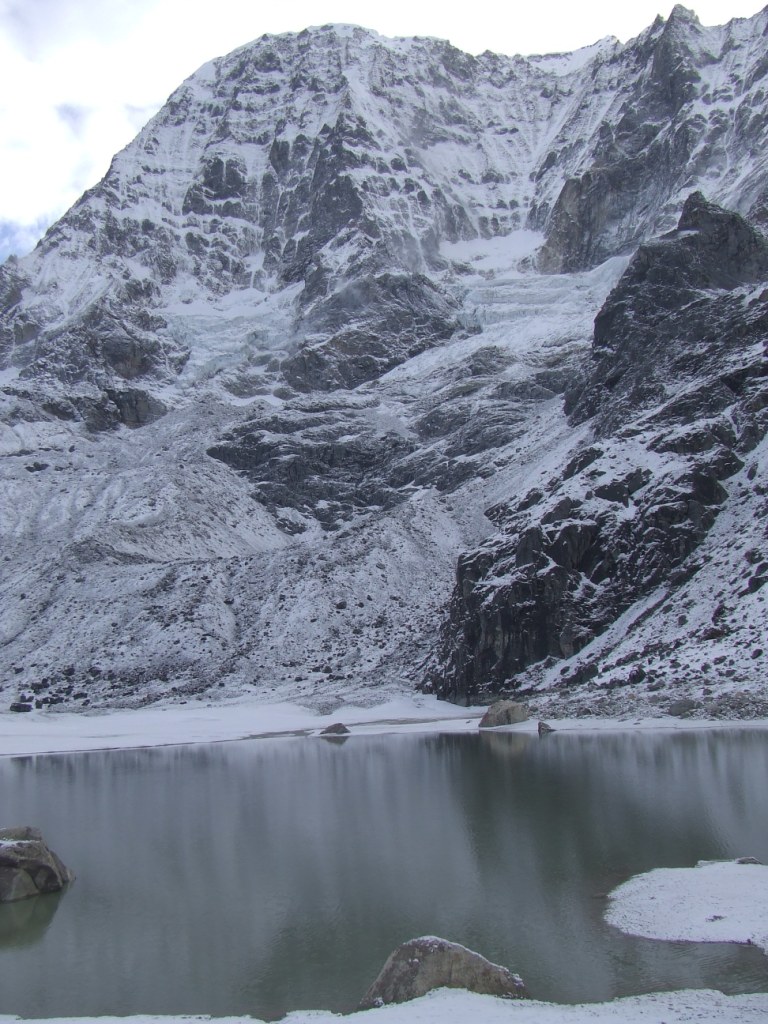
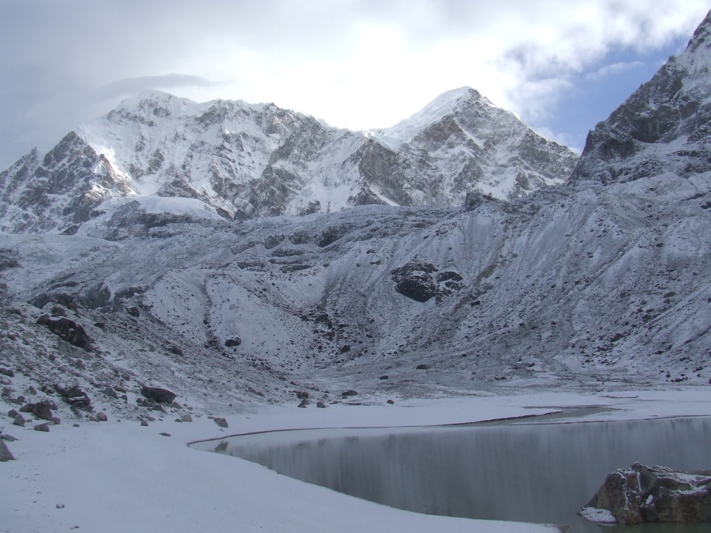
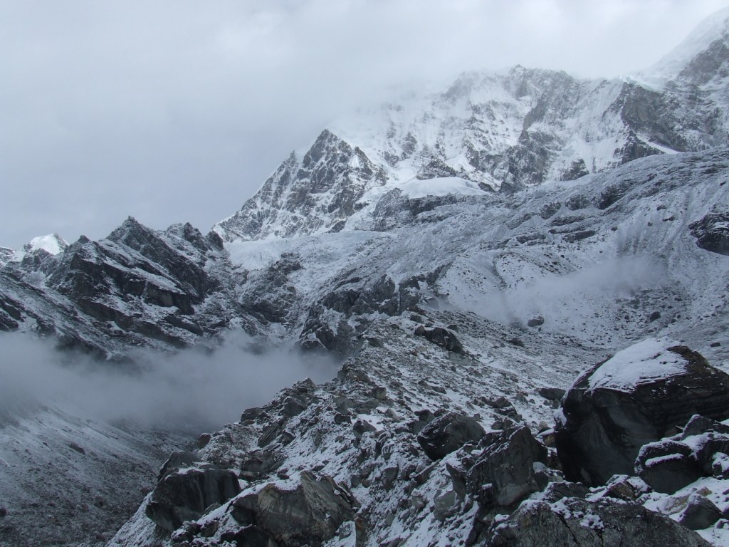
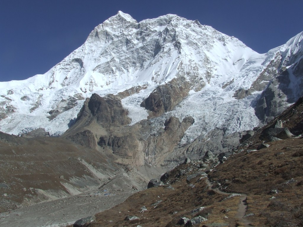
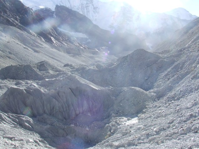
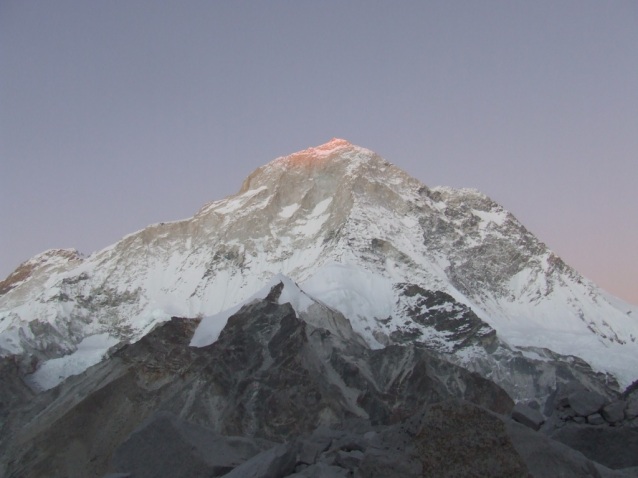
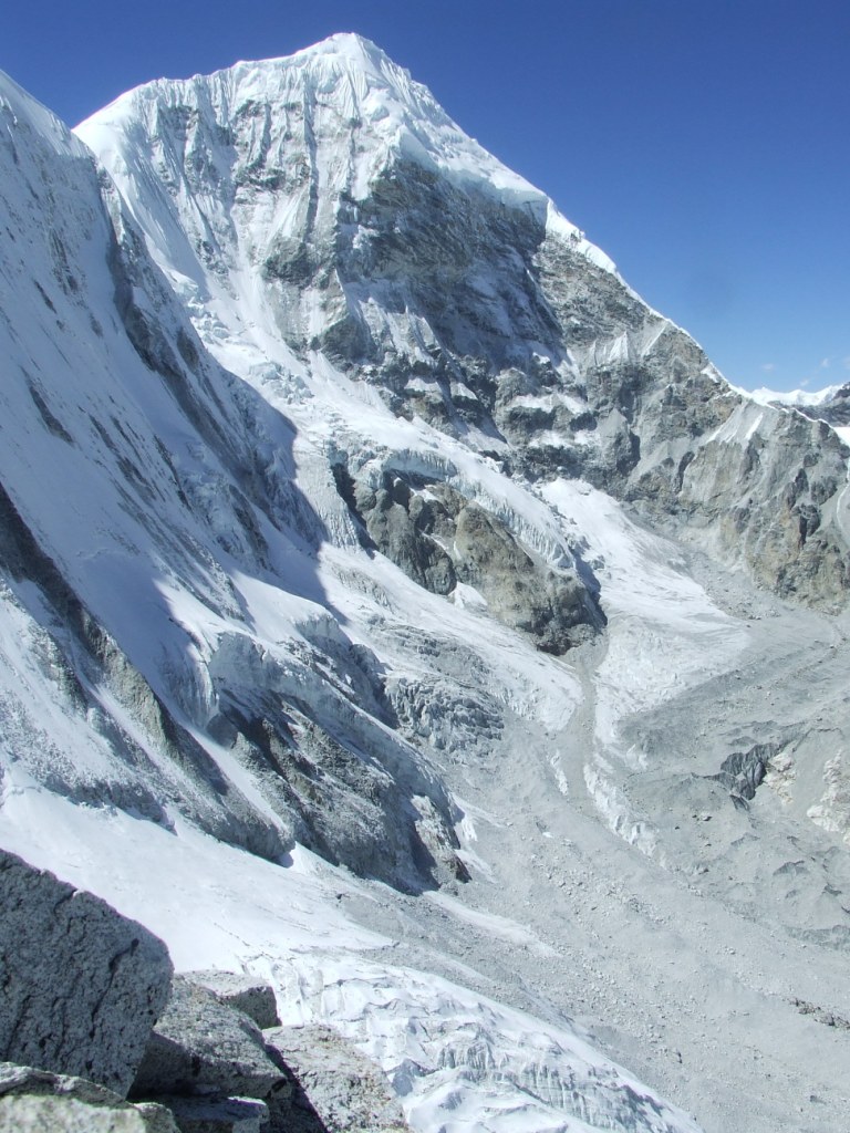
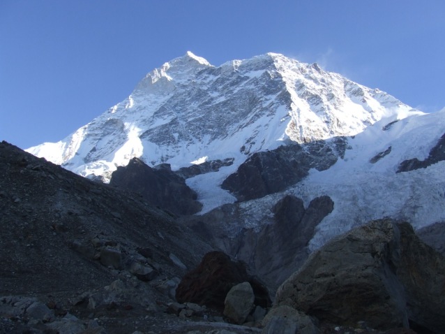
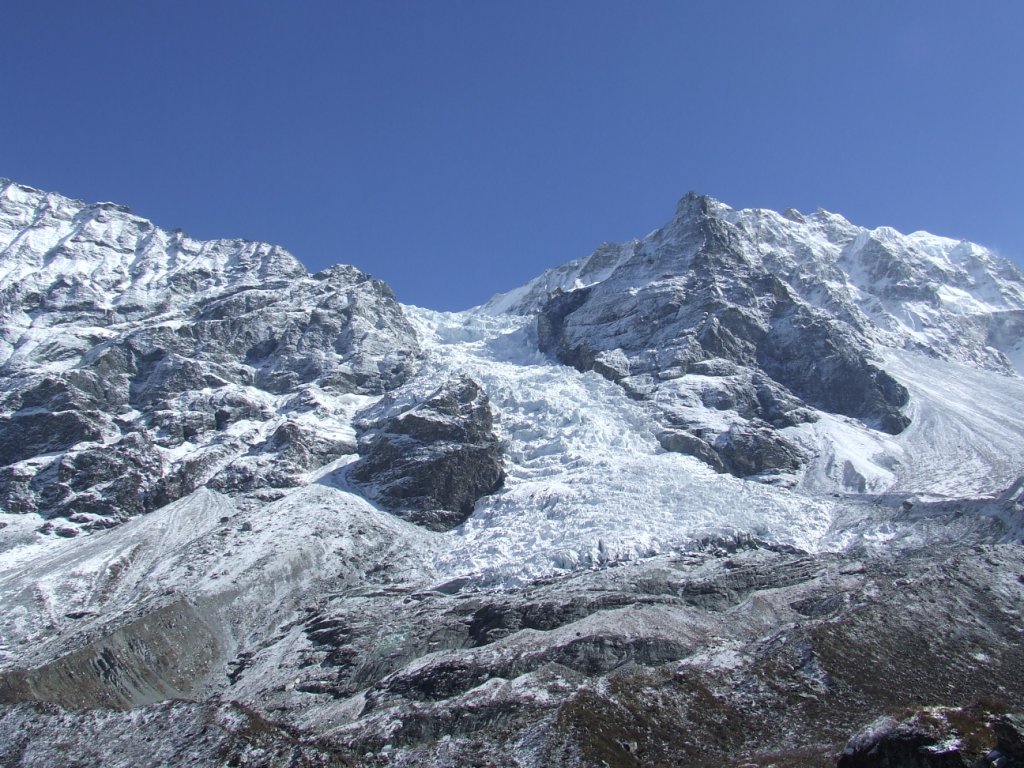
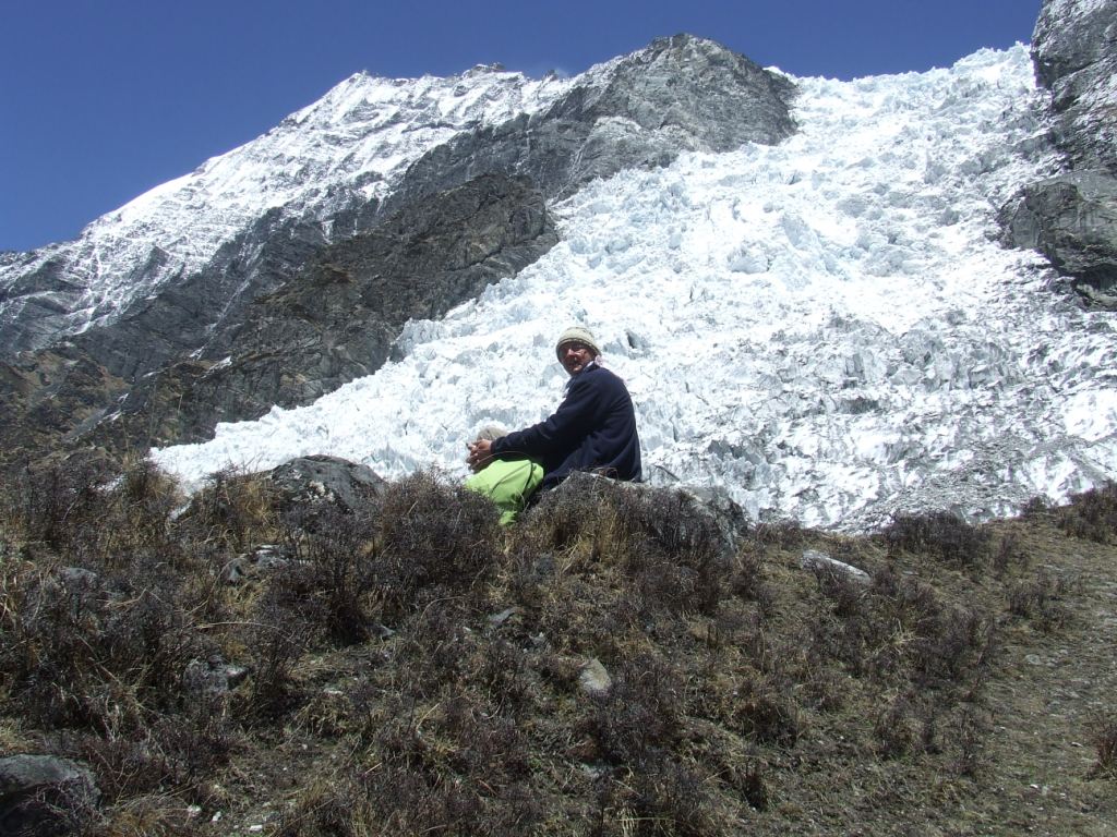
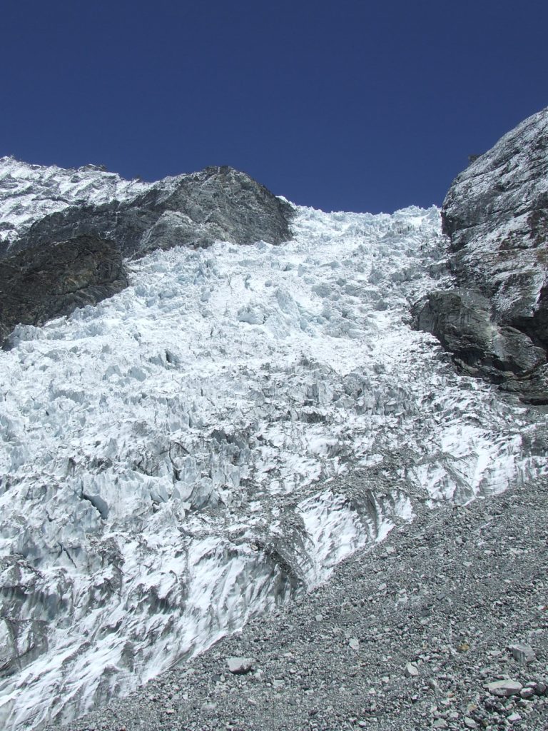
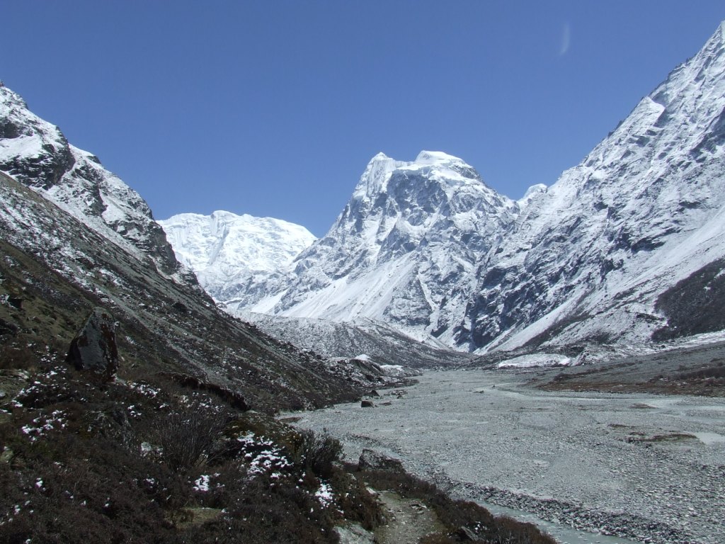
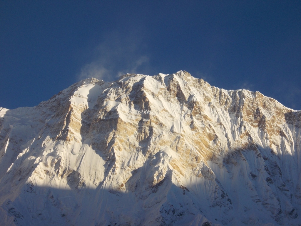
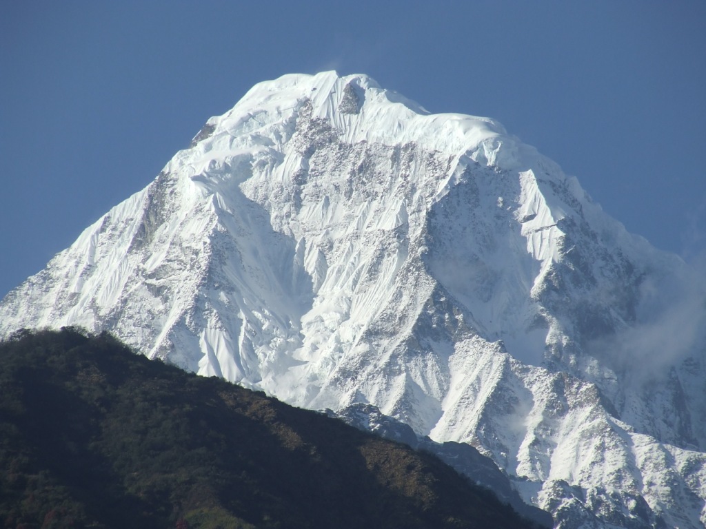
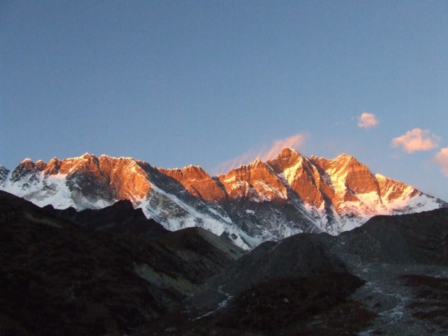
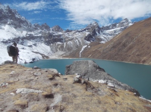
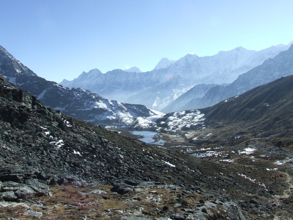
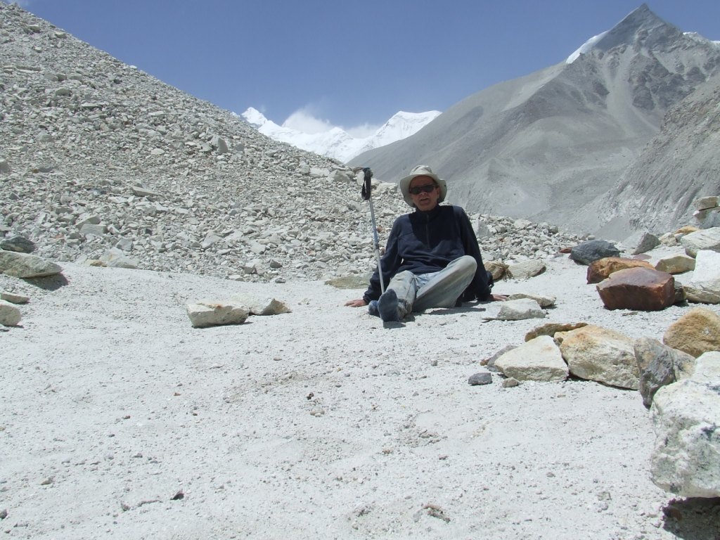
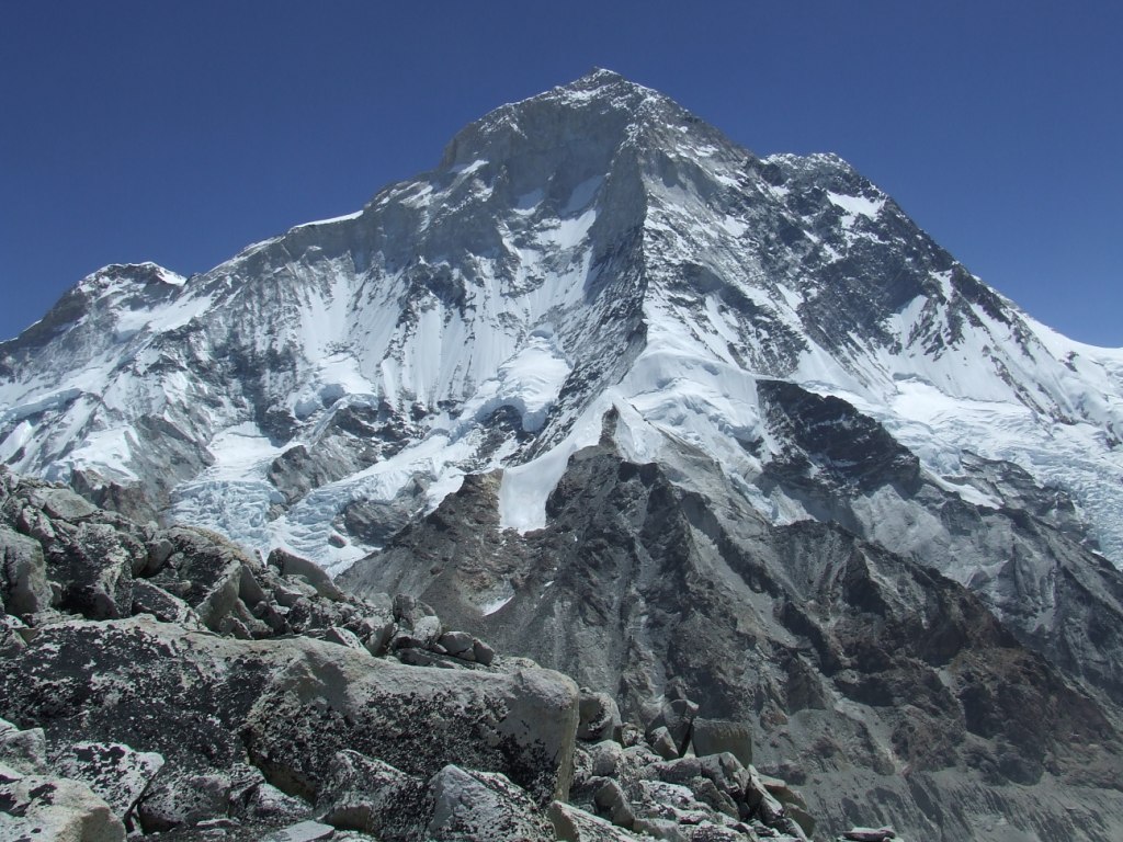
The weather quickly gets blocked with the rise of mists caused by the heat of the first sunrays. Snowing begins but there is no thunderstorm. The mist withdraws from time to time to make us perceive majestic summits and so close, a gigantic cliffs. We arrive, exhausted, to Dudh Kund. Surprised! There is no lake but an alignment of low walls. I forgot that the lake is further north. It is necessary to continue…

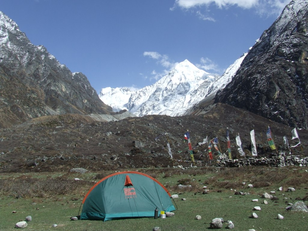
The lake is smaller than I thought. Its level lowered a lot as the various strata left on its banks show. The massifs appear by intermittence. We settle the tent on an small protected area of fine sand. 

Solu 2016 vers Dudh Kund 5

Thursady 26th May, from Dudh Kund to Taksindu la

Awake 6:00, t= 7°c, departure 9:00, Arrival 5:35pm, 17.6 km en 8h35, cumul ascent 554 m, cumul descent 2136 m

Dudh Kund Pokhari

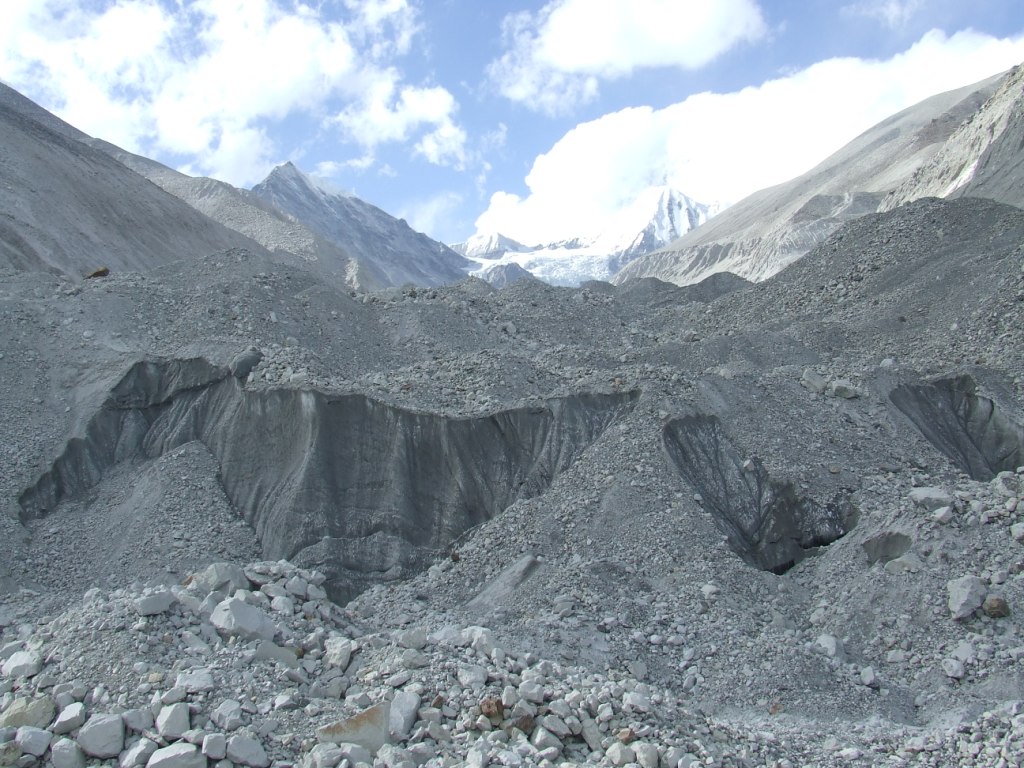
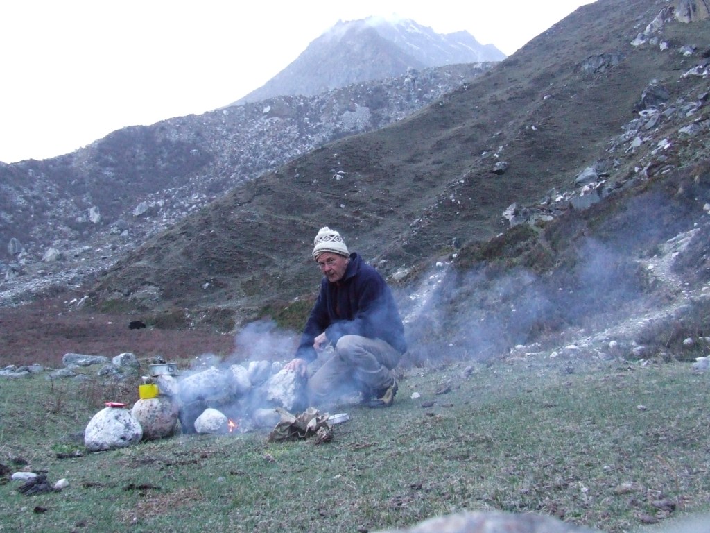
The mountains did not appear in the evening and it snowed this night. The temperature remains however too high to have a clear and dry time. We dry the bags and affairs in the shy sun rays morning. I walk to get the rare moments when the landscapes appears from the mist. The place is magnificent. I collect some old coins on the banks of the lake.

Solu 2016 Dudh Kund 1Solu 2016 Dudh Kund 2 Solu 2016 Dudh Kund 3 Solu 2016 Dudh Kund 4 Solu 2016 Dudh Kund 5

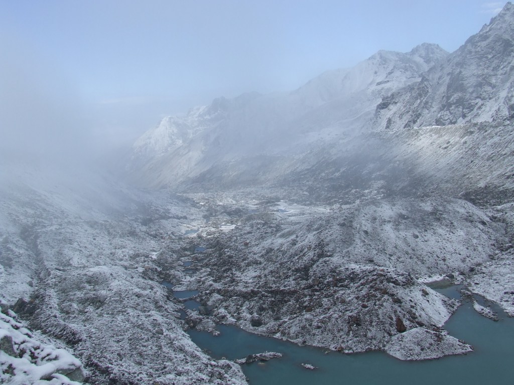
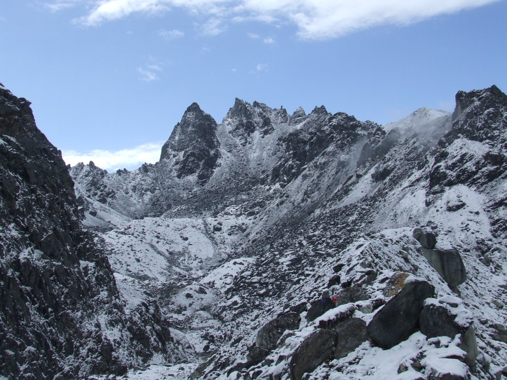
I take advantage of our stay to locate the possible passages to rise on a crest or on a summit. It will be a waste of time for this time: the weather is far too unstable to be able to continue. The weather quickly goes bad. We decide to come down, again in the fog, and occasionally in the rain. We are happy to seek refuge in our lodge of Taksindu la.

Friday 27th May, from Taksindu la to Phaplu (2490 m) wp 84

Awake 6:30, t= 14°c, departture 8:30, Arrival 1:30pm, 14.7 km in 5h, cumul ascent 421 m, cumul descente 997 m

Solu 2016 vers Phaplu 1

We take our time this morning. The weather is sunny,  even if the massifs are already in the clouds. We have no regret to have shortened our stay in altitude. The road from Taksindu, is carriageable, at least by tractors and motorcycles. It is necessary to pay attention not to leave the old track which is frequently cut,  to avoid monstrous bends. The way crosses very attractive forests of hundred-year-old pines.

Solu 2016 vers Phaplu 2

Solu 2016 vers Phaplu 3Solu 2016 vers Phaplu 4

Solu 2016 vers Phaplu 5

The trek ends to Phaplu, a little bit glaucous city, as all the border cities .

Solu 2016 vers Phaplu 6

We book the return jeep in the lodge. Meeting at 5 am for a precise departure at 5:30 am.


Kongde ri

Dhud Kund 2

Context:

We should be in Makalu in May, 2016. Rather than to return directly from Tumlingtar to Kathmandu, we plan a trek from Khandbari, East to North West to Salleri (return by jeep) or Phaplu (return by aircraft) by Phedi, Bung, Panggom, Taksindu.

Two segments are planned to be close to the high mountain: one leading to the base camp of Kongde (6093m) and one leading to Dudh Kund (Milky Lake) close to another small 6000.

The major part is situated at low altitudes under 3000m, in the Hills. We should have a beautiful view of the high massifs in the North from Kongde as well as from Dudh Kund ri if the ascents are feasible.

The distance to be traveled is important: 236 km on 19 days with an acclimatization day towards 4000m and the 2 explorations. It will be possible to eliminate a segment according to the difficulties  found on the ground. The track towards Kongde is totally invisible on Google Earth. It will be necessary to follow the torrent leading to the base camp. On the other hand, the track to Dudh Kund is perfectly visible and recorded. The explorations to lead to points of view on the massifs to the North remain to be explored, in both cases.

Situation:

Trajet Solukhumbu Kongde Dudh Kund1

Click to enlarge

Timetable:

Kongde Dudh Kund Agenda

Altitude=f( Distance)

Kongde Dudh Kund Altitude Distance

Altitude at Night:

Kongde Dudh Kund altitude nuit

Daily Difference of Altitude:

Kongde Dudh Kund denivele jour


From 8 to 27 October 2015

Sherpani pass vue de Kamepe ri

Foreword:

For this third exploration of the valleys of Makalu, we had seen large: overhang Shersong to discover simultaneously Everest and Kanchenjunga, go up to the foot of Cho Polu, finally overcome a 6000 m summit for, very close, admiring the Baruntse!

I had recruited a partner on trekkingpartners.com to secure the progress, always risked, in the high mountains. It was a wrong choice because this bad guy abandoned in Kongma, pleading a too heavy bag, painful feet and the bad weather! It will be necessary, in the future, to pay more attention on the selection of the candidates for Adventure!

It was thus necessary to pull down a little my ambitions but the most mattering had been made (my first one 6000 solo!). Furthermore, the extraordinary valley of Barun, for the first time, revealed under a magnificent autumn sun.

Luckily, I will manage to move in spite of the oil crisis which shakes Nepal. Few days after my return, the internal flights will be cancelled because of shortage… After the earthquake of last April 25th, the Nepalese have to be particularly serene to support with so much peace all these misfortunes and all these hardships without flinching!

001Kathmandu

Trekkers will be more numerous than in May, 2014 on the paths to the base camp. Higher, it will be the total solitude, broken by some ravens trying to steal my small pittance. I’ll tend to sympathize more with guides and the Sherpas than with certain very demanding and sometimes quick-tempered tourists. I am increasingly against the package tours sending people effortlessly at high altitudes and leaving in the mountain, the heaps of their garbages as eternal memories of their passages (see in appendix: The trekker and her porters).

Preparation:

The same equipment is used than in May, 2014. I embark this time 4.5 kg of food for 6 days planned in autonomy on the Barun glacier. I am loaded with 20 kg, water and petrol included (it is too much, my back will not forget quickly).

Roads are registered from Google Earth on the GPS as usual. The Barun glacier was turned upside down, probably by the April 25th earthquake, and, in this hell of mass of fallen rocks and gaping cracks, my forecasts will not serve much…

Situation:

situationSituation parcours Glacier Barun effectué

Access et Budget:

I travel again with Air India (620€, good service). It is easy to find cheaper but the stopovers are often very long… On the way back, we’ll arrive with a delay of more than one hour to Delhi but the flight for Paris will wait for us wisely. Yeti Airlines, as the other companies, increased its price rates in 2015 (247€ AR). I used private jeeps for the route Khandbari-Num (600Rs on the way out, but 3000Rs on the way back) by fear of petrol shortage but also for comfort!

On site, in Nepal, the spending, all inclusive and without counting too much, was 500€ (with 4 « free » days of autonomy). With the domestic and international flights, the total spending is 1370€, including visa and access to the park. For such an adventure and when we look at catalogs, it remains really very cheap!

It is necessary to count on average of 15 to 20€ / day during the trek itself, when we do not drink beers (350 in 500Rs the bottle, prefer it the local raksi 😉

Time Table:

Agenda

Stages:

Altitude à l'étape

Altitude = f(Distance):

Altitude f distance

Daily Height Difference:

Dénivelé Jour

The Trek, Day by Day:

Thursday 8th October: From Num to Seduwa –

departure 11:35am – arrival  5:55pm – altitude 1564m

The journey in jeep was very comfortable. On the road, the so desired mountains already appear. It is a call for Adventure!
002 seduwa

I’m not in top shape for this first day that isn’t the easiest. From Num, Seduwa always seems very close, at the same altitude and just separated by the Arun’s valley. Just to remind: you should not forget the 720m descent followed by a 820 m ascent. We don’t hurry up and will arrive at nightfall in Seduwa.

003 seduwa

From 9 to 11th October: Interruption in the region from Seduwa, Robesha to Tashigaon

Here is a three days interruption to bring to a successful conclusion, the necessary audits for the progress of our projects in common with  Friends of Nature. I discover a very pleasant waterfall to have a bath at less than half an hour of the village.

005 seduwa cascade

Monday 12th October: From Seduwa to Tashigaon

Wake up 6:45am, departure 8:40am, arrival 1:15pm, altitude 2200m

The walking is easy today. It’s necessary to be careful to avoid the leeches by walking as much as it is possible on stones of the path. The second rice harvest of the year began and the activity is going full swing in fields.

On the way, I visit the Tashigaon’s school, recently equipped. The welcome is warm. The weather covers in the morning but we avoid the rain. I settle down in the only one lodge open.

006 Tashigaon

Tuesday 13th October: From Tashigaon to Kongma

Wake up 6am, T inside 14°C, departure 8am, arrival 3:30pm,  altitude 3614m

The weather is beautiful at the beginning of the morning and will cover strongly in the ascent to finish with a very violent thunderstorm in the evening with hailstones and snow. The tropical climate brutally gave way to winter.

This day is probably the most difficult of all the trek with an imposed 1450m ascent. The « partner » shows abnormal and alarming signs of fatigue and bad-humored. The only advantage of the situation is that it is reversible. This argument appaises me when I wonder how I’ll manage to drag him up to the Barun glacier…

We lunch at the middle route in a small restaurant (N 27.642, E 87.2152, 2939m) belonging to the elder son of the Kongma lodge’s owner, opened for the occasion. It is a family business on all the road up to the base camp…

I locate the  crossing of the path for the Isuwa (Ishuwa) valley on the crest (N 27.647117 ° E 87.209821 °). It can be a future trek. It is not said that the path continues very far. The descent then the progress in full jungle, if the path disappears, would compromise the project.

It rains a little (I have no translation for « pleuvioter ») when we arrive in Kongma where two new lodges have been built since 2014. I remain faithful by installing in the oldest.

In the evening, while the snow begins to whiten the surroundings, a guide asserts that the bad weather will still last one week because the rain has to clean the earth from the blood of animals sacrificed during the Hindhouist festival of Dashain. Very useful! And as a happiness never arrives alone, the « partner » learns me that he abandons me to my sad fate… (phew!)

DSCF3134

Wednesday 14th October Acclimatization in Kongma

The rain replaced the snow in the morning. I had intended to cross the four passes to arrive to Dobato today, by neglecting the acclimatization, a precaution nevertheless necessary. The bad weather persuades me that it is better to stay in Kongma. I pass a large part of the day in the bed, under 3 layers of blankets.

I meet two young German trekkers who recognize me. They organized their trek with the information of my logbook of May, 2014 and they come back from the base camp. Here is a pleasant surprise proving the rising celebrity and usefulness of my site 🙂 They hoped to go to Sherpani but they abandoned, without any accompaniment… It is a pity we do not met earlier.

Thursday 15th October: Kongma to Dobato

Wake up 6:15am – T inside 7°C – departure 7:20am – arrival 1:30am – altitude 3900m

As I am used to Kongma and above, it is an aldready lost race against the clock with clouds. The sun just rises for extracting the mist from hillsides filled with humidity. As usual, the mist rises to accumulate towards 4000m. I leave with the sun and arrive at the Kongma pass at 8 am. I still perceive the mountain range in the East, dominated by a high altitude layer of clouds. Among them has to hide the Kanchenjunga (8586m and the World’s third summit). It seems that we see it from here by clear weather. Summits combing the Isuwa valley are totally hidden.

DSCF3148

The valley, from Tashigaon to Num, is always under the clear morning sun. It seems to me already very far.

A drizzle joins me towards the 3rd pass (Shipton la, 4230m) which is soon transformed into snow until my arrival to Dobato. The walking is one thousand times easier than last year because the path is free of any snow or freezes. I pay however attention at every step not to slide on wet stones. I catch a light but persisting headache, in spite of the acclimatization of yesterday. A tablet of ibuprofen doesn’t delete it completely. I force to eat on the road by sheltering me under the roof of a recently constructed building.


DSCF3163

The snow doubles near Dobato and I am happy to find Pemba Sherpa welcoming me with his good mood. We lunch together on a delicious dalbath with undefined offals, washed down with tea.
DSCF3166DSCF3169

Friday 16th October – Forced Acclimatization in Dobato

At about 5:30 am, the icy snow crackling on the steel sheets roof, wakes me. It is more than a bad omen. I don’t rush for a departure at dawns… It will snow all day long and I begin to despair about the bad weather. Apparently, the blood of the Dashain sacrifices isn’t washed easily. I try to manage my day so that the time doesn’t pass by too slowly. The arrival of trekkeurs, in the afternoon, gives me the opportunity for lively discussions. Six French arrive from Yangle with a porters regiment. One of them shouts out to me brutally because he finds shameful to use the services of 12-year-old children, carrying an heavy backpack (30 kg). I may try to argue that he should pressure his travel agency, that it is none of my doing, whom I am myself simultaneously guide, porter, and trekker, nothing can be done but time passes and it is what matters! See Appendix  » the trekker and her porters « .

Saturday 17th October – from Dobato to Yangle kharka

wake 6am – T inside -1°C – departure 7am – arrival 1:40am – Altitude 3620m

For reassuring me from my doubts of yesterday and/or surprise me, it’s full sun this morning! Enough to punish those who gave up quickly because of the bad weather and to reward my tenacity! I left a few foods to Pemba because I cannot now stay 6 days on the Barun glacier. It is useless to overload.


DSCF3184
DSCF3187DSCF3192

The mist rises from East, pushed by an icy wind. Masses of fallen rocks lining Barun were a little strengthened since May, 2014 and the progress is made a little more easily. To Yangle whom I find under the mist, the young owner re-knows me and I find a couple of Spanish met to Seduwa. They come back from the base camp where they found clear weather. It restores my confidence and courage. Another good evening at the corner of the fire.
DSCF3196

Sunday 18th Octobre – From Yangle to Shersong

wake up 5:45am – T inside +1°C – departure 7am – arrival 3:06pm – Altitude 4698m

This is the third difficult day of the trek with a more than 1000m ascent. I consider that the acclimatization in Kongma and Dobato has to be enough. This year, the Langmale lodge is opened and allows a safety stop for trekkers without tent.

I have the surprise to discover the magnificent valley of Barun under the sun. The landscapes are great, still very green and bordured with ochre, dark and gigantic cliffs. Farther are outlined the snowy high mountains which I have to join in two small days from now.

DSCF3197DSCF3205DSCF3210


A light headache accompanies me on all the ascent. The wind remains icy and the sun has difficulty in warming me when I stop to have a break.

I only meet a young mom and her baby in all day. She asks me where are my guide and my porters. When I reply that I am alone, she remains very sceptical. This situation seems for her totally improbable. She leaves me with her doubts.

DSCF3233

I find my camp in Shersong and I put my tent in the same enclosure. The ibuprofen eliminates the headache. A chicken soup mixed with semolina is a delight.

DSCF3236

Camp de Shersong, bordé par les Pics 6 et 7

There is already nobody anymore here. It is the edge of the mineral world.

Monday 19th October – From Shersong to Barun’s Camp

wake up 6:07am – T inside -4°C – departure 8:25am – arrivée 3:24pm – altitude 5122m

The fine weather persists! I can take advantage of the sight on peaks 6 and 7 (6758m) on one side and Makalu (8485m, the World’s fifth summit) of the other one.

DSCF3242

Le Makalu, 5ème sommet du monde – 8485m

Everything is covered with hoarfrost. I need a lot of time to unsettle the camp, dry the sleeping bag and the tent. The sleeping bag dries on a stony low wall. The tent will remain wet at folding.

I thus leave late but I quickly arrive at the base camp, at 10:40 am. The Pasang’s lodge is padlocked. I learn that she got married this year and left living on the Tibet’s border. I take advantage to have lunch with a slosh of rice and potatoes with tea in the last lodge open (700Rs!)

DSCF3248

I go then on Sandy Camp’s path. Everything goes correctly until 5000m. I follow a series of cairns I had not seen last year. As they take me towards a kind of plateau, I don’t worry, thinking that I maybe found a solution to climb the hundred meters separating the glacier from the moraine where is situated Sandy Camp. Unfortunately,the path ends suddenly in a slide of dangerous masses of fallen rocks, totally unstable. It is impossible to progress there, even slowly. A breaking granite block hurts me the shin. The GPS indicates that I am still 1.4 km from Sandy Camp. I don’t recognize anything of the configuration of the last year. The more I move forward, the less I manage to guess where is Sandy Camp

DSCF3255

emplacement du Sandy Camp, avalé par le glacier

At 2:30 pm, I have to face the facts: Sandy Camp disappeared. The moraine, with all the hillside of the mountain slid in the glacier. Itself is unrecognizable. It consists of immense craters, mounts of stone and of gaping cracks.
DSCF3263

I continue to progress in sloping masses of fallen rocks and finally perceive on the glacier a small more or less horizontal headland. I move towards there slowly. This flat plateau of fine sand is crossed by small cracks. The ground is unstable everywhere but it’s there indeed I have to settle down for the night. I have no option.

DSCF3256

Camp sur le Barun

I have to go back to look for the water for dinner and breakfast in a crack. When I go back up, I hunt a crow which began to tear my bag of reserves. It’s about time! It didn’t have time to begin them. My new camp is 80m lower than the missing Sandy Camp. At nightfall, I can perceive the summit of the Everest behind Lhotse.

Tuesday 20 October – From Barun’s Camp to Kamepe Ri Base Camp

Wake up 5:49am T inside -6°C – departure 7:45am – Arrival 12:40am – Altitude 5472m

The progress seems at first sight less difficult than yesterday. That’s not the case. heap of mass of fallen rocks remain little convenient to the walking. I fall by twisting me the right ankle. A small pain will appear then from the slightest twisting. I am reassured to have taken anckle brace and compression wraps.
DSCF3259

DSCF3273

Vers le glacier latéral de Sherpani

I had planned to approach the side glacier of Sherpani through the bottom, meaning from the Barun glacier rather than by the headland formed by the moraine. The destruction of Sandy Camp’s moraine doesn’t leave me the choice: it became the only possible way. I go on in a narrow neck by which flows the water coming from the glacier. Here, nothing holds, whether the stones on the ground or the mud and stones walls dug by the torrent.

I also have difficulties to find the camp of the last year. Everything seems to have been upset, here also. With less violence. I find footprints which confirm that trekkers passed here recently. We had informed me repeatedly that two groups had tried to join Sherpani pass.

I take advantage of the sun to do a small laundry and toileting a little. The water of the small torrent tends to go astray during after noon with its flowrate growing because of the increase of temperature. It comes to invade my camp! I build a small dike with stones and mud so that it stays in its bed. My ankle does not hurt me any more.

DSCF3277

Coucher de soleil sur le Makalu, vu du Camp de Base du Kamepe Ri

The closure of the double roof, which worked already badly, dysfonctions totally. It is maybe because of the fine sand? I curse because it is the worst place where it could occur! I repair by drilling the fabric and by sewing all the opening with my rope which has a too important diameter. The repair will allow me to preserve a little of my heat.

Wednesday 21th October – Kamepe Ri’s Ascent – 6132m

Wake up 5:40am – T inside -9°C – departure 7am – arrival at summit 12am (N 27.864611°, E  87.017533°) back to CB 3:24pm

Ascension Kamepe ri

It is the D-day. All efforts which precede were made to overcome this summit. If the monsters which surround us, Baruntse and Makalu are inaccessible, the ascent, begun last year up to 5850m, seems feasible without particular equipments. The base camp is perfectly placed and the weather, as since several days now, is totally cleared.


DSCF3285DSCF3288

The progress begins with the ascent of a slope composed with more or less coherent granite blocks. This is easier than the way to reach the base camp. The absence of backpack also facilitates the task. The sight gets larger gradually towards Makalu and the Barun glacier, towards the passes of Sherpani, the spotless glaciers and the summits behind, towards Khumbu. The relatively soft slope leads me until 6050m approximately. I believed that it was practically about the highest point, according to the indications of my GPS. However, I am still far from the summit, made up of a double peak forgotten by Google Earth. I begin to perceive the first peak which I by-pass. It hides a second one that I have to join by a delicate crest because it is necessary to by-pass obstacles which give into a void 
DSCF3291
DSCF3293
DSCF3300

DSCF3308

Le Baruntse et ses glaciers

At the summit, I can discover the Baruntse as well as its glaciers and the massifs further to North West: Cho Polu and Lhotse mainly. Everest guesses, hidden for its biggest part by Lhotse.


DSCF3307

I lunch at the summit and decide to descend by a channel composed of dust and gravels in the South side, which seems to me safer than the path for ascent. This descent goes on with bigger and bigger blocks to give onto the Sherpani glacier.

DSCF3305

I install my microspikes for the pleasure to walk on the ice. By progressing, I find footprints in the single file. These tracks go to Sherpani Pass and confirm that a group at least went recently to this pass.

DSCF3326

Glacier de Sherpani

DSCF3330

By coming down, I discover, at the foot of the glacier, the camp called « Swiss Camp ». The place would be magnificent if there were not the heaps of filth left by the organized groups, which respect nothing. Old metallic tables, numerous pairs of disemboweled shoes are friends with stoves, bags and bottles of plastics. Autonomous trekkers, even without consciousness, could not leave such memories because they would not be simply capable of carrying them to there! See Appendix « the trekker and her carriers »

I return bad-tempered to the camp.

Kamepe Ri, in Scherpa means the mountain without snow. Snow is ka in Sherpa by growing longer the A, as in Turk kar (R not pronouncing, cause a natural extension of A). The etymology is probably common. These small details of the History of the Humanity fascinate me.

DSCF3345DSCF3346

It’s now my stove which abandons me during the preparation of the dinner. I may clean the jet and the oil pipe, I do not manage to relight it. It is maybe the pump. The breakdown is rough in any case and I have the dirty hands of soot. This last event incites me to give up staying one day furthermore to try to join Sherpani Pass. I shall content myself with the beautiful victory of today. It is what we have to call the Wisdom!

Thirsday 22th October : From Kamepe Ri Base Camp to Makalu Base Camp

Wake up 6:06am – T inside 0°C outside -7°C – departure 9:05am arrival 6:15pm – Altitude 4844m

More than the material troubles, the return towards MBC annoys me. I know that, what about is the path chosen, it will be dangerous and exhausting. As I went with difficulty by the border of the glacier, I choose to return by a more central route. I begin the return by following a series of cairns on the Sherpani glacier. These disappear in the neck joining the Barun glacier.

DSCF3347DSCF3354

In this battlefield for giants, it is sometimes necessary to lose more than half an hour to avoid a crack appearing at the last moment: there is no global visibility. I slip down on an ice banister of ice to win some time. I also try to avoid the biggest hillocks and the funnels of mass of fallen rocks. Time goes by and I move forward very slowly, approximately 300 m/h reported to a straight line. When I reach finally the limit of the glacier, I continue by following the bank of the rising torrent, hoping to join the base camp without bother. I notice that it is not the good solution because it would be necessary to follow the long bends formed by its meanders. On the other hand, the tempestuous water often prevents the progress on the bank. I thus decide to join the beginning of the path, in overhang, with the GPS.

I have not joined the path yet when the night begins to fall. Fortunately, a half-moon, already raised, is enough to light meagerly the obstacles in my acrobatic progress. I have to walk even more than one hour before finding the base camp.

It is a particular feeling that that to hear voices again far off and to smell the smoke of the wood fire. I rush into the only one lodge open, exhausted by 9 hours of unpredictable walking, strewed with falls. My back will keep a painful memory during several weeks (month?).

I spend the rest of the evening with a couple of French, tenants of a house to Patan. They want to join Khumbu via Sherpani with their guide. Good luck!

Friday 23th October – from MBC to Yangle kharka

Wake up 7am – T inside -5°C – departure 7:45am – arrival 3pm

The weather is wonderful in the base camp. Makalu, majestic, always thrones so near.
DSCF3356

DSCF3358

Pic 7. On distingue probablement Isuwa la sur sa droite.

The path doesn’t present no more difficulty, especially with the bag relieved by 4 kg of food. The weather covers itself gradually in the morning and the snow begins to fall well before the lunchtime. I cannot put any more my gloves because my fingers are hurt and painful by the numerous catching up on the granite blocks of yesterday.

I cross a procession of numerous Japaneses rising towards the base camp. Some are equipped with umbrellas. In the fog and the snow, this show is phantasmagorical.

I force to stop and lunch in an abandonned shelter. There is not a soul around here. The nature covered itself with a white coat. By leaving, I have difficulty in finding the way from time to time. I arrive finally to Yangle kharka which looks like a Christmas card. The lodge is padlocked and I am afraid of having to spend new night under the tent. The owner waves me from the other side of Barun: he gathers his 13 yaks with his companions then he will join me. I can settle down on the first floor, remained open.

Finally, it is me who join him because he waves me again. In a small wooden shed, an improvised party has begun: eleven of the yaks are parked. Two ran away in the jungle but they will be found. Each day has enough trouble of its own…nobody is worry. The herd is now ready to join Tashigaon for winter.

My glass of tchang doesn’t dry up because my host fills it before the level lowers little. I also resume strengths with a delicious mixture of meats and rice. Then the time for dances comes to accompany the traditional Nepalese music. I’ll fall several times when it will be necessary to return in the lodge and I do not remember any more how I crossed the small bridge of wood covered with frozen snow stepping over Barun…

Saturday 24th October – from Yangle to Dobato

wake up 6:15am – T inside -4°C – departure 8:10am – arrival 4:45pm

It’s again under the beautiful sun that I continue the descent on the valley of Barun. The small icy East wind begins again to blow. My back hurts me quickly and I am obliged to stop more often to ease the pain. I don’t meet anybody on the road except two trekkers going up towards the base camp.

DSCF3373

In the big and endless ascent to reach Dobato, the weather quickly covers and, finally, the lodge appears in an icy fog. A lively hubbub escapes from it. It is filled with and overflows carriers, guides and some rare trekkeurs. Some aldready settled tents. A couple of German settled down in the dormitory. I try to invest a bed which seems free. The man goes out of his sleeping bag as a compressed spring which relaxes brutally. He has serial killer eyes. I ask him if it is some problem. He doesn’t even deign to address me! His guide, very embrassed, arrives at his rescue.  » You cannot stay in this place, it is necessary to install somewhere else  »  » are all the beds occupied?  » No answer.  » Please, settle down with the carriers « . It is not because it doesn’t please me but I refuse as a matter of principle. I empty my bag on the bed to show that I’ll not capitulate at such an arrogance on behalf of these tourists and such a submission on behalf of the Nepalese. Finally, the Nepaleses are not dissatisfied with my decision and we’ll spend a very good evening together. I’ll learn the next day that this harmful persons will not even pay their beds and will let their guide paying their bill from his own salary…

Sunday 25th October – From Dobato to Kongma

Wake up 6h30 – T inside -1°C – departure 8am – arrival 2:25pm

The weather is mixed this morning, with some bits of blue sky which will quickly disappear. When I arrive at the first of the four passes, the fog wrap me. The local gods protect me from the rain and from the snow. I have never gone through these passes under a clement weather! A nice team of Italian settled down in Kongma with their own cooking. It will limit our exchanges.

The owner of the lodge phones to Num (Japanese Sherpa Lodge) to book for me a place in a private jeep for return to Khandbari. Indeed, the shortage of gas would make the return impredictable in public jeeps (?).

Monday 26th October – from Kongma to Seduwa

Wake up 6:06am – Departure 7:25am – Arrival in Tashigaon 11:15 – Arrival in Seduwa 4:45am

It is a long day of descent with a climate becoming again soft. My place in jeep is confirmed in the evening for the next day at about 1 pm.

Tuesday 27th Octobre  – from Seduwa to Num

Wake up 5:40 – departure 6:45 – arrival 11:45

End of the trek.

Appendix : The Trekker and his Porters

It belonged in Dobato and it had rained all day long. This kind of days, time goes by very slowly and it’s necessary to learn patience. There is nothing to make that to read, as slowly as possible, the only embarked book or to empty the spirit by trying to warm ourselves closely to the woodfire.

What will the weather be tomorrow?  » More the rain falls, less there remains in the sky  » said the optimist.  » A big depression invaded the country. It is hung on the Himalaya chain » said the pessimist. If it continues, passes will soon be closed!…

A femal trekker arriving of Yangle Kharka extracts me from my torpor . The afternoon is half moved forward, as stuck between a gloomy morning and one evening which doesn’t arrive. I examine her in detail: she is dipped, drawn features and seems angry. The ascent towards Dobato is a torture under normal circumstances and the rain had to transform every stone into formidable trap for ankles. I show that I feel sorry by a smile. My mimic is an invitation to the conversation.

Having drained more or less, she gets closer to me of a warior step.

Lire la suite

The Valley of Langtang


NEPAL 2010 04 216

From 18 till 27 April 2010

1. Intro and preparation :

It’s 8 years after my last trek, in the valley of Khumbu, that we prepare this new one, in Langtang, third journey in Nepal, but the first one for Sylvie. With those of the Annapurna and Khumbu, objects of the first two treks, it is the most considered by Nepal, and thus one of the most run. The risks are big to be disappointed. Especially as mountains are not very high surroundings, with Langtang Lirung peaking at 7246m.The eruption of Eyjafjöll will begin to block the international flights the day of our arrival to Kathmandu, on April 15th. We thus had the double luck not to be stuck in France and to avoid the traffic jams of walkers on the main path. Nevertheless, Air India will reserve us a surprise: our bags stayed in Delhi and will arrive the next day to KTM. The phenomenon was frequent in 2010. It is to bet that with the new airport, these small inconveniences are now avoided. The experience will be made in March, 2013 … (made also in November, 2014, seems OK nowIt is our first experience of an autonomous ballad in mountain, with tent and food for some meals, and partly off the beaten track.Autonomous because we hope to get off the beaten track to go at the end of the valley and also to try the ascent of Yala Peak (5500m) requiring a base camp isolated between Kianjin gompa and the summit.The preparation is made with Google Earth. It will be difficult to detect the precise position of Yala Peak and impossible to find sure information for its access before being on site.Weight of bags 13 and 14.8kg with two days of autonomy.

2. Localisation

The valley of Langtang is situated at about fifty kilometers as a crow flies in the North of Kathmandu. From Siabrubesi, in a vegetation of tropical type at 1450m, it ends near the border with the Tibet in a glacier at approximately 4500m (place called Sarwa Kharka) after a progress of about fifty kilometers.

NEPAL 2010 04 000

3. Access

Because of its closeness of Kathmandu, the route can be made easily by foot via Laurebina ( Gosain Kund) or, a little less easily by Sandgrouse most easterly. We chose to reach it by the bus until Syabrubesi to win a little of this time which is always sorely lacking.

So cruel is the route by bus from Kathmandu to Syabrubesi. Departure at 6:30 am. 11 hours to travel for 110 small km.

Attention: the bus doesn’t leave from the station (in 2010 in any case) but  from a very confidential location a few hundred meters away from there (the best solution is to ask at the station)


18-avr

Lama

2500

19-avr

Langtang

3450

20-avr

Kianjin gompa

3870

21-avr

Kianjin gompa Kimshung glacier  28°14’9.30″N  85°34’47.50″E

4518

22-avr

Langshisha kharka

4100

23-avr

Kianjin gompa

24-avr

Kianjin gompa Tsergo ri  28°12’46.39″N  85°36’2.38″E

4960

25-avr

Kianjin gompa Langshisha kharka  28°12’44.86″N  85°40’7.20″E

4100

26-avr

Lama

27-avr

Syabrubesi

1450

4. Timetable & stages

The statements of the GPS were lost (first awkward use!). It remains that the use of a GPS is totally unnecessary as long as we stay on the main path and to Langshisha kharka. A comfortable base camp will be situated in Kianjin gompa from which will be made three explorations in the day (Kimshung glacier, Tsergo ri, Langshisha kharka)


5. Map of the main route

NEPAL 2010 04 102b

6. Logbook

April, 18th :

After a good night in the Tibet Guest House in the main street of Siabrubesi, rustic and nice, we leave for a big day of walking with a 1000m ascent. The very dense forest protects us from a strong sun. We are sometimes accompanied by very turbulent monkeys. It seems that these scamps are a little drugged at this time of year with the herbs they select. After Bamboo, the weather covers and we take our first rainy drops 1 km before Lama.

NEPAL 2010 04 106       NEPAL 2010 04 113

In Lama, we settle down in the first lodge. About ten walkers already arrived. The place is not lacking.

April 19th:

We go on the ascent with the always noisy torrent nearby. The forest clears up little by little and we realize that we cannot reach Kianjin gompa as expected. We cross then pastures on which the Tibetan families live. The headache settles down with the altitude. A stormy rain begins to fall long before the night. The lodge is spartan and the welcome always so nice. The prices rise with the altitude.

NEPAL 2010 04 133         NEPAL 2010 04 143

April 20th:

The sky is blue in the early hours and we are surrounded by the first snowy massifs. We start a little later that usually at 8:10am and we are disappointed to see the horizon blocked by clouds, to the East. But the sky gets free on the road and the severe beauty of the mineral world in which we enter amazes us. Kianjin gompa is nested at the foot of the Lirung’s glacier. Our overnight stop is also our base camp to visit the region. The numerous lodges give us a very wide choice. The prices of rooms and meals are fixed by a common rule.

NEPAL 2010 04 152 NEPAL 2010 04 163 NEPAL 2010 04 173

The cheese diary, installed in the village will provide us in invaluable local « Comté ».

April 21st:

NEPAL 2010 04 178     NEPAL 2010 04 179

Awaked a little late at 6:15, we discover the massifs and the glaciers under a totally pure sky. A breakfast of milk çay with Tibetan bread and omelet has to be a sufficient fuel for going to the foot of the Kimshun Glacier. The approximate route was established with the help of Google Earth and entered on the GPS. It’s our first real test as we leave beaten track!


NEPAL 2010 04 179b

NEPAL 2010 04 182       NEPAL 2010 04 189

It is often necessary to interpret our way between two points and the advance becomes harder and harder in moraines and bushy shrubs. We cross the bed of a dead glacier and a small torrent. We follow finally the moraine of the Kimshun glacier which we climb by following more or less clear paths made by yaks. We disturb them while they are grazing. We arrive at 4500m on the side of the glacier towards 11:30, a little out of breath! On the crest, we take a frugal lunch of some figs and cereal. We admire the  » falls of ice « . The glacier is silent. There are not the almost continuous crackles which we heard in the Karakoram where the descents are even more lively.

NEPAL 2010 04 198     NEPAL 2010 04 199 NEPAL 2010 04 193

The return is more direct, most of the time in balance on rocks or through bushes before joining a real path. At our return in Kianjin towards 14 30, we take a very hot shower. The heating of the water is solar. The snow begins to fall in the middle of afternoon. We wonder if we will be able to walk tomorrow towards Langshisha kharka. The preparation of bags is nevertheless made to travel light.

April 22nd:

Sylvie wakes me while the day didn’t get up yet. She caught a food poisoning by gulping down some bad bacterium. She decides to leave in spite of her fatigue but she gives up after the breakfast. I’ll leave alone for Langshisha for 2 days.

NEPAL 2010 04 201

  NEPAL 2010 04 206     NEPAL 2010 04 207

Outside, all is carpeted with few centimeters of snow. Departure at 7:30. Fortunately, the GPS points allow me to walk at dawn without seeing the way. I find myself on a small landing runway. There aren’t certainely often planes here! I step over rusty barbed wires. I know that the path is not far.

I exceed the point corresponding to a possible ascent towards Yala Peak. The slope seems rough but possible without an heavy backpack. The path towards Langshisha is finally found. It’s sloping very soft in the hollow of the valley. The weather is clear as usual in the morning. I lunch towards 1:30pm at the top of a pass opening on magnificent massifs eastward and the pastures of Langshisha.

NEPAL 2010 04 210        NEPAL 2010 04 216

I arrive to Langshisha at 2:30. I exceed the pastures but it’s not very serious to continue when the path is not clearly defined any more. I return on Langshisha to establish the camp. The place is of a great beauty. As usual, it’s unfortunately polluted of rest that groups let for several years. Taxes paid to enter the park do not serve to organize spring-cleanings, apparently!

There is not a soul around except some yaks grazing casually. I settle down among them without attracting the slightest interest. It’s not a bad things! I do not find any spring around. It will be necessary to go to the torrent to draw the turbid water which shines with thousand glitter of mica.

NEPAL 2010 04 223    NEPAL 2010 04 224NEPAL 2010 04 229

There are some ruined huts of shepherds near flags of prayers. They are a possible refuge in case of storm. One of them is covered.

I see  five horses crossing which seem abandoned. How make the owner to find them there? The place is apparently several kilometers away from the first house.

The wind blows hard from the West and it’s very difficult to start the fire. Maybe because of the altitude? Here, oxygen is 60 – 65 % of sea level.

Having more or less filtered the water of the torrent, I look for some wood to make a fire. It is not lacking. Fortunately, it does not snow this evening. When the sun sets, the temperature falls drastically.

After a meal of soup and pastas, I do not delay going to bed. The bag is not of sufficient quality for protecting me correctly from the cold. The sleep is interrupted with awakenings due to my too slow breath. I am certainly not correctly acclimatized  to the altitude nevertheless still limited.

April 23rd :

NEPAL 2010 04 233        NEPAL 2010 04 252

At about 4 am, a brutal rumbling suddenly wakes me. I go out of the tent covered inside with a thick ice sheet. It is an avalanche but I do not distinguish it in the night. At about 5 am I get up to light the fire to warm up. A match is enough this time for lighting it: the wind fell. Breakfast of pastas, cappuccino and cereal bars. I do not have food supply anymore …

I begin then the ascent of the small mountain giving onto pastures. I stop at 4700m at 8:30, the deadline that I set for myself. It allows me to discover the surronding glaciers and their retreats probably due to the Global Warming. They illustrate, in life-size, the studies on the speed of the retreats I had read concerning the region of Langtang. At 9:30, I am down again.

NEPAL 2010 04 266        NEPAL 2010 04 267NEPAL 2010 04 268

A yak grazes near the tent and I find that its arrogance is worth a photo. It takes very badly my intrusion in its territory and decides to charge at me without notice. It is in the viewfinder that I see it too close! I jump on the side. This reflex makes me press on the shutter button. It was a close call! A horn in the stomach in this place is equivalent to a certain death after a long agony. Retrospective shivers …

I fold the tent, dried by the sun, and take the way back at 10. On the way, I regret that Sylvie did not come because this place is magic, incomparable in all that we saw before. The place is at the same time limited, domesticated by pastures, at the same time savage by its isolation and gigantic by the closeness of peaks and glaciers who surround it.

I reach Kianjin at 14. Visit of the monastery and the cheese fabric with Sylvie who was waiting patiently for me. She tells me that a French, arrived  the day before, decided to cross alone the Ganga la. I am amazed because the pass is apparently covered with snow. We’ll never know if he succeeded …

April 24st

NEPAL 2010 04 303b

Today, this is Tsergo ri ! 5000m, 1200m of ascent.

This is also the first stage to estimate the possibility of going to Yala Peak (5500m) because there is not more than a large plateau to be crossed to join its base. In fact, after the frosty night in Langshisha kharka, I see the feasibility of the expedition from a different perspective. It would be necessary to sleep at  5100m, almost 1000m higher, meaning approximately with 7°c less …

NEPAL 2010 04 305       NEPAL 2010 04 308NEPAL 2010 04 315

We leave towards 7:20am. I have lost the waypoints prepared with Google Earth by trying to save memory! I haven’t more than the point of the summit. We don’t find the entry of the path by going out of Kianjin. We decide to attack the ascent, going directly in the direction of the summit which we don’t see. It is a little bit precarious. The slope seems correct at the moment but we do not know which type of ground we’ll meet. We hope to find the path by gaining altitude. We’ll find it only at arrival, having crossed some passages of unstable rocky plates.

NEPAL 2010 04 317        NEPAL 2010 04 320NEPAL 2010 04 349

Arrived at 12:45 after a windy lunch. It is cold top there. Clouds have already begun to accumulate on the crests.

The Yala Peak defies us. We see it now very well. Its access seems incredibly easy. The possibilities of camps are multiple on the plateau. Furthermore, when I saw on the satellite photo, numerous points of water … It will be for a next time with adapted sleeping bags!

pano1

We find easily the way to come back on the crest of a neighbouring hill (fine red line on the 1st photo). We are afterward stunned by looking at our path of ascent ( blue line): it attacks directly the mountain. We opened a new way 😉
We have dinner in the evening with a couple of Czech volunteers  established to KTM.
Having given up the ascent of Yala peak, we decide to return to Langshisha Kharka to make me forgive for having been alone there. This time, it will be for the day.

April 25th:

NEPAL 2010 04 373      NEPAL 2010 04 381      NEPAL 2010 04 393

We leave at 6:30 to avoid to be short in time, because the round trip will be made on the day. We arrive at 10:45. The weather already gets covered but the panorama remains extraordinary. We feel tired of the previous excursions and of today and  exhausted, ice-cold but delighted,we return to Kianjin towards 15:30.

April 26st:

NEPAL 2010 04 429   NEPAL 2010 04 464         NEPAL 2010 04 473

We begin the big descent at 7:30 after warm goodbyes to our hosts. We’ll never forget the kindness of their welcome.

The Tsergo ri’s silhouette we know well now, accompanies us a big part of the morning. We eat our first Tibetan yoghurt. Extraordinary!

We stop at Lama Guest House this time, first building on arrival in the descent, a large hotel where we are the only customers; we spend the evening with the owner, very nice.

April 27th :

NEPAL 2010 04 495      NEPAL 2010 04 460

We thought having made more than half the way yesterday but the descent  seems to never finish towards Syabrubesi. Left at 8:30, we give up the lunch having wait ¾h unsuccessfully. We buy our bus ticket to be sure to have 2 seats the next day. We notice that the Yeti Guest House in KTM charged us our one-way ticket the double!

An  office with a Chinese sign is settled in the main street. Big public works machines are parked. The road towards the Chinese border is being prepared.

april 28th:

NEPAL 2010 04 508      NEPAL 2010 04 510

The bus takes us in 7:00 am, as expected. 10 hours of road this time to join KTM. But we shall have time to rest there!

7 Conclusion :

We didn’t make all what was planned. It has been necessary to postpone our ballad in Yala peak for example. We had the opportunity to meet inhabitants of the valley in optimal conditions. The landscapes are magnificent and have not to envy treks at higher altitudes. The fact of having managed to get off the beaten track gives us the desire to go farther towards the freedom and longer conquests by looking for the improvement of our autonomy.


8 Annex

Poverty of money vs poverty of time – (21/4)

We often say with compassion that the Nepalese are poor. Many western organizations are delighted to organize development projects in Nepal, as this cheese diary in Kianjin by a Swiss association. A million thanks to them for their work when these projects lead to long-lasting and independent exploitations, what is the case here.

; pour lire la suite, cliquez ici

The Annapurna Sanctuary


??????????

From March 28th to April 4th, 2013

Intro:

While coming back from the Makalu trek (March 2013), interrupted by the bad weather, we decide to go to the Sanctuary of Annapurna. Indeed, it remains two small weeks in Nepal of which we want to make the best use. Terai does not attract us a lot and we are afraid of the malaria, maybe wrongly. I came already to the sanctuary of Annapurna, in March, 2001. It is thus a repetition for me but the first one for Sylvie.

DSCF9997  treks du sanctuaire des Annapurna

objective:

None only to take advantage of an exceptionally beautiful environment even if it is stuffed with tourists, if the weather is more clement than in the valleys of Makalu …

Preparation:

By force of circumstance and also due to the lack of necessity, no preparation is made, at the opposite of the four last treks. The trek of Annapurna is, by excellence, the highway for trekkers. There is no possibility of getting lost, even by making it volontarily. It would have been possible to prepare a ballad from the Sanctuary to get closer to big monsters which surround it. The map shows some interesting possibilities.

Permis :

We rush to the tourist office to obtain the licence by arriving in KTM, at the return from Tumlingtar ( Makalu).  On Saturday and during holidays of Holi, our chance seems very reduced to find open offices. We arrive at 3 pm as the ACAP’s office closes at 4 pm but we forgot passport photos. Employees show us where to make them at 10mn by foot. Park Entrance permits go out of the printer at 3:40 pm. Great! On the other hand, TIMS’ office is closed. We’ll alter those of Makalu by adding some names of villages on our road… and shall see!

Backpacks:

They are relieved from any food and the tent because we shall go to guesthouses marking out frequently the route.

Access:

In Kathmandu,  » turist  » buses leave exactly at 7 am from Kanthi Path (27°42′ 42.08″ N, 85°18′ 54.54″ E) close to the American embassy, 10mn from Thamel (KTM Pokhara in 8 hours for 600Rs). We choose to enter in the park by Kande (28°17′ 32.63″ N, 83°49′ 26.60″ E) on the road to Naya Pul because the map indicates an altitude of  1725m while Naya Pul is situated farther, at only 1070m. By this way, we hope to avoid too many tourists on the first part of the trek and some hundred meters of unnecessary ascent. The bus stops at our request. But it’s without taking into account the small pass to cross at the level of Bhichok (2100m)

Agenda

Arrived altitude dénivelé in
28/3 Landruck 1587 445 7h
29/3 Sinuwa 2350 763 8h
30/3 Deorali 3151 801 7h30
31/3 ABC 4124 973 4h30
1/4 Dobhan 2520 -1604 7h20
2/4 Jinnu 1723 -797 7h30
3/4 Rest in Jinnu 1723
4/4 Siwai 1410 -313 3h30

  The trek, day to day

  • On Thursday, March 28th: from Kande to Landruck

DSCF9997 treks des Annapurna 2803

The weather is beautiful but foggy enough to hide the peaks of Annapurna since Pokhara. A taxi takes us to the station of buses towards Baglung (28°13′ 56.77″ N 83°58′ 57.48″ E) for 300rs. One of them goes at about 8 am (100Rsx2 to Kande). In Kande, we take a breakfast by the roadside and find easily the entrance of the path (28°17′ 32.63″ N, 83°49′ 26.60″ E). With our light bags and the well marked path, it is a pleasant and bucolic ballad. Our entrance fees are checked in Pothana or Bhichock. The altered TIMS stay deeply in our pockets… We arrive at Landruk at about 3:40 pm.

DSCF9999          ??????????

  • Friday, March 29th :

DSCF10007 treks des Annapurna 2903

Awaking at 6:15 am, and departure at 7:10 after a copious breakfast. We pay 1805Rs for the dinner, the room and the breakfast. The first part of the route is a very pleasant descent to New Bridge. Things go bad then with a 900m ascent until Chhomrong. We lunch towards 12:30 (veg chowein and milk tea for 630Rs).

DSCF10007      ??????????

It’s then necessary to begin a dramatic descent as the ascent in the morning. We wonder the utility to rise so high to come down again immediately rather than to simply follow the Modi Khola. Knees suffer enough to imagine that this visible detour was conceived to make live the numerous Chhomrong’ shops and lodges. We benefit of the big deposit to buy a little whisky at an affordable price (250Rs for 400Rs in lodges at this altitude).

DSCF10023 DSCF10021

We arrive to Sinuwa at 3 pm. Hot showers for 100Rs (50 % more 800m higher)

  • Saturday, March 30th :

DSCF10023A  treks des Annapurna 3003

Awaked at 6 am. It alreadygets a bit colder (9°c in the room). The note also increases with the altitude (2140Rs). We go at 7:35. Now that we are on the main way, there are crowds of people on the path, in both senses. Nevertheless, it remains  strangely clean. The ACAP made a remarkable work of cleaning since 12 years ago. The path was then strewed with plastic packagings, bottles and metallic cans.

The Macchapuchare is clearly visible but clouds arrive fast on Annpurna, far away. A small drizzle joins us at the end of morning. We lunch in Himalaya (sautéed potatoes with tea for 720Rs). We begin to wonder if we took enough rupees for the whole trek.

??????????

The rain doesn’t leave us until Deurali where we arrive at 3 pm. All the lodges are complete! We find us a place in a shack for blankets. It is not fantastic and I imagine that it will the same in ABC. I obtain from the young boss that he books for us a room as everybody has now a telephone. Thing are made quickly and efficiently (We’ll learn the following morning, before leaving, that all rooms are at this time already complete above). We did well!

The lodge is occupied by a group of 22 tourists, probably portugueses. They are nice but it is necessary to let them our places at the table when comes the dinnertime. Slower than them, we ‘ll disturb each other during a big part of the trek.

??????????       DSCF10068a

These big groups became a not insignificant inconvenience of this type of treks. I imagine that it’s the same in Khumbu where I was relatively quiet in 2002. Long live to more original routes!

  • Sunday, March 31st:


DSCF10070 treks des Annapurna 3103


Awaked at 6 am. It is 6°C in the room. We have breakfast with guides to go early through the corridor between Deorali and MBC to limit the risk of avalanches. We pay 2590Rs there. We leave at 7:10 am under a perfectly blue sky. The sun takes time to join us in this narrow valley. Rather than to cross Modi khola, we stay on its right bank. Already engaged, we notice that the main way passes now on the other side, on one hand probably to avoid the risks of avalanche, and on the other hand because our path crosses tongues of frozen snow  in a 45° slope. Sliding there could be fatal.


   DSCF10082   DSCF10085

DSCF10090

 We arrive to MBC in one hour. There are crowds of people here. Clouds come through the bottom at an impressive speed. We have less than one hour of walking when we are plunged in a light fog, herald of bad weather.

   DSCF10099          DSCF10100

The boss of the Snowland lodge waits for us. The room is spartan and clean. We spend a large part of the afternoon and the evening with a couple of young French, Mélissa and Johnny, in sabattical travelling in Asia.

  • On Monday April 1st:

DSCF10120

The crystal clear sky in the sunrise illuminates in gold the massifs surrounding the sanctuary. We are far from grey valleys of Makalu. It’s only 0°C in the room and -3°C outside, very warmly by comparison with the -7 and -17°C of 12 years ago in the same period! We make a series of photos before the breakfast.

   DSCF10144

??????????

The breakfast is large as usual. The note also: 3640Rs but we’ll not go higher!

DSCF10178

We leave at about 8:10 am and we find Johnny and Mélissa on the left bank of the torrent shortly before Deorali where we lunch quietly together. We leave at about 1 pm to arrive at 3:30 to Dhovan. The first rainy drops begin to fall. Hot showers at 150Rs.

  • Tuesday, April 2nd:

DSCF10200 treks des Annapurna 0204

The sky is clear when we wake up. Departure at 7:30 am. The majestic stature of Macchapuchare always seems to protect us but Sylvie falls twice in the first half hour. It is necessary to pay attention on the roots which cross the path and to the fine ice sheet which recovers them!

DSCF10056

            DSCF10217            DSCF10231

The big descent continues until Bamboo followed by a good ascent then by a descent up to the monstrous staircases leading to Chhomrong. The continuation is partially made under an increasingly dense shower. We arrive already well wet to Jhinnu at about 3 pm. We enter in the first lodge (Hot Springs) without choosing. The welcome is rather cold this time. There is no waiter and it is necessary to go by ourself to the kitchen to order our consumptions. 

As we decided to spend one day in Jhinnu, we leave in search of a nicer lodge when the rain stop. The hotel Namaste offers us a garden filled with flowers and a much warmer welcome.

   DSCF10272     DSCF10253

  • Wednesday, April 3rd:

It’s another galley to order the breakfast: Hot Spring lodge is organized to receive the groups with their guides, in reality servants who take care with ordering the meals. I forget my daily omelet. 1930Rs, the prices begin again to fall a little with the descent. We then spin to settle down in Namaste. It will be our shortest walking of the trek. Departure at 7:30 am, arrived at 7:35 am!

        DSCF10258      DSCF10271

They prepare us the room which we chose, then we leave towards the hot springs. We are not alone on the way! The hot springs are situated near the Modi khola. Ponds were built to collect the hot water and allow the tourists to warm after a compulsory shower. A guard controls the hygiene of the place, The ACAP made a good job in the park.

The bath gives us a lot of good after all these efforts. The water is  37°C and we spend a good moment in this pleasant and well organized place (50rs*2).

We spend the rest of the day into the lounge. An enormous thunderstorm bursts at about 2 pm. We are very satisfied to be protected. Soaked trekkers rides up and fill the last rooms and the washing lines of their wet clothes. In the evening, we play cards with German trekkers and their guide.

  • Thursday, April 4th:

Wake at  6 am, breakfast at 6:30, departure at 7:30 after some beautiful photos of south Annapurna (7219m and of Hiunchuli 6434m) which dominate the village.        

 DSCF10262     DSCF10265

DSCF10286

We come down towards New Pul. The map indicates a new road along Modi khola which avoids Gandruck and the long road to go there. It’s by this new path that we join Siwai, terminus of the road for Mahindra jeeps.

We have the same feeling than into Num in the region of Makalu. Here, everything seems dirty and ugly. We are nevertheless happy to see a jeep ( 300Rs/p ) getting ready for the departure towards Naya pul. There is also a bus ( 500Rs/p ) which drops passengers there then leaves for Gandruck to come back to Siwai before leaving towards Pokhara. It is maybe the best solution.

DSCF10291

The jeep drops us in Naya pul after the big hour of chaotic road. First, It stops at the office of the ACAP then at the office of the TIMS. I have a pitching in the heart with  our altered TIMS of Makalu. But the kind state employees give us a big  smile by registering our names in a big register which will finish in a big cupboard on which will settle a thick layer of dust.

A bus (150Rs/p) gets ready to leave as we join the pavec road overhanging Naya pul and takes us for Pokhara. The circle is completed.


From 6 to 29 November 2014294

(You can enlarge photos by clicking above)

1. General feelings :

Boz51 (Voyage Forum) gave us the desire to make this trek with his article and his photos at the end of 2013. Many thanks to him for it!

If the valleys of Solu Khumbu are very busy, they are not less dangerous there. Helicopters are uncountable which fetch the carefree tourists suffering from the mountain sickness because they went up too fast.

To go by the transverse path by the 3 passes (Kongma, Cho and Renjo) allows to take advantage at the most of the beauty of mountains while avoiding the crowding of these long rows of walkers clashing their sticks in cadence, driven by a « guide » at their head and another one at their back … They cannot, fortunately, go out of the valleys to remain unbroken.

Three passes at more than 5300m, a small summit at 5640m and 170km in 23 days among which 10 at more than 4500m, are tiring! Especially when we carry 18kg and 14kg.  We take tent, food, stove to be autonomous. And the autonomy is costly here. With the evident comfort of the numerous lodges on the main paths, it will be hard to decide to pitch our tent under wintry temperatures (-10 to -20°C at night)

But what a wonderful weather! A sun dazzling all day long, during all the trek. Almost to be tired of daily sunsets on our favorite monsters … We were lucky when we think of the drama of October 14th [ 1 ]. The mountain maintains control over our fates.

And then, let us not neglect an advantage to be many on these most beautiful mountains of the world. We met men and women led by the same passion, with whom we spent great evenings to reconstruct, hastily, the World.

Nepal stays strangely outside of the time, in spite of sometimes very modern aspects: for example immediate phone to France at 5180m, in front of the Roof of the World. At the same time, the airport of Lukla is an unhealthy barrack (and that of Kathmandu is not better) in which we will catch a big cold, waiting for an uncertain plane.

Finally, this place is artificially developed since Edmond Hillary, first man to overcome Everest in 1953 with Tengzing Norgay, transformed these mountains in a pilgrimage place for all those who want to have seen, once in their life, the Roof of the World. It is not there that we will discover the authentic life of the typical villages of Nepal. We cannot have everything.

[1] On October 14th, 2014, a cyclone, born in the Bay of Bengal, poured more of 150cm of snow on the massifs of Annapurna. Totally predictable and totally unforeseen, it killed suddenly more than 40 walkers of whom half of the carefree « guides » and of porters, buried under avalanches at the level of Thorung la in particular.

 2. Situation:


0001

 3. Timetable :0001c

4. Stages :

0001a


 5. Altitude :

0001b

 6. Daily height difference:

0001d

7. Embarked equipments :

We plan 5 days of autonomy in food with a partial provisioning by lodges:  3.8kg consisted of sausage, semolina, dry bread, cheese, muesli, dried milk, chocolate, dried fruits, cereal bars, biscuits and spirulina ( 10g / j  on all the trek).

Shoes: LOWA – The Tibet pro gtx. Mine begin to suffer seriously after Dhaulagiri and Makalu

Backpacks: Osprey exbone 58, Gregory Wander 70

Tent: Easton Kilo (more space than the previous but less easy to rise: we make drill the longitudinal rod in carbon without understanding why)

Stove: MSR XGK EX with 500ml of gasoline bought from KTM. We will come down with 300ml.

Mattress: Thermarest Néoair XLIT

Sleeping bags: Valandré Bloody mary

We take for the first time micro crampons: Microspike Kahtoola which will be very practical of use and useful during the passage of Cho and Renjo.

8. Access et costs :

We took Air India tickets via Go Voyages (629€ per person). A delay scheduled the day before return made us miss the connection for Paris. Air India was correct by installing us in the hotel of the international zone at its expenses. On the other hand, Go Voyages was beneath everything while informing us about a modification of schedules without indicating the changes!

The ticket return KTM Lukla is bought 330USD by email at Yeti Air (Tara Air = subsidiary). It is an important cost for a catastrophic service. The company is only partially responsible because first are the airports of KTM and Lukla which are totally malfonctionning. I preferred to return in helicopter (cost 500USD, flight Tara Air  in the course of refund) because Sylvie, separated on another flight had been able to return on KTM while I stayed in Lukla with my plane out of order! See the Appendix 2  » Lukla, the mousetrap « 

Count a daily expense for two between 3000 and 5000 Rs (25 to 42€) according to the height of the lodge, including the breakfast, the lunch and the dinner with a correct bedroom but not warmed (it is not an option ;-).

A particular mention for the Namaste lodge in Gokyo whose cooking is excellent!

9. Waypoints GPS (Garmin Etrex Vista H) and traces :

They are listed in the Appendix 1. They indicate the points by which we passed. We do not promise that they are the best or  unique paths to arrive at the stages, in particular for the crossing of the glaciers because they move! The heights indicated by the GPS are close to those indicated by Google Earth

The GPS is a comfort for this type of trek. It is not a necessity. It allows to estimate the distance to reach the stage and to feel reassured when the path fades a little. It is necessary to say that weather conditions were very favorable. Some passages of the three passes or the two glaciers in the fog would have required the use of the GPS or at least a compass for a minimum of security.

10. The trek from day to day

1st day From Lukla to Phakding (2633m) 7.5km in 3.5 hours, descent -224m

Lukla Phakding

Although it seems strange, we took off prematurely from the airport of KTM. It is necessary to say that in Lukla, that’s hell. Hardly a plane poured hastily its lot of fresh walkers that it fills with exhausted trekkers to look for its flight on the so short and sloping runway! The roarings of engines at maximum power, before the take-off, are intercut with the noise of the blades of the helicopters which take off or land on a nearby small ground.
003b        003c

The weather is clear in Lukla and it has to be an event because the feverish activity of the airport badly hides the probable inactivity of the previous days, due to the fog, to the wind or to the age of the captain.

We look forward to running away, the time to distribute the loads on backpacks. The path is wide, in descent and all is OK. We walk in T-shirt and the weight of bags hardly is smelt. There are a lot of people on the road and we must have crossed in one hour the equivalent which passes by Makalu in a year.

Crossing of dashing villages with pleasant lodges  alternating rain forests. That will not last, at least as for the vegetation …

015        018

021

2d day from Phakding to Namche Bazar (3384m) 10.4km in 7h10, ascent +751m

Phakdind Namche

T inside at 6:15 am +9°C. Depart at 7:30

It makes a radiant sun again and it is sufficient to put us in a good mood.

024       028

We buy without losing too much of time our TIMS 2*2000Rs then our entrances to the park of Sagarmatha 2*3000Rs. It is better not to go without paying because we shall be checked several times by soldiers on the road before Namche.

If the TIMS has a debatable utility, the entrance of the park allows at least to clean the paths.  12 years ago, they were strewed with garbage. Today, they are really clean. Paths out of the main way are not, unfortunately, the object of the same attention …

Today is more difficult because it is necessary to face the terrible ascent leading to Namche. I hope not to arrive too late because it is market day. But bags decide on our speed of snails.

The beauty of mountains begins to appear through pine forests and we discover after a turn, the still distant silhouette of Everest.

037     038

In Namche, the market is still active when we arrive. We make a visit after being installed in one of the numerous lodges. Here the telephone always works ( Ncell) and will work until Gorakshep.

3rd day Acclimatization in Namche Bazar

The day is dedicated to the rest and to the small ballad in the neighborhood of Namche. We locate the path to Tengboche. We walk up  in pastures overhanging the city until the lunch. Clouds arrive in afternoon and the mist goes up gradually from the low valleys to invade the city and disappear with night.

??????????     043

044     050

4th day from Namche Bazar to Tengboche 3857m, 11.3km in 6:10, ascent +473m

Namche Tengboche

T=12°C inside at 6h.

A complet blue sky is there and we take our time for the breakfast. It is the moment to take energy to face the ascents towards the high mountain. We standardized our orders, in front of the luxury of the offered menus: a small pot (1 liter!) of milk coffee for two, a pancake with honey for me and some porridge for Sylvie. In brief, a  » ressuscitation kit  » that we can only find in the touristic zones when we know that a meal, whatever it is in Nepal when it does not consist exclusively of Dahlbat is not a meal.

We will always pay attention to leave the convoys of mules or yaks on the valley side of the path. One French died, few weeks previously, pushed by the load of an animal. He fall in the ravine and his body was never found.

??????????    056

The Ama Dablam makes its first appearance at a bend of the path. We have to go at the foot of this magnificent mountain then by-pass it during about ten day.
080

We arrive in Tengboche at 1:30 pm. This beautiful monastery, surrounded by dry stones lodges, welcomes us on a headland with magnificent panoramas that we can even admire from our bedroom. We attend Buddhist ceremonies in which we understand nothing after a copious lunch.

072

The waves of mist don’t manage to cross the hillsides we climbed in the morning and the sky remains bright for the show of crests on fire at sunset.

105

I count not less than 35 people in the dining room well warmed on the fire of dried yak dungs, in the evening. Our first parts of Rumi begin, ideal solution to spend pleasantly the time while waiting for the dinner.

5th day Acclimatization to Tengboche, chörten at 4183m

We have time and we give priority to acclimatization. The magic aspect of the place is an opportunity to spend the day pleasantly to rest. The headaches are not too present and managed with Ibuprofen.

099    081

The morning is dedicated to look for and to follow the only path leading to mountains surrounding. I go to a small chörten combing a summit. It allows me to discover the glacier and the massif of Kangtega (6685m), Ama Dablam (6856m) as well as the massif of Nuptse (7861m), of Lhotse (8414m) and in the background, already, Everest (8848m).

088    092

6th day from Tengboche to Pangboche 3955m, 4.4km in 2:20, ascent +98m

Tengboche angboche

T=+2°C inside at 6h.

We leave at 7:40 am. The rows of trekkers are already on the way. We have to learn to manage their doublings or crossings on sometimes narrow paths. Our stage is short and we continue the step with our quiet rhythm to protect the crew!

111

We cross Pangboche to settle down in the last lodge. It allows us to explore easily the path to go to the Base camp of Ama Dablam.

We take advantage of it to bathe in the torrent. The water has to approach 3 or 4°C. The sun-drying is a real happiness. The evening takes place together with Hervé, solitary trekker. He is the first one whom we meet without guide. It creates movements of solidarity.

7th day From Pangboche to CB of Ama Dablam 4572m, 6.2km in 3:20, ascent +617m

Pangboche Ama Dablam BC

T=1°C inside at at 6h. We leave at 8:20 to arrive at 11:40 at the base camp. The ascent is rough and Sylvie has a persistent headache. It is not a good sign. The base camp has been certainly established at the bottom of a lake. Climbers’ numerous tents are installed there.

117    ??????????

120    125

We settle down at some hundred meters aside to give way to the dream. Especially as the camp is downhill and doesn’t arrange the most beautiful view.

The weather is always very clear but the small ice-cold wind pierces us. We lunch with pancakes prepared in the morning in Pangboche and with sausage. This one causes an indigestion which cuts our legs in the afternoon and the evening, experience to be avoided!

We lie in the tent in which temperature brutally falls from 35 to 0°C at the time of the sunset. It is a long night of waits and interrupted sleeps.

126

8th day From CB of Ama Dablam to Pangboche, 6.2km in 1:45, made descent-617m

T=-4°C inside at 6h. We wait for the sun heating the tent to prepare the breakfast made of muesli, milk and cappuccino. The sky is a little bit milky this morning. We fold up the camp slowly to leave at about 10:45 am. We arrive at the lodge at 12:30 am, exhausted but headaches and nausea are practically erased. We have the afternoon to recover definitively from the food poisoning. The sun is again radiant.

134

I wash Sylvie’s hair with the water warmed on our stove. I try to shave myself and give up definitively this type of useless exercise up to the end of the trek. We shall see in KTM.

The evening takes place together with a group of Spanish, around the stove. I wake up at night with a headache and difficulties to breathe. The lack of oxygenation causes headaches. We are not still well acclimatized.

9th day from Pangboche to Dingboche 4339m, 5.9km in 3:45, ascent +384m

Pangboche Dingboche

T= 0°C inside at 7h.

We leave late towards 9 am because we do not wish to join Chukhung today. The nighttime experience proved us that we are not still ready for the high heights.

135     138

The ascent is progressive today and we take advantage of great panoramas. It is necessary to be careful to take the good fork because we abandon the big track which leads to the Everest base camp. Dingboche, where we stop at about 12:45 am, is now on the road of Island Peak and Renjo la, first of three passes which we want to climb.

142     144

I thought that the path would be deserted but that’s not the case. This is not any more the crowd but there are still some groups of walkers on the road. In Dingboche, shops allow a possible food supply.

We find a lodge which gives onto Island peak and Lhotse. The dining room is admirably situated, in overhang, to attend at sunset on Lhotse. The steak of yak is excellent. And the bedroom is free.

147      149

150      158

10th day From Dingboche to the Camp of Lhotse 4912m, 7.3km in 3 hours, ascent +572m

Dingboche Camp du Lhotse

T=0°C inside at 6:30. Departure at 7:55. The ascent is continuous and soft. We arrive in Chukhung at about 10:50 to take a tea and to leave at about 11:30. It is necessary to us to grope to find the way towards Island peak. It becomes more confidential because mainly borrowed by the climbers.

174     172

We find at about 1 pm, at the middle way to the Base Camp of Island peak, a location with a view of the glacier of the Lhotse and the Ama Dablam. The sandy soil is frozen and a stone is needed to tap the pickets of the tent in the sand. There is not liquid water anymore here and it will be necessary to melt the snow for the meals.     175

At the end of afternoon I climb on the moraine to attend at sunset. The sky hides itself more and more and the gilded brightness on summits are a little sieved.

192p

Dinner of semolina, cheese, biscuits and chocolate.

11th day From the Camp of Lhotse to Chukhung 4726m, 2.2km ¾ an hour, descent -186m

T=-11°C inside at 7am. Awake at 8:30 am to try to benefit from of the sun, unfortunately absent.

The night was cold but the breath seems better. The sky is grey for the first time this morning. We leave only at 10:30 am because it takes time to make the breakfast: the jet of the stove is blocked and it is necessary to unsettle it to be able to light the fire.

Every picket sticks terribly on the frozen ground. It is necessary to dig a cone around each with the back of the blade of Opinel to unstick them from their gangues of ice-cold sand.

The descent on Chukhung is fast. We find a very nice « resort » which is not more expensive than a lodge … Because of cloudy weather, we cancel the ascent of Chukhung ri. It’s a pity because Yannick, met later, will tell us that the panorama at the top is extremely beautiful.

199      ??????????

We go in afternoon in recognition of the path leading to Kongma la, first pass of our trip.

The sky gets free at the end of afternoon for a more magnificent sunset as unexpected on Lhotse and valley

201     203

12th day From Chukhung to the Camp of Khumbu (4906m), Kongma la 5514m, 9.3km in 9:40 am, ascent +180m

Chukhung Camp du Khumbu

We get up a little earlier, at 5:30 am because the step will be long today. The acclimatization time is finished. The path towards the pass of Kongma is well drawn and rises regularly on its first part. The sun quickly join and warm us.

208      211

212      221

The last part is rough on the other hand because it is necessary to cross what appears to be the real cliff. Without GPS or the trace of the path (because snow for example), the progress would be unpredictable.

??????????      230

Arrived on the pass at about 1:10 pm, the view is great, with a totally crystal clear sky.

231           234

Some volutes arise from the top of Lhotse and an emerald green lake extends at our feet. We lunch on the  pass in a hidden recess shielded from the wind.

The descent is a vast scree, covered with ice in certain places. We left our Microspikes at the bottom of our bags and we are not proud of this lack of preparation. It is sometimes necessary us to go down on buttocks to avoid a fatal fall.

236      237


We arrive at about 4:10 at the foot of the impressive moraine of the Khumbu glacier. We hesitate to cross it because it is late. We do not want to take the risk of losing us on the back strewed with cracks and with iced lakes. We thus decide to settle the tent on a bed of icy sand already in the shade. Here, as in the first camp, we do not find a torrent for the water supply. It will be necessary to us to melt some snow to prepare the meal of semolina mixed in a Turkish chicken soup bought in a Namche shop. Here is the globalization lived on the ground!

242      ??????????

Beautiful sunset on Pumo ri (7165m). It is our new friend, having abandoned today the Ama Dablam.

241

We go to bed at about 6 pm after an uncomfortable Rumi party: the pieces of paper are unstable on sleeping bags and we have -12°C in the tent!

13th day From the Camp of Khumbu to Lobuche 4931m, 1.7km in 2 hours, ascent +25m

Camp du Khumbu Lobuche

T=-3°C inside  at 8:30am. We adopt the same tactics as in the first camp, waiting  comfortably in our sleeping bags for the sun to come to lick the icy walls of the tent.

We are voluntarily lazy because the stage will be short today: we just have to cross the biggest glacier of the world.

We end quitly our breakfast when two fellows rush down from the pass. It has to be 10 am. Yannick and Fin left at 6 am this morning from Chukhung and are already at the foot of the moraine at the end of morning. They envy us to be able to settle where we want with the tent but they are 4 times faster than us. They hope to cross the glacier in 20 mn. They will spend 1  hour there by crossing without worrying about cairns. We will spend, us, 2 hours.

245      249

253      255

14th day from Lobuche to Gorakshep (5172m), Kala patar 5640m, 9km in 2:50 + KP, ascent +241m

Lobuche Gorakshep

There is not far from Lobuche to Gorakshep and it is necessary to become used again to the long organized rows of trekkeurs with their sticks clashing in rhythm. The Lobuche’s pass is a bottleneck in which the patience is not an option 😉

257      263

??????????      ??????????

In Gorakshep, lodges are not lacking and the prices continue to increase. I negotiate 300Rs a room against 500. They will refund themselves easily on the meals. We find Yannick and Fin there who just come back from the Kala patar. What an energy! We lunch together before they come down towards Lobuche. As finer negotiators, they do not have to pay for their rooms (moreover, they never pay).

We leave at about 1 pm towards Kala Patar to arrive at the summit at about 3:15. Our objectf is to wait for the sunset there. My GPS indicates 5640m, in compliance with the point found on Google Earth. Yannick himself found this altitude. Nevertheless, the official height is only of 5545m there. I see a small hill, below, which could be the « former » Kala Patar. Strange. Maybe that the Nepalese State wants to avoid a classification in the trekking peaks list, worried of not killing the goose that lays the golden egg? You should not repeat it but it would be easy to him to collect 5000€/day  by taxing the ascent. If this hypothesis is correct, the trek without compulsory guide in Nepal has beautiful days.

We wait two long hours that the sun accepts to lie down. The experience is irreplaceable but it is necessary to manage the cold.

289

290     293

Sylvie goes down half an hour before me and I catch up her at night. It is necessary to say that its fluorescent orange raincoat must be visible from the Moon. Always improvident, we forgot our headlight. We put ¾ hour to join the lodge.

307

15th day In Gorakshep. Round trip to CB Everest (5247m) 4.6km in 3:30

Gorakshep EBC

T=-1°C inside at 7:30am.

I leave only at 9:30 am towards the Everest’s base camp, letting Sylvie rest of her yesterday descent. One of its toenails exploded.

Without the backpack, I feel wings. I arrive there at about 11:20 am. There is some trekkers but no tent on the moraine. We planned initially to camp there but we preferred the comfort of the lodge … I do not regret the walk because the landscapes are very different from those who preceded. I have now to enter in as much to go on the back the glacier. It is a world of blocks of ice, so big as icebergs, as congealed in their fall towards the valley

310      313

318      319

The absence of tent is maybe understandable by the Sherpa’s strike begun in May, 2014, following the avalanche killing twelve of them and leaving their families in a total destitution.  We have the right to risk our lives to accomplish our passions. Taking risk with people who make it for their surviving seems to me a little bit shocking.

16th day from Gorakshep to Dzongla 4831m, 11km in 6 hours, descent -341m

Gorakshep Dzongla

T=-1°C inside at 6:30am.

Bad news this morning: the manager of the lodge learns us that the government decided to close the airport of Lukla from 26 till 28 November because a summit of the SAARC [ 1 ] will take place to KTM. Our plane has to leave the 30th and we are at risk to have crowd to Lukla looking forward to return on KTM. Without mattering on the weather which can very well conjugate its efforts to stick thousands of trekkers several additional days. These news waste us the morale and will be confirmed in Lobuche and Gokyo.

The time is at the descent. We go now to the second pass which joins the valleys of Khumbu and Ngozumba.

323      326

338      339

The descent towards Dzongla, by by-passing in height a magnificent lake, is soft. We abandoned, inLobuche, the main road which comes down towards Namche. In Dzongla, several lodges competes in spite of the low attendance of the path.

[1] SAARC = South Asian Association for Regional CooperationDuring this « summit » will be decided the construction of a hydroelectric dam, cofinanced by Nepal and India for a billion dollar amount. Sanjaya (Friends of Nature) was right, when in May, 2014,  he was predicting that the » Gold of Nepal  » is the hydroelectric strength to get in mountains and to distribute on all the Indian subcontinent. He dreamed even, I remember, about an electric car for all the Nepalese.
We better understand why Lukla is a mousetrap (appendix 2): the airport of Kathmandu includes on the same place the domestic and international parts. It is not possible to manage simultaneously these two types of flights. When it is really necessary to make land international flights (case of the SARC meeting), it is necessary to cancel all or part of the domestic flights. What is made here by the government in its big wisdom! 😉

17th day from Dzongla to Dragnag (4717m), Cho la 5369m, 9.1km in 8:30, descent -120m

Dzongla Dragnag

T=-5°C inside at 5:30.

We leave at 6:45 am for a new hard walking. We took out our microspikes this time! We move again in a great environment and under a sky of azure. After a 45° slope , we arrive on the glacier. Crampons are very efficient on the ice and we feel safe.

353      ??????????

??????????      357

366      369

The sight on the pass is also magnificent and numerous clouds form when we arrive at about 11:15. We lunch of toasts of county and of chocolate… The cold wind pierces us as in Kongma la.

370      372

The Ngozumba glacier has nothing to envy to that of Khumbu. It will be necessary to us to cross it tomorrow.

The descent is vertiginous as the ascent but less stable with big stones which ask only to come down with us. It is necessary, in the continuation, to go back up a small unforeseen pass which nevertheless peaks at 5150m, before joining Dragnag, already in the shade, at 3:15 pm.

379     380

With days and especially with nights, the spirit of the trek has changed. It was initially to balance a comfortable part in lodges with an autonomous, uncomfortable part allowing to enjoy mountains, isolated in the most extraordinary places. Although the conditions are not harder than around Dhaulagiri or in Makalu, we lose the courage to install the tent in the big cold, to dinner briefly while the steak of yak and a well burning stove wait for us at some kilometers … This is how we gradually abandon settling in the base camp of Cho Oyu …

We spend the evening with Didier, retired Breton professor. He walks in inverse sens with a friend and without guide.

18th day From Dragnag to Gokyo 4758m, 4km in 3:20, ascent +47m

Dragnag Gokyo

T=-4°C  inside at 7h

We leave at 8:10 am by following the foot of the mountain northward to join the path which crosses the Ngozumba’s glacier. The track is correctly marked on the ground and we scrupulously follow cairns. From time to time we hear the fall of stones on the ice already warmed by the sun.

381      383

The ascents and the descents on the back of the glacier are more tiring than we had planned. The very good weather of the morning covers gradually. We arrive at 11:30  at Namaste lodge recommended by Didier: the cooking is there excellent. Coincidence or mark of good forks, we find Yannick and Fin there.

??????????      ??????????

??????????      394

We shall not forget the Yack Sizler vegetables French fries.

On phone, Yeti Airlines’s Tulsa reassures us. The airport reopens 28 and the closure will have no incidence on the boarding of November 30th. Maybe.

We take the luxury of a hot shower afternoon!

19th day In Gokyo. Round trip towards Cho Oyu 4965m, 8.8km in 3:30

Gokyo vers Cho Oyu

The breath was difficult this night, with the headache that goes with it. Everything is back to normal again with some ibuprofen.

T =-5°C inside at 7am.

I pass a verbal contract  with Sylvie: we shall walk towards Cho Oyu during 2 hours, no more … The sky is particularly clear this morning. We exceed of a kilometer the 4th lake without being able to see the Everest on the right because we miss a small additional kilometer… We discover to the left Cho Oyu (8188m) and to the right Gyachung Kang (7952m).

402      410

401p

On the way back, we meet Arnaud and Christine. We’ll meet in Namaste Lodge!

20th day From Gokyo to Lumde (4400m), Renjo la 5366m, 11.5km in 9:40 am, descent -358m

Gokyo Lumde

T=-4°C inside at 5h30. It will be tiring today because we have to cross our third and last pass, Renjo la. We leave at 7:20 am to reach the pass at 12:30. We suffer in the ascent but microspikes are again very useful. We take advantage of it to cut the tortuous path by crossing the ice surfaces.

??????????      423a

425e

We lunch on the pass where the sights are again magnificent. We perceive Makalu (at the back on the right of Lhotse) at the foot of which I was in May. This time and contrary to the Kala Patar’s point of view, Everest is the highest, also seemingly.

??????????      430b

430d           430f

The descent is also hard. It is because, probably, of the accumulation of fatigue since the start of the trek. On the road, before the big descent towards Lumde, there are magnificent places to establish a camp at the edge of a torrent

431a      454b

21th day From Lumde to Namche Bazar (3384m), 19.1km in 7 hours, descent -1016m

Lumde Namche

T=-1°C inside at 8h. We took our time in the breakfast with Arnaud and Christine. They walk faster than us but we meet now every evening in the same lodges.

I had planned a stage to Thame but we continue towards Namche. It allows us to win one day to manage the departure of Lukla which risks to be difficult.

We go from the mineral and clear world to the world of forests and mists. By coming down, the weather covers itself and we go into the clouds which hang on to the hillsides of the mountain.

455c      454k


We arrive in Namche at nightfall. The circle is completed.

22nd day From Namche to Phakding (2633m), 10.4km in 6:20, descent -751m

The sky is grey on Namche and it will stay until Phakding. The valley below seems plunged into the twilight of a Tolkien’s tale. We phone to try to leave one day earlier Lukla.

470b     ??????????

23rd day From Phakding to Lukla (2857m), 7.5km in 3 hours, ascent +224m

The sky remains grey all day long. We have an important feeling of cold here, more than in high height. No plane landed or took off today. We shall see good tomorrow.

At the end of the trek.

Appendix 1: list of the GPS points

Coordonnées réelles Khumbu 2014

You can see the complete spreadsheet with time schedule, ascents, possibility of organizing a new trek etc. by the tab Autonomy Tools / tableur spreadsheet Excel

The site doesn’t accept .kmz files. The file will be sent on Wikiloc by this page on the right side.

Appendix 2: the mousetrap of Lukla

To go out of Khumbu, there are several solutions. To take the plane, it is seemingly the simplest and the fastest: in hardly half an hour, you do the route to Kathmandu in a twin-engine plane, like Indiana Jone. Statistics: a crash a year, it is sufficieent to avoid it.

You can otherwise lengthen your trek of 5 days by returning by Jiri, knowing that it will be necessary to add 11 hours or more of bus to join KTM. No statistics concerning buses.

Finally, the legend says that you can also pass by a village named « Salery ». The trek Lukla-Salery takes only 2 to 3 days. A jeep would take you then towards Kathmandu in 17 hours on a path which really seems no suitable for vehicules on the map. The investigation does not allow us to determine where arrives this hypothetical jeep and people interviewed in Kathmandu are at least perplexed.

The helicopter which can take off in a little less demanding conditions of visibility that the plane is the last option, but it is much more expensive. The prices rise without limit when planes do not take off any more. 400, 500, 700 USD. Business is business.

Because it is necessary to know that planes and helicopters move only at sight, that they have to cross over high passes because Lukla is surrounded with monsters with  snowy summits.

It is also necessary to know that the weather in Kathmandu is very different from that of Lukla: when it is possible to envisage a take-off in the early hours in Lukla because there is still no wind and because night mists are dissolved with the cold, Kathmandu often soaks in a thick fog. When the fog gets up finally in Kathmandu, winds got up on passes and the mist already invades the tarmac of Lukla.

In these two situations, the persons in charge of control towers, if they do not drink the tea, forbid any take-off.

In brief, Lukla is a mousetrap.

If you decide, nevertheless, to return to Kathmandu by plane, there are three golden rules to be respected.

1. Buy a ticket for the first morning flight. It gives you priority in front of the troops of flight of the day.
2. Remain Zen and  leave politely pass before youfor check in, the organized groups supervised by corrupted guides.
3. Ask Saint Claire so that the weather does not degrade before you embarked on the liberator zinc.

The True Adventure to illustrate the process:


This article is waiting to be translated, in a few weeks.

We want to return in the valleys of Solu Khumbu (first passage in 2002) by trying to cross three passes: Kongma, Cho, Renjo La, and to go to four base camps Ama Dablam, Island Peak, Everest and Cho Oyu. We should find ourselves in isolated passages while returning on the very busy paths leading to Gokyo and Gorakshep.
21 days of trek from Lukla with 5 to 7 days of autonomy under tent with  possibilities of intermediate provisioning. A lot of time above 5000m with the risk of snowbound passes, the risk also to find no plane from Kathmandu also because of the weather…

End of August, 2014: on-line purchases of KTM-Lukla Return tickets 330USD (very expensively but it is for a noble cause 😉 via the site Tara Air was made during the day and with the kindness of the Yeti Air staff. Having said that, impossible to buy directly on a secure site: it is necessary to transmit the copies of passport and bank card (2 sides) by email… And Paypal did not reach to Nepal yet apparently.

It will be necessary to choose among three options during the journey, according to our shape, to the climate, and to the poeple on the road: ascent of Pokalde from Kongma la (hillsides seem strong and maybe unbridgeable without special material), ascent of Chukhung tse from Chukhung, or go to the base camp of the Everest by climbing on Kala patar (option depending on the crowd met between Lukla and Pangboche). This last option is chosen for the description of the current project.
All our thanks to those of you who would set of their time to criticize this preparation!

Situation:

situation


gradient altitude per day

dénivelé jour140914

altitude at night

altitude soir140914

altitude for distance

Altitude f(distance)


Planed schedule

agenda140914


Option Pokalde

Option Pokalde 2 Option Pokalde 1


Option Chukhung tse

option Chukhung tse 2 option Chukhung tse 1


Total carried weight

liste embarquée 1 liste embarquée 2 liste embarquée 3


From Num to the East Pass’ Belvedere

From 7 to 26 May 2014

DSCF1634

 Click photos to enlarge them

GPS points in Annex and via GPS/Tableurs – Spreadsheets

Objectives :

After the forced stop to Kongma in April, 2013, because of the late snowfalls having blocked the

access to Shipton La, I organize a new trip towards Makalu, 5th summit of the world throning in 8434m.

The objective is to by-pass it until « East Pass » at 6150m, full stop of the project, to have it just 2300m up, in front of me.

Beside the meetings with our friends of Khandbari, Seduwa and Chyaksa danda, it is a ballad in 17 days with a total difference of altitude of 5400m, on a round trip distance of 130km.


Summary and Introduction:

Valleys and crests leading to the monsters of Makalu’s high mountains do not deny their reputation: the sky will be hardly blocked, up to the Base camp of Makalu (MBC). The rain will sometimes be present at the end of morning. Going up, the weather clears up to give way to a perfectly crystal clear sky during my four days and three nights of isolation after MBC. This respite will plunge me in a fabulous universe, which will mark my dreams as much as my shins: the trip is dangerous on a big part of the route, without path in the masses of fallen granit rocks of sometimes several hundred kilos in unstable equilibrium.

I won’t go to East Pass, ultimate purpose of this trek because enormous and inescapable glacier preceding it, with no visible track. The risks are too big. I shall contemplate it of my improvised belvedere at 5850m, big consolation prize …

With three foreign walkers met in three weeks, we can say that this trek is confidential. This Sherpa’s region would be worth nevertheless being better known, so warm than it is not need to know how to speak their language to exchange and spend long and unforgettable evenings by sharing Rocksi without moderation (Arack in Sherpa: alcohol of millet distilled once) and Sucuti (dried meat of yak recooked in the wood fire) and the unchangeable dalbath.

It is precious to discover their culture mixed with cheerfulness, innocence and frankness…hoping that it remains for a long time hung on on the sublime hillsides of their sacred mountains.

Preparation :

The route and the stays are positioned with the help of Google Earth ( GE ) and points entered in the Garmin GPS.

5 Days of autonomy are planned (2.6kg of food + tent).

The total taken weight is 18kg, including the water, the gasoline and the camera bag. Backpack: Gregory Wander 70; tent: Vaudé Power Lizard SUL 2 places; stove: MSR XGK EX with 400ml (100ml will be enough) of gasoline bought in a petrol station in Kathmandu; mattress: Thermarest Néoair XLIT

Sleeping bags: Valandré Bloody mary

I am accompanied with my friends of Friends of Nature to Tashigaon then alone up to the East Pass’ Belvedere.

Situation and route:

DSCF1373 situation


DSCF1373 trajet

Access :

Turkish Airlines, “best European company”, will not contradict its recent reputation. For 584€, it is the most direct access  to KTM. The ticket KTM Tumlingtar was bought by internet, it is a considerable novelty. From Tumlingtar to Num, jeeps leave when they are full (14 passengers): 150Rs to Khandbari (a small hour) then 600Rs to Num (4-5 hours)

A road is under construction to continue, as it is said to Tashigaon (not too fast!)


Budget :

Flights international: 584€, national KTM Tumlingtar: 184€, visa, entrance fee in the park, the accommodations and the meal in KTM and during trek: 420€, that is all in all less than 1188€


Agenda :

agenda

Height at Night :

Altitude à l'étape

altitude distance


Difference altitude / day :

dénivelé jour

The trek from day to day

Wednesday, 7 May – from Num to Seduwa

Descent  49m;  6km in 4:30; altitude at night: 1572m

DSCF1406a Num Seduwa


It is necessary to take back the good habits after 3 hours of expectation and pay the last seat which remained desperately empty to be finally able to leave. Finally 4 hours of jeep between Khandbari and Num on an chaotic track opened five years ago. This time, we are lucky because the rain does not fall.

   DSCF1406DSCF1406b

The trek begins only towards 1 pm after an inescapable dalbath in Num, giving strength enough for the route. I have to get used again to the bag, which destabilizes me at every false step.

The descent from Num is vertiginous. It avoids a real cliff which falls in the Arun’s bed.

I have difficulty following Sanjaya, been used to the path. We arrive shortly before the nightfall in Seduwa. Our friends wait for us there and reunion  will be celebrated  with the local Tongba (beer of millet which continues to ferment with the successive additions of hot water in the mixture).

A turista takes shape in perspective. It is unfortunately a good idea to avoid Tongba and  Chang unless if the water being used is enough boiled or was chemically treated before.

Thursday 8 and Friday 9 – Interruption of the trek.

Stay at Friends Of Nature’s farm between Chyaksa and Tashigaon

It is an ideal opportunity to enter Sherpa’s houses and share their everyday life. My friends translate but it is not need for words to appreciate the tchang prepared by the hostess in front of us. The principle is  to never let glasses empty. They have to be always full. We also attend the distillation of this beverage which will take the name of Rocksi to Arack or still Local. The cold source is situated in the superior pot and must be regularly changed to allow the condensation of the distillate. Contrary to Tchang and Tomba, this drink is completely safe for the digestive system.

In the farm of Friends of Nature, we shall also kill the chicken which will improve considerably the dalbath. On these lands, the experiment of the kiwi culture began in spring. It will soon be a source of vitamins for all the populations of the valley (approximately 4000 people)

DSCF1410DSCF1446

DSCF1447

Saturday 10  May – from Seduwa  to Tashigaon

Ascent: 628m 8.45km . altitude at night: 2200m

DSCF1407 Seduwa Tashigaon

We continue to walk in rice fields and I discover my first leeches. They hang on to soles or to clothes when we touch them. They infiltrate then under clothes to quietly drink the blood. They are plenty between Seduwa and Tashigaon but I’ll not see them any more afterward. To avoid them, it is necessary to walk at maximum on stones and avoid the edges of paths.

The country remains peaceful and hot.The overcast weather does not allow to distinguish the surrounding mountains.

In Tashigaon, we celebrate my solo departure the next day with a lot of beers. The manager of the park warns me on the difficulties of the route and makes me understand that it can be wise not to go up to the Base camp. I note it but I burn with impatience to get stuck with myself finally in the real difficulties of the route.

DSCF1487

DSCF1470

Sunday, 11 May – from Tashigaon to Kongma

 Up at 5 20, departure at 6 20. Arrived at 13 45, Ascent: 1429m 6.45km

altitude at night: 3629m

DSCF1495 Tashigaon Kongma

The ascent from Tashigaon to Kongma is practically continuous, in the forest. I take advantage for the last day in tropical atmosphere. Birds answer in the infinity. The last rhododendrons illuminate with red brightness the path. The steeply track is an obstacle. You should not try to go faster than of reason. The air is not still lacking but the path already dilutes in separated series of stairs on which feet, still clumsy, look for an often uncertain support. The ascent is long. It is necessary to be patient. It is the price to be paid to escape, maybe, the mist which surrounds anything when the sun begins to give.

There are few houses on the way, some farms among which one allows the provisioning and even a lunch when it is opened.

I meet a Sherpa  with a high-alcohol breath. I shall learn afterward that they find the energy there to carry their heavy loads.

I find Kongma without the snow setting we had left, there is a little more than one year. The almost vertical walls I cross today were then covered with snow. I feel more at ease.


 DSCF1497

 DSCF1509

Monday, 12 May – In Kongma, acclimatization day

I hesitate to stay but I need to be reasonable. The good weather invites me nevertheless to leave. I met the day before my first trekker. He comes down from Makalu and indicates a beautiful antenna from Shersong: the crest to be taken staying on the left to overhang the base camp at 5300m or a bit more in the direction of the peak 3. In clear weather, by settling there we can discover simultaneously Makalu, Everest, Lhotse and Kanchenjunga. I would not go this time if I can go towards the East Pass which is the objective of my project.

The day is long in Kongma. I take advantage of it to do my first laundry and have an a little less superficial wash. It is necessary to recognize that it is not easy to remain a little bit clean on this route. From Tashigaon included, there is no water source a little isolated except the possible toilet …

I order chapatis for the breakfast. Bad idea because the owner understands chiapati. She begins to prepare some Tibetan tea. I won’t confuse anymore  » chiapati  » Tibetan tea and  » tchapati  » bread

DSCF1524

Tuesday, 13 May – From Kongma to Dobate

Up at 5 30, 4°C in the room. Departure at 6 40 Arrived at 14 00. 

Ascent 290m in 7.53km; altitude at night:3900m

DSCF1525 Kongma Dobaté

If there were only four passes (Kongma, …, Shipton, Keke) to arrive to Dobate with Shipton peaking at 4234m, the walk would be almost a formality. But the snow is always there with more than one meter in thickness in certain places. It spreads on the longest part of the route. The path remains often well indicated but endless sinking up to the thighs is exhausting.

The weather quickly becomes cloudy and the fog fills all the space. A short and unreal moment, peaks 6 and 7 appear. I get closer to the high mountains!

I meet three yaks coming down in the direction of Kongma. When it will be necessary to follow the same way, each of their steps forming a column of space in the snow down to the ground will be a trap still slowing down my progress.

DSCF1534

DSCF1538        DSCF1540

  DSCF1545

Icy snow walls must be crossed with the help of hands to reach the third pass. The path has disappeared under the snow and the trek is similar to climbing. I begin to understand the negative words of the park’s manager in Tashigaon.

The lake preceding Keke La is partially covered with snow and ice. Ice cracks under my foot and a shoe fills with water. I hurry to go out and to empty it but the damage is done.

The descent towards Dobate where the husband of the Kongma lodge’s owner waits for me, Pemba Sherpa, is more serene: the snow almost disappeared and the red and yellow rhododendrons alternate.

I shall spend a good evening there. His English allows us to exchange on his life and on my project. I have some difficulties understanding how he can live so isolated and far from his family. Apparently, this situation suits him very well. Many families are, like him, separated during the autumn and spring seasons between Tashigaon and the high valley pastures leading to MBC.

I dry my shoes and my pants close to the fire and drink tea without counting.

DSCF1556     DSCF1562

DSCF1564

Wednesday, 14 May – from Dobate to Yangle kharka

Descent -256m in 9.6km; altitude at night 3644m

Up at 6:05; 0°C in the room; departure at 7:20 arrived 14 15 in the rain.

DSCF1567 Dobaté Yangle Kharka 

The weather is beautiful in the early hours and mountains appear by stealth, for a little while … During the copious breakfast made of pancakes and tea, Pemba warns me that a rockslide destroyed a big part of the track leading to Yangle Kharka, the only hamlett opened before MBC and thus an inescapable stop. He prepares two additional pancakes for my lunch.

I find a waterfall shortly after Dobate and I take advantage of a ray of sun to take a great shower.

I change the first set of batteries for the GPS. The descent towards the Barun’s valley complicates and I believe to be in the collapses described by Pemba because I am sometimes in an almost vertical channel which has to be the bed of a torrent when it is raining. It is not the case and it is only a stimulating appetite walk compared with the long kilometer of unstable rocks that waits for me along the Barun!

At noon, the rain begins to fall. At first insignificant then expanding. After the forest, the grazing appears and the path becomes easier. I arrive to Yangle Kharka at the right time because the rain doubles intensity and I would not have stayed dry a very long time in these conditions.

DSCF1570    DSCF1573DSCF1574

Yangle Kharka seems very boorish for a hamlet at this low height. I am so far from Annapurna!

Sad and long afternoon to try to warm myself close to the wood fire where will be prepared my evening dalbath. This simple thought kills my appetite. Everything is dirty and nice here. The rain prevents any serene vision for an immediate future.

DSCF1578

Thursday, 15 May – from Yangle Kharka to Shersong

Ascent  : 1071m in 12.91km; altitude at night:4715m

Up at 5:08 3°C inside  Departure:  6:10 arrived at 14:46

DSCF1586 Yangle Kharka Shersong         

Departure after a breakfast of pancakes and tea. I subscribe to pancakes because it seems a speciality of the region. I order it also for my lunch to save my reserves. And it is so famous after the perpetual dalbath …

The next accommodation is situated in MBC and requires a 1200m ascent. All the farms are closed between. There is a real risk of mountain sickness. We know how that begins with a big migraine and nausea. You never can tell how it will finish. Back in Khandbari, my friends will tell me that they were very worried because they had heard, from authorized source, that a French had died in MBC during his sleep. They thought that it was me …

Thanks to my equipment, I plan to stop to Shershong (with none shelter place). I shall not make there my second day of acclimatization as expected because it will be made at MBC at two hours and 200m ascent from there.

The valley must be magnificent when the weather is clear. It is not the case today. The sun remains hidden very often and thick layers of fog hang on to the trees of the valley and the abrupt hillsides of mountains. It’s a pity but, normally, the weather should improve with the height…

DSCF1587      DSCF1588

DSCF1593

In Yak Kharka as in Langmale, buildings are actually closed with padlocks. Refuge is possible however possible in adjacent shelter if necessary.

A silent kid follows me during dozens of minutes. I go nevertheless very slowly for him. He will be joined by his father and his brothers. They go  to the second base camp where, it seems, more than 200 people prepare expeditions to overcome the summit of Makalu. I imagine, in my long solitary walking, the kinds of traffic jams which have to reign there. I have never understood this paradox: so much personal effort to find themselves finally crowding in places so empty, mineral and majestic. Each to his cup of tea!!

DSCF1602

DSCF1606       DSCF1610

The air begins to be lacking and it is necessary to manage the beatings of my heart which is now beating too fast with the slightest effort. Stops are necessary more and more often. No matter, I have time.

I arrive under the snow to Shershong and I find a water source at 150m from the camp. I set up my tent  for the first time without any problem. The weather clears up in the afternoon, enough so that peaks 6 and 7 appear in an supernatural environment. These enormous cliffs, so close, set the tone of what will be my environment from now on.

My first autonomous evening in these conditions gets me a compensatory happiness for the past efforts and a strong motivation to continue towards the Barun’s glacier …

I have to erase a big migraine with some Ibuprofen and I have the impression that my heart is going to stop because it beats very slowly. These almost 1100m of ascent at this level are too important. The night will be difficult and long with numerous awakenings because of my difficulty to breth: I went up too fast.

DSCF1613     DSCF1618

DSCF1623

Friday, 16 May -From Shershong to the Base camp of Makalu    

 T internal 0°C; T outside-7°C Up at 5:10 Ascent 126m on 3.57 km

Departure 8:07 arrived 10:00; altitude at night 4841m 

DSCF1625 Shersong MBC

It is Sylvie’s birthday. I wish her Happy birthday by the thought.

At the exit of Shershong, I locate the crest which leads to the high pastures above MBC, described by Philippe in Kongma. If I do not manage to progress towards East Pass after MBC, I shall go up to discover the chain from Everest to Kanchenjunga …

I get ready quite slowly because the road will be short today.

The weather clears on the road. It bodes well. For the first time, Makalu appears to me, majestic and wearing a curl of clouds. We shall not leave each other during 5 days.

DSCF1632

  DSCF1634


I take advantage of the sun to get washed a little less basically than usually. I also dry tent and sleeping bag, wet in Shershong.

I go in recognition of the path, following Barun’s glacier afternoon. It begins well drawn (stop at WP413). I cross in great shape my first 5000m during this exploration.

The lodge is very basic but the atmosphere is friendly. Carriers come to spend the night and we share our dinner there. It is -1°C at about 4 pm and I am afraid of lower temperatures higher, when I shall be alone.

DSCF1758DSCF1640

Saturday 17 May – From MBC to Sandy camp

Ascent: 359m on 5.16km; altitude at night: 5200m

Up: 5:08 Departure: 6:08 arrived: 12:20

DSCF1641 MBC Sandy Camp

I stop at 7:30 to protect me with sun cream: the sun is present and burns as soon as it gives to these heights. The weather will remain totally clear during my stay above MBC. This respite is a big chance which will allow me to benefit completely from extraordinary and always renewed spectacles.

DSCF1644

DSCF1658

I have to leave the path which leads to the second base camp because I have to go to the left to join Sandy Camp. This hypothetical camp is not situated on any map and was located on GE. When I leave the path, it becomes chaotic, on the back of the glacier.

DSCF1652

DSCF1656

I progress now in the unstable rocks and I join the line of break between the glacier and the hillside on the right bank of the glacier. It is not the best solution because it is a zone of fallen rocks where the progress is difficult and dangerous. I constantly think that a broken leg means the death now. Nothing very heartening. I recognize finally Sandy Camp’s location in an overhang of small hundred meters. I knew that climbing would not be simple there and I had planned to go up by forming zigzags on the slope. It is not so simple because rocks, from all sizes, fall down and slide by pulling others with them. Nothing holds. I choose to go up by the bed of a waterfall, thinking that stones will form a more coherent set, thanks to the flows of water. Nothing changes it. On the contrary, the simple fact of putting my foot somewhere diverts sometimes the current  towards me.

I am not proud when I get, dipped, to the top. The experience is not to renew!

There is so much collapse here as there was of avalanches in the valley surrounding Dhaulagiri. It is necessary to become used to these new songs of the mountain.

Accéder à Sandy Camp est un exercice délicat: éviter de déplacer de trop gros blocs de granit en progressant

Accéder à Sandy Camp est un exercice délicat: éviter de déplacer de trop gros blocs de granit en progressant

  DSCF1671

Sandy Camp is a magnificent terrace of fine and white sand, a real paradise for a sunbathing in an environment of snowy peaks, in the crystalline sound of the near torrent and in front of unchanging Makalu. Afternoon passes, enjoying the simple pleasure of the sweetness of the sun and the fantastic view on Lhotse (8516m),  Lhotse Shar (8393m), Everest at 18 km (8848m), Shar Tse (7591m), Shar Tse 2 (7457m) .

DSCF1678part

DSCF1673

My heart beats now too fast without making any effort. Everything will be back to normal in the evening and the migraine is not there.

It is 15°C in the tent in 17:00. My fear of low temperatures at high height was not founded.

DSCF1681

Sunday, 18 May – From Sandy Camp to the Camp of the Pass

Ascent: 273m in 3km;  altitude at night: 5473m

Up at 4:56 T=2°C inside, -5°C outside

Departure 6:55 arrived at 14:30

DSCF1677 Sandy Camp Camp du Col

DSCF1685

The setting-up time is now more important than in lodge because it is necessary to unsettle and to tidy up all the equipment and to prepare the breakfast (muesli + milk 100g and cappuccino with Brittany biscuits)

The weather is fair and I follow the road planned in my GPS It brings me up while staying on the flat which goes along the Barun’s Glacier. I saw dozens of times the profile of this mountain which I have the impression to know by heart. I find cairns sometimes. It really had to be a path a long time ago. The condition of the garbage at Sandy Camp reminds me that it was not used for several years.

The first part is made without too much difficulty. The descent towards the glacier and the moraine leading towards the East Pass is much less easy because the slope is too important for trying a direct descent. To try to join the glacier by staying on a horizontal is not more possible because the wall of the hillside becomes more and more vertical. I once fall, taken by the weight of the backpack. Arrived on the moraine, I continue to follow my GPS points but the ground is always so unstable.

After a fruitless attempt of progress towards the foot of the main glacier going downhill to East Pass, I decide to stop on a sandy location which  was a formerly camp, that I baptize Camp of the Pass, for lack of any better name. The location is ideal to plant the tent, always in front of Makalu, but higher and higher with regard to it.

vue sur l'amont du glacier avec le Cho Polu au fond, but ultime du trek Makalu 2015

vue sur l’amont du glacier avec le Cho Polu au fond, but ultime du trek Makalu 2015

Le Makalu, majestueux et définitivement dominateur

Le Makalu, majestueux et définitivement dominateur


DSCF1701

I saturate with meals of dry sausage and tasteless couscous. It will be necessary to vary the menus the next time. I dream about a tomato soup …

It is today one first record : my highest ground night, at 5473m … And everything goes well.

DSCF1703

DSCF1706      DSCF1708

DSCF1709

Monday 19 May – From the Camp of the Pass to the East pass’ Belvedere and return

final altitude 5850m;  ascent: 377m in 1.8km

Up at 5:08 Departure at about 8 am. Arrived at  10:00

T =-1°C inside T =-10°C outside

It is only when having unsettled and tidied up my things that my look is attracted by the slope which faces my camp in the direction of East pass. It seems to me obvious that from this height, I shall have a good point of view allowing me to decide on the way to be followed. I have a choice to be made: either come down towards the MBC to join the heights above Shersong, the antenna recommended by Philippe in Kongma, or go up towards East pass today if I find a more or less safe passage.

Half an hour has to be enough. I do not even take water.

DSCF1711       DSCF1712

un des glaciers du Makalu

un des glaciers du Makalu

Without bag, the ascent appears to me a soft escapade. A crest masks other one and it is necessary to go on climbing to hope to have a finally clear view. I need 2 hours to see finally appearing the mountains’ circus  surrounding East Pass. The glacier is enormous, inescapable and spotless. To cross it alone and without appropriate equipment seems to me totally irresponsible. The bell of return has just rung. I am at 5855m. A helicopter takes brutally me out of my dreams. It is the first contact in three days. It was on the way to the second base camp of Makalu when the pilot saw me in the middle of nowhere. He comes towards me and I make a sign meaning that everything goes well. Everything goes very well even because I taste the success of my project as a gourmet in the various small dishes in the delicious flavors.

DSCF1726pan

Sherpani pass, at the bottom to the left, appears to be a wall of unbridgeable ice. East pass, at the bottom to the right, seems more feasible after the long ascent of the glacier!

DSCF1730       DSCF1731

DSCF1734

What I do not still know is that I am just at the middle point between my camp and a summit rising in 6072m, easily accessible and from which Baruntse is completely visible. It will be for next time …

Down to the camp, I plant my tent on the same location … That misses a little of anticipation. We shall do better next time.

The weather covers little at the end of afternoon, enough to worry me a little bit.

Tuesday 20 May – Return to the Makalu Base camp

Descent: -632m in 7.28km, altitude at night 4841m

Up at 4:48,  T =-1°C inside-10°C outside. Departure 7:25. Arrived 17:45

I guzzle my fourth extraordinary breakfast. The road will be long and difficult today to join MBC.

There are two important difficulties to overcome because I do not want to try the low way by the meeting place of the side glacier where I am with that of Barun. I go back up on the plateau which leads to Sandy Camp without finding my way back on the way out. The GPS gives me a big service. I come down from the plateau towards the Barun’s glacier by preferring to slide on a glacis of bits of gravel and sand. Everything leaves with me but the advantage is to have the same speed which allows to plan and to avoid the biggest pebbles.

DSCF1745

This time, I prefer to avoid the masses of fallen rocks by progressing on an uncertain line on the back of the glacier in the direction of the path to the second camp of Makalu. I avoid so much as possible hollows and bumps formed over the centuries by the slow advance of the glacier.

DSCF1750      DSCF1752

Marcher sur le glacier, c'est poser les pieds sur des blocs de granit en équilibre instable

Marcher sur le glacier, c’est poser les pieds sur des blocs de granit en équilibre instable

  DSCF1755

My jeans will not take out whole there, torn in legs and on buttocks and my fingers of the left hand will superficially be cut, due to rubbing on granite rocks.

I arrive really exhausted but happy to see again human beings in MBC after more than 10 hours of walking. Excellent evening when I celebrate my victory with the local vodka.

Wednesday, 21 May – from MBC to Yangle kharka

Descent -1197m in 16.43km

Departure 7 :20 arrived 15 :15  Altitude at arrival: 3644m

At noon, the drizzle joined in. The return at the low heights is synonymic of overcast weather apparently. But nothing more can affect my morale now.

My times of walking are too long. The ideal is 7 hours for one day. But Sherpa make in one day what I travel in three. It’s difficult in these conditions to find coordinated places of stays. They go from MBC to Tashigaon in only two days …

I saw, this time, a shepherd installed in Shershong under a roof of covers recently settled. The farm of Langmale was also open and it would probably have been possible to take a meal or at least some tea there.

I meet my only group of carriers of the day. Seen their drunkenness, I do not have to be any more far from Yangle Kharka …

DSCF1759      DSCF1763

DSCF1765

It is not either by going down it that I was able to admire this magnificent valley. I spend an excellent evening with my new friends. Here the words are not necessary to feel integrated into the family by sharing the meal together. Some words as lasso (thank you) or salti (ni) (friend) cause true laughting and the conviviality is very there.

Thursday, 22 May – from Yangle Kharka to Dobate            

Ascent: 256m in 9.9 km; Alttude at night: 3900m

Up at 5:45 departure 7:20 arrived 15:00

The weather is as yesterday and on the way out covered. The ascent towards Dobate is terrible even with my bag having lost more than 2 kilos.

DSCF1773      DSCF1782

DSCF1787

The evening with Pemba and carriers will be a big reward of the efforts of the day. I discover the traditional sucutti, the yak meat dried by fire and placed again in the flame to be tenderized. Taste and share without moderation with the local Arack. The social life, in its original sense about which I am fond of is there. It is like a fabric warped day after day by the tradition. Everybody takes a place here in the warmth after the efforts of the day. Extraordinarily, I am included in this precious fabric. We don’t to think about anything, we enjoy simply the present moment, together.

DSCF1793 DSCF1795


Friday, 23 May – from Dobate to Kongma

Descent -271m on 8.73km altitude at night: 3629m

Up at 5:35; departure 7:12 – Arrived 14 :45

Depature after review of my « exploit » by looking at photos with Pemba. He remember me that he had told, on the way out, by analyzing the drawings of cooking on my pancakes that my trek would be a success. His grandfather taught to him to read the future in this way.

It is the day of four passes. Everybody told me that the snow melted since my first passage. It is true that the path is a little more visible. It will be necessary to fight all the same step by step to move forward in the soft and thick snow on several kilometers, in the drizzle and the fog sometimes.

I look for the crampon lost on the way out without finding it.

DSCF1801       DSCF1804

DSCF1814

I find the warm atmosphere of Kongma where I shall spend a new exceptional evening. A dinner guest shows me his invaluable booty: he has in his pocket three yarsagumba, collected in the region of Yangle Kharka. It is about caterpillars infected by a mushroom which eventually kills them. Middle plants middle insect, this is a medicine with numerous virtues in particular the increase of the sexual capacities, that the rich Chineses buy at a high price, up to 5000€ / kg.

DSCF1820

Saturday 24 May – from Kongma to Tashigaon              

Descent: -1429m on 5.7km; altitude at night: 2200m

Up at 5:15 departure 7:30 arrived 13:30

I leave shaved but always dirty. I shall wait to find a waterfall to take a shower on the way while the temperature appreciably went back up.

In Tashigaon, the guesthouse is unfortunately closed because its owner left with helicopter to Kathmandu. I am disappointed and I go to the guesthouse where we stayed in March, 2013. The atmosphere is more hoisted and the exchanges more limited although cordials.

DSCF1838        DSCF1836

DSCF1844

Sunday, 25 May – From Tashigaon to Seduwa   

Descent:  -628 in 8.7km; altitude at night: 1572m

I find no more leeches on the way. I find Dawa in his school in Chyaksa danda where he took the place of Head teacher during my trek. It is an excellent news which we shall celebrate in family that evening by getting away the neck of one of its chickens in Seduwa.

DSCF1879       DSCF1875

  DSCF1882

DSCF1873


Monday 26 May – from Seduwa to Num

Descent:-49m in 4.8km, altitude at arrival: 1523m

Up: 6:55; Departure 7:45 arrived: :12:30

We shall never enough say that this abyss to be crossed between Seduwa and Num is a torture because we already believe that trial is finished when it is necessary to go up by an steeply ascent furthermore of 700m, in the tropical torpor.

DSCF1904

I arrive while a jeep goes away for Khandbari … It will be necessary to wait patiently that an other one fills, during three long hours. I would have preferred to spend this time in the company of my friends in Khandbari. We have so many things to be said ourselves …

DSCF1959pan4

DSCF1975        DSCF1968DSCF1986

 Annex GPS points

you can find the complete Excel spreadsheet on tab GPS/Tableurs – Spreadsheets

gps blog p1 gps blog p2

DSCF1678

Around Dhaulagiri


From Darbang to Marpha

From 4 till 19 October 2013

??????????


Our objective:

This trek is in mind since 2001, when I was coming  down from Jomsom to Gorepani to go up for the first time towards the sanctuary of Annapurna. 12 years ago, the impressive mass of Dhaulagiri facing the indented profiles of Annapurna, spaced out by the world’s deepest valley, gave a great desire for escapade: get off these beaten tracks, already well occupied.

This trek is an interesting technical range because it requires a bigger autonomy than that lived during the precedent treks  (Milam in October, 2012 and unfinished Makalu in April, 2013), bivouacs over 5000m and the necessity of warming the water with another fuel than wood.

We plan to trek solo around the Dhaulagiri from the terminal point of the road, Darbang,and, then acclimatized to the heights, to join on the other side of the valley, the lake Tilicho – the « highest » lake of the world, by the Mesokanto pass.

Preparation:

After the adversities of April in the Makalu region (snowbound passes), we took the resolution to trek in autumn to benefit from the most clement weather conditions: the summer monsoon must have passed and the wintry cold at high altitude have to come.

Route:

We prepare the route and the stages with the attentive reading of the 3 years old logbook of Sébastien and Fabienne, (http: // http://www.blankpage.fr/voyages-et-treks/tour-du- dhaulagiri/)
We put back their route on Google Earth and their way points will be the basic datas for our GPS.

Situation:

Situation

Backpacks:

We plan 7 days of autonomy for food, 7 in 8 kg consisted of dry ham, sausage, semolina, Wasa type bread, Comté, muesli, dehydrated milk, chocolate, dried fruits, cereal bars, butter Brittanny biscuits. The spirulina makes its entry to be tested (500g: we are always lacking vitamins at high altitude and we are quickly in lack of fruits. We shall see if the cure fills this lack.

Shoes: LOWA – Tibet pro gtx
Backpacks: Osprey exbone 58, Gregory Wander 70
Tent: Vaudé Power Lizard SUL 2 places
Stove: MSR XGK EX with 900ml of petrol bought in Pokhara
Mattress: Thermarest Néoair XLIT
Sleeping bags: Valandré Bloody mary
We also take 2 panchos which will be used the one to cover the backpacks which remain outside at night and the other to protect the ground of the light but fragile tent.
I carry18kg, including the petrol and the water and Sylvie approximately 14kg.

Access:

We took a Malaysian flight , the cheapest at the time of the purchase but which makes a detour by Kuala Lumpur. It is a good company but the journey is a little bit long, even in A380.

J1: In Kathmandu, we take easily our TIMS and entrance fees for the park of Annapurna.
J2: Tourist bus from Kathmandu to Pokhara (because lack of booking, we were squeezed, close to the driver). In Pokhara, the sudden and magic appearance of sacred Macchapucchare is not to reassure us. The monsoon is still anchored on the Himalaya from where it must have fainted for several weeks.
J3: bus from Pokhara to Beni at 7 am in the morning then bus from Beni to Darbang. The road is collapsed towards Bablyachaur, requiring a change of vehicle.

DSCF0532  DSCF0533

DSCF0538

Agenda :

agenda

Height at the stage:

altitude à l'étape

Height function of  distance:

altitude f distance

The trek from day to day:

  • 1st day  : From  Darbang to Dharapani in 3 hours

DSCF0545    DSCF0547

We erased tire from the journey with a good night. The sky is grey in the early morning and a drizzle hides the streets of Darbang. I lost my Kway in the last bus yesterday afternoon and the police promised me to make everything to get it back while the bus had already restarted. After a copious breakfast (milk tea, chapatis, omelet), the police announces us that the Kway was found! it will be very useful,even precious to us in the days which follow …

DSCF0557   DSCF0550

DSCF0570

It is a small stage to warm up. Bags are heavy and we are afraid of a lumbago … The rain dries up before we went out Darbang at 10am. It is necessary to follow the left bank of Lyagdi khola. We shall follow this river up to its spring. The weather is temperate with a little more of 20°C, and we walk without any trouble on a well drawn path  with sometimes already some masses of fallen rocks.

We arrive at about 1 pm and the welcome is warm to Dharapani. We take advantage of the afternoon sun  for the toilet and the washing amid the villagers. We walk in this beautiful village where big bundles of cannabise grow in the gardens.

DSCF0568   ??????????

  • 2d day  : From Dharapani to Muri in 7 hours

DSCF0582   ??????????

DSCF0583

The weather remains grey but not raining. After a first ascent until 1868m, we come down in rice fields by muddy paths to avoid the bend by Phaliyagaon. After the crossing of a tributary, we go to a waterfall where we take a relaxing shower. The path continues to rise on the new hillside to give onto Muri at a height identical to the peak of the day.

DSCF0601   DSCF0591

We look for a guesting house while the rain begins to fall. After some hesitations, the villagers open us a basic but clean room and bring back a bed out of nowhere. We are the curiosity of the children and we take advantage of it to make some photos. The traditional dalbath  will be served to us in the evening. We pay 1000Rs the room, dinner and breakfast (chapatis, milk tea and omelets)

DSCF0609    DSCF0612

  • 3th day: From Muri to Boghara in 9 hours

DSCF0616   DSCF0617

We walk with our rhythm, that is very slowly. Dhaulagiri came to light this morning as to motivate us.

DSCF0618

The weather remains soft and we continue to walk in rice fields. The path sometimes completely disappears and we go to a wrong direction. The GPS indicates a gap with regard to the route but we do not find the good way. A farmer indicates us a bridge far and down in the valley … We join it by cutting through fields. It is sometimes necessary to jump carefully low walls separating terraces. The journey wrongly begins with such a mistake in a populated region… What would it have been at 5000m? It worries us.

DSCF0620   DSCF0621

DSCF0623

We cross small hamlets until Naura. We lunch in a welcoming farm after 4 hours for walking. The sun is always present at intervals. It is said that we need 3 hours to join Boghara.
We shall put 5 on a magnificent and vertiginous path. The ascent is rough with a 600m elevation. The weather is sunnier than yesterday but we see a beautiful rainbow on the opposite hillside.

DSCF0627    DSCF0631

DSCF0634    DSCF0638

DSCF0640   DSCF0645

Boghara is a beautiful village nested in rice fields at 2000m. The first house offers us the hospitality. A laying hen is installed with us and defends its territory. We fight with a cow which does not want to give its place in the only water source to have a wash.
The numerous children in the house do homework before the dinner.

DSCF0643   DSCF0656

  • 4th day : from Boghara to Dobang in 9 hours

We negotiate friendly with the owner who asks us 1750Rs of which 600Rs for the room (how much for the hen?), as expensive as in Kathmandu. It is the proof that it is always necessary to ask for the prices before settling down …

DSCF0659   DSCF0661

DSCF0662

But the sky is totally blue this morning and it is good for the morale.
Ascents and descents exhaust us and we are happy to arrive at Phylankos kharka, a hut where a woman with a big kindness prepares Chinese noodles that she cooks with delicious herbs picked in her garden.

DSCF0665    DSCF0667

DSCF0672

An old man who lives with her indicates us that 2.5 hours are needed  to reach Dobang. We shall put only 3. Not so bad!

But we begin to get tired in the muddy and tropical rainforest. Dobang is a clearing without visible agricultural activity. A room is proposed at the same price as the location of the tent (400Rs). We choose the room to gain the time of the dismantling tomorrow morning. The dalbath is 300Rs, moderate price at this height. We spend a good evening with locals a little bit tipsy with local alcohol.

DSCF0674

  • 5th day : from Dobang to Chauribang in 6h30 

DSCF0676   ??????????

DSCF0679   DSCF0681

DSCF0682     DSCF0684

It is a day to walk in the mud and in the tepid and warm rainforest. The difficult passages multiply. We go carefully to avoid falling. We have plenty of time. We stop at 1:40 pm at Chauribang which marks the end of the forest while we had planned to rise up to the camp of the Italians. It remains in theory 3 hours and we are otherwise afraid of arriving there at dark night.
We settle down next to a hut where it will be prepared for us the eternal dalbath. So, we save our reserves. It is possible to settle down under a roof and on the straw but we prefer to test our equipments before being in more difficult conditions, in particular the stove. It works perfectly.

Toilet is made in a torrent loaded with mud because we find spring water (at the entrance of the site nevertheless) to late and after some wanderings.

DSCF0685    DSCF0687

  • 6th day : from Chauribang to Italian Camp in 4 hours

It rained a large part of the night but the sky is blue in the awakening. It is what matters! We tidy up the wet tent and the wet sleeping bags.

DSCF0689   DSCF0692

DSCF0693

I begin the cure of spirulina this morning (3 soup spoons with the tea). Dalbath at dinner and chapati with orange marmalade for the breakfast! Royal! 1300Rs for the location, the dinner and the breakfast.
We were right to stop at Chauribang! The path becomes chaotic at the exit of the forest and on the moraine. In fact, there is not soon a path anymore because it has been taken by an avalanche on several hundred meters. (Two months ago as it will be told us on the Italian Camp). The progression is similar to climbing in certain places. We even have to dig holes in the ice to raise us in a difficult passage.
We meet the  first trekkers since Dharapani. They arrive from the other sens while we look for a passage to cross a strong torrent. They had good weather at the top and it reassures us.

DSCF0694   DSCF0695

DSCF0699   ??????????

We get lost little in the masses of fallen rocks of the avalanche before finding the extremity of the path. An old pair of shorts abandoned on the ground was supposed to give the direction to take …
Dhaulagiri confides majestically on the side. We got closer to it since the last time we perceived it from Muri. That gives us enough courage to continue the ascent!
By arriving at the Italian Camp, a light migraine settled down. I take of ineffective Dafalgan then some more effective Ibuprofen. We are surprised by finding two groups of trekkers with their guides and carriers there. They walk in the same sense as us and nevertheless we didn’t see them. Mystery…as they walk necessarily faster than us.
The bath in the torrent next to the camp and the sun drying are a real moment of happiness.
The manager of the camp propose a varied menu with in particular excellent spaghetti, coincidence or willingness to honor the name of the place? It is another economy for our reserves and we take advantage of it shamelessly!

The fog falls with night and we hear numerous avalanches which put us in the mood of the high mountain. There is so much that we could believe that a thunderstorm develops above us.

DSCF0704

  • 7th day : acclimatization day at Italian Camp 

DSCF0705     DSCF0714

Weather is fine, 8°C between both roofs of the tent in the awakening at about 6 am. The sky is pure and the panorama magnificent around the camp. We are really at the foot of Dhaulagiri. It is the first time we get so close to such a monster.
The groups left towards the camp of the Japanese when we come back from the washing. I take advantage of it to install a table and two armchairs for our comfort before the arrival of possible new groups …

DSCF0711   DSCF0710

During a recognition walk, we see them as a colony of ants in a single file going up an enormous moraine. Sylvie worries about the difficulty. It is true that this portion of the trek is considered as difficult and dangerous.

Four New Zealanders and their carriers and guide as well as two young autonomous Czechs arrive in the afternoon.
The sky covers itself gradually in the evening and the rain begins falling at night.

DSCF0718

  • 8th day : Forced acclimatization day at Italian Camp

The drizzle always falls at the awakening. We have breakfast in 6:30h as we had ordered it the day before with the aim of a departure towards 7:30h. But it continues to rain and the sky is totally blocked. The manager disadvises us to leave. The New Zealanders decide, them, to try their luck. We stay with the Czech. The day slowly passes in the rain. Parties of Rummy* in the tent make spend the time.

*Sylvie created a game of cubic Rummy (Okey in Turkish, because it is there that we discovered it) with small squares of paper which line up preciously in a box of Tictacs. We called it, probably with good reason ,  » the smallest rummy of the world « . Quietly, it serves with success  for its 3rd trek.

  • 9th day : from Italian Camp to Japanese Camp in 6:30h

DSCF0721    DSCF0723

DSCF0731     DSCF0733

DSCF0737     ??????????

DSCF0741    ??????????

The temperature fell outside this night to 0°C. The sky got free at the same time. We pay 7700Rs for our 2.5 days. We find our way which comes down brutally towards the glacier then we attack the ascent on the other side, so steep. However, we do not feel at any moment in danger.

The landscapes are splendid and we discover them ceaselessly different by progressing on steep paths at the foot of the vertical walls. We overtake a padlocked shed that we had taken, by far, for the Japanese camp . It is more probably the abandoned French camp.

DSCF0746    DSCF0743

DSCF0751

By leaving the narrow and windy corridor which gives onto the Italian camp, we go up on the glacier whom we shall leave only after the Dhaulagiri base camp. We arrive at the new Japanese camp towards 13:45. New because it does not correspond to the location suggested by maps. We find the Czechs and a young guard of a tent « hotel ». He proposes a rustic accommodation since two years from September till November. As well as in Dhaulagiri CB, as long as there is somebody on the spot (to be checked at Italian camp).

After the installation of the camp, we are going to take a tea (100Rs*2). The location costs 300Rs. We prepare our first meals.

DSCF0752     DSCF0754

  • 10th day  : from Japanese Camp to approx. Dhaulagiri BC in 7h30

We roam in the distribution of the works bound to the autonomy. While Sylvie tidies up the tent, I prepare the breakfast (muesli + milk + cappuccino). But we leave only at 8 am. The walking is alert and we take advantage of spectacular landscapes.

DSCF0761   DSCF0760

DSCF0768   DSCF0770

DSCF0775    ??????????

DSCF0778

The path is rather visible but we do not find the camp indicated by Sébastien (28°44 ‘ 44.65″ N – 83°27 ‘ 50.95″ E). The gaps between the path and the GPS have to find explanation by the movement of the glacier. We perceive a camp (colored plastics on stone walls), from an overhang on the glacier, which we interpret as Dhaulagiri CB. Shortly after, at about 11 am, we lose the path and we meet with our Czechs who left earlier than us this morning. They are lost as us.

It seems impossible to join the very visible camp but on the right bank of the glacier while we are now on its left bank. Czechs tried to cross it in several places unsuccessfully. I suggest them following strictly my GPS points. It turns out that these points allow us to cross the glacier in a totally secure path. It turns out as well as the camp seen before, is not Dhaulagiri CB indicated by the GPS, more upstream to approximately 1km. We find moreover the fragments of the former camp.

Our Czech friends prefer to come down to the new camp. We settle down near the former camp in a location which seems secure.
While we install our camp and while I fetch some water in an crevice of the glacier, the sky covers itself with a very low cloudy layer. We are afraid of the snow.

DSCF0786

DSCF0788

The night falls and we feel very alone in this environment becoming lugubrious with the crackles of the glacier and the ceaseless avalanches. We shut away ourselves in the small tent where we hold hardly sat for a comforting dinner. The snow begins falling.

  • 11th day : Forced acclimatization day at approx. Dhaulagiri CB

DSCF0790   ??????????

It snowed all night long and it continues even more in the early hours. The snow accumulates on the roof. The contacts of the roof with the sub-roof provoke a very unpleasant condensation. We do not hurry up to get up because we know that we cannot leave and that the day will be long.
The tent is quickly warm, up to 18°C while it’s a soft  7°C outside. The snow stands firm on the ground nevertheless. Sleeping bags, wet on their outside coat with the condensation of the night, dry fast. It is an excellent news.

We wait in the good mood but not without apprehension. The crackles of the glacier(ice-cream maker) and the thunder of avalanches is almost continuous. To be totally alone in this mineral and hostile universe gives the feeling to be very small. It is good the atmosphere that we looked, we are not going to complain!
We take advantage from calm weather for making a recognition by means of the GPS. We discover aligned cairns  near the camp. We are near the path or near a recently abandoned path. We progress towards the upstream in agreement with the GPS on near 1km. We are very probably on the good way.

The snow begins again to fall and we shut away ourselves in the tent. The day ends one more time with Rummy’s endless parties in which I lose ceaselessly.

  • 12th day : Second day at approx. Dhaulagiri CB 

The snow continues to fall. Everything is now covered with a thick white layer. It is hardly cold outside: 0°C. The water condensed into the tent but we manage to mop it without any trouble. We do not want to venture on an uncertain path, without visibility and in the snow.
The temperature rises fast until 20°C in the tent. It is almost too hot.
The wind gets up by gusts in the afternoon and the snow and the fine hail double. We acclimatize very well in any case and it is not any more question of headache even if it is difficult  to achieve prolonged efforts.
We have enough food to hold another 5 days at least but boredom is arriving at the end of the second day of wait. It was not possible to plan one also bad weather in October while the monsoon should be ended since almost one month.
In these circumstances, we envisage as less and less likely the future of the loop to Tilicho lake .

  • 13th day : from approx. Dhaulagiri BC to Deleval camp  in 9 h

It does not snow any more this morning but the fog surrounds our camp, preventing us from seeing mountainous walls nearby.
We get ready to leave when we see getting closer two silhouettes by the downstream. It is guides which explore the possibility of leaving for a group stuck to the lower camp  1km below. They announce us that the weather has to be better today. They had a communication bysatellite telephone . Good news but we had decided to leave, in any case, the waiting becoming intolerable.

We follow cairns and GPS. Our tracks of the day before yesterday are completely erased. We arrive at the end of the valley which parts in two. We find no more cairn and we try to join the next GPS point by following the left brook.

??????????

DSCF0796   DSCF0797

The group, led by our two guides of this morning, joins us while we look for our way. They indicate us the direction: it goes on the crest separating both valleys. The group consists of German met in the camp of the Italians. They are surprised as much as us to meet in a so abandoned place  …

Low and grey sky is always above us when we decide to stop. We cannot pass through the French pass today. The best solution is to find a safe place to spend the night. I come down in the left valley to find a surface more or less flat and a little more protected from the wind, unsuccessfully. Exhausting and running out of air, I have difficulty going back up. We decide to stay next to the path by removing and by compressing the snow to plant the tent there.
I melt the snow with the stove to make some tea. We dehydrated today because the water was available only in the form of snow which we ate in insufficient quantity.
We are installed at 17 30 and we have 4°C in the tent. We were not able to take advantage of the views on the mountain today but we are on the right track and we keep all our chances for a surprise tomorrow. Our installation at 5100m in the snow hardens us and this experience delights us.

DSCF0800   DSCF0801

DSCF0803

  • 14th day : from Deleval Camp to Hidden Valley in 4:20h

DSCF0806

??????????

We get up at dawn and the sky is crystal clear this morning! An extraordinary environment surrounds us. It dazzles us especially as we saw nothing yesterday. It makes-11°C outside and-4°C in the tent. The breakfast will wait, we take advantage at first and without restraint of the overwhelming panorama. The sun illuminates gradually the tops of Dhaulagiri glaciers at its foot. The light shifts from the yellow gilded to the pure white.

The efforts of the last days justify themselves all at once and the doubts disappear. Here, the imagination is overtaken by the reality.

??????????   DSCF0813

DSCF0814   ??????????

DSCF0818   DSCF0821

Clouds arrive fast and I perceive far off, in front of us, the group of our German friends in single file attacking the French Pass (5362m). We leave at about 9 am and we try to walk on the snow without breaking the thin ice sheet to avoid pushing feet up to ankles. The exercise is uneasy and the ascent tires us. When we arrive towards 10:20, the fog surrounds us. An ice-cold wind slaps us the face.

DSCF0828   DSCF0832

DSCF0827   DSCF0844

DSCF0847

Hidden Valley wears correctly its name: it is necessary to begin the descent to glimpse a dry, flat and surprising landscape at this height. The wind always blows and we do not find a location a little protected to bivouac. A small torrent flows nearby. You will not  melting snow will not be necessary today to prepare dinner.
The weather gets up in the evening and allows us to appreciate this magic place. We imagine a next frosty night. It will not be the case!

DSCF0848   DSCF0850

DSCF0853

DSCF0851

  • 15th day : from Hidden Valley to Yak kharka in 8h30

We get up too late at 6h20 and the sky is already loaded with low clouds which partially hide high mountains around us. We only see the Dhaulagiri’s summit. The night was not cold enough  to free the sky:-5°C outside.

??????????   DSCF0860

DSCF0864   DSCF0865

DSCF0867   DSCF0871

DSCF0875   DSCF0885

DSCF0887   DSCF0889

We leave at about 9 am without hurrying up because we foresee to stop at an intermediate camp indicated on our map. The ascent towards Dhampus Pass (5270m) is long. The weather deteriorates before 11 am. We are taken in an ice-cold fog at first. The snow begins falling by more and more violent gusts. The path quickly fades completely and we would be lost without the GPS. The reading is made difficult. We meet two carriers who hesitate as much as us.

DSCF0893   DSCF0898

DSCF0899   DSCF0906

We do not find the intermediate camp. It would have been very difficult in any case to plant the tent in such conditions. Only while arriving in front of the valley of Kali Gandaki the weather gets clearer  to make us glimpse the massif of Annapurna in a very perturbed sky.
The deepest valley of the world opens in front of us.

DSCF0908   DSCF0912

We arrive tired to Yak kharka and we are happy to find a nice Nepalese young person who offers us some tea and a memorable soup of fresh tomatoes .

At least, this evening, it does not snow for planting the tent.

  • 16th day : from Yak kharka to Marpha in 3h30

DSCF0919   DSCF0922

The wind and the ice of yesterday scarified our badly protected faces. Our lips doubled in volume. It’s with the swollen face that we wake up.
It rained once again all night. Big blows of wind shake the tent. Some bright periods allow us to appreciate the close presence of Annapurna. The point of view here is even more exceptional than that of the more distant, lower and crowded Poon hill.
The descent of yesterday was important (1080m). This one of today surpasses it: 1500m. The weather becomes milder with the descent but our feet suffer; I try to progress backwards to avoid the repeated crushing of my toes. During these precarious exercises, Sylvie walks like a crab.

DSCF0924   DSCF0927

DSCF0929   ??????????

We arrive in Marpha by following the property of a big monastery then by diving into alleys to find us in an  artificially civilized world create for the tourists. The shock is rough, especially as our faces burn by the lack of protection of yesterday. Feet and knees ask for grace. But it’s all right because a wide selection of restaurants stand in front of us and our sense of smell.

Our odyssey stops in this luxury debauchery, in the Apple’s country and under a drizzle which comes back again: the bad weather will not abandon us like that.

As there is no means of transportation in the beginning of after noon for Beni, we do not have more than to choose a guest house and to begin parties of rummy which will give us the reputation of the Frenchs with small papers in the dinning room … Small papers which saved us from nervous breakdown at 5000m, when the snow and the wind persecuted our small tent.

DSCF0935     DSCF0936

Return

DSCF0938    DSCF0939

DSCF0945

We leave the next day at 7h30 by bus for Beni and it’s not an comfortable party! The rain ravaged the track which, in certain places, looks like more to a torrent of mud or to big fathomless puddles in which it is necessary to throw numerous stony blocks to be able to pass with the bus.

At a specially precarious moment, all passengers rush in a single movement outside the bus by stepping over any sorts of parcel and jerricans when the vehicle in full acceleration skates and slides dangerously towards the mountainous wall. We are luckier than a jeep which will crash 500m below, the same day, causing the death of its eight occupants.
We take a taxi in Beni for Pokhara and it is a big relief to find our guest house and its nice owners.

Teachings:

A standard list seems inescapable to avoid forgetting so elementary items  as the sun cream!

The tent isn’t heavy, 1 kg, but a more than 5 days stay is hard for the morale, especially in difficult weather conditions. Look for a bigger volume tent with some hundred grams more for similar duration or longer treks.

We took too much food because we bring back about 2 kilos. We can thus recalculate the necessary quantity to 750g / 2 persons.day. Also by limiting the spirulina, the effect of which was not demonstrated, to 20g / j.person for a future and longer term experiment of . It is not possible to consider spirulina as a food because of its taste and of its consistency (small dry flakes)

The quantity of petrol does not exceed 350ml for 7 days of autonomy because we bring back 550ml approximately. We can thus count 50ml / 2 persons.day plus a security for the next treks.

Shoes were perfect concerning the comfort and the waterproofness in very difficult conditions (several days in the water and the mud then the snow). The big descent of Dampus pass to Marpha left our toes in poor condition. The handicap would have been important for continuing towards the Tilicho lake with its ascent and especially its abrupt descent from 5200 in 2700 m. Open sandals could be a solution?

The ascent towards the Tilicho lake was cancelled. It will be an opportunity for a new adventure, probably by the inverse route and by coupling the trek with other passages off the beaten track because the path following the road of Marpha to Tatopani dramatically changed since 2001. To walk with or to go alongside to all kinds motor vehicles is not really captivating …

The trek around of Dhaulagiri is metamorphosing: it is likely that refuges will soon be settled all along the route, during the high season from September till November. The only break at present is situated in Hidden Valley. The offer is very limited on Italians Camp , Japanese Camps , the Dhaulagiri BC and Yak Kharka but exists. The possible margins on the meals are very important and the market exists. The spirit will be modified but there will be still large place to feel the wind of adventure.

We are ready to face longer periods of autonomy (up to 10 days). In the meantime, we shall return on the trek of Makalu in May, 2014 for a visit to our friends of Khandbari, Seduwa and Chyaksa danda and the East pass to tickle 6000m.

Annex :  GPS waypoints placed on GE from the real track

To reach the GPS coordinates  in Google Earth, you have to open the Excel page below: GPS pour article Dhaulagiri

You have just to copy  both coordinates ( North and  East) of a point and stick them in Google Earth.