
From 6 to 29 November 2014

(You can enlarge photos by clicking above)
1. General feelings :
Boz51 (Voyage Forum) gave us the desire to make this trek with his article and his photos at the end of 2013. Many thanks to him for it!
If the valleys of Solu Khumbu are very busy, they are not less dangerous there. Helicopters are uncountable which fetch the carefree tourists suffering from the mountain sickness because they went up too fast.
To go by the transverse path by the 3 passes (Kongma, Cho and Renjo) allows to take advantage at the most of the beauty of mountains while avoiding the crowding of these long rows of walkers clashing their sticks in cadence, driven by a « guide » at their head and another one at their back … They cannot, fortunately, go out of the valleys to remain unbroken.
Three passes at more than 5300m, a small summit at 5640m and 170km in 23 days among which 10 at more than 4500m, are tiring! Especially when we carry 18kg and 14kg. We take tent, food, stove to be autonomous. And the autonomy is costly here. With the evident comfort of the numerous lodges on the main paths, it will be hard to decide to pitch our tent under wintry temperatures (-10 to -20°C at night)
But what a wonderful weather! A sun dazzling all day long, during all the trek. Almost to be tired of daily sunsets on our favorite monsters … We were lucky when we think of the drama of October 14th [ 1 ]. The mountain maintains control over our fates.
And then, let us not neglect an advantage to be many on these most beautiful mountains of the world. We met men and women led by the same passion, with whom we spent great evenings to reconstruct, hastily, the World.
Nepal stays strangely outside of the time, in spite of sometimes very modern aspects: for example immediate phone to France at 5180m, in front of the Roof of the World. At the same time, the airport of Lukla is an unhealthy barrack (and that of Kathmandu is not better) in which we will catch a big cold, waiting for an uncertain plane.
Finally, this place is artificially developed since Edmond Hillary, first man to overcome Everest in 1953 with Tengzing Norgay, transformed these mountains in a pilgrimage place for all those who want to have seen, once in their life, the Roof of the World. It is not there that we will discover the authentic life of the typical villages of Nepal. We cannot have everything.
[1] On October 14th, 2014, a cyclone, born in the Bay of Bengal, poured more of 150cm of snow on the massifs of Annapurna. Totally predictable and totally unforeseen, it killed suddenly more than 40 walkers of whom half of the carefree « guides » and of porters, buried under avalanches at the level of Thorung la in particular.
2. Situation:

3. Timetable :
4. Stages :

5. Altitude :

6. Daily height difference:

7. Embarked equipments :
We plan 5 days of autonomy in food with a partial provisioning by lodges: 3.8kg consisted of sausage, semolina, dry bread, cheese, muesli, dried milk, chocolate, dried fruits, cereal bars, biscuits and spirulina ( 10g / j on all the trek).
Shoes: LOWA – The Tibet pro gtx. Mine begin to suffer seriously after Dhaulagiri and Makalu
Backpacks: Osprey exbone 58, Gregory Wander 70
Tent: Easton Kilo (more space than the previous but less easy to rise: we make drill the longitudinal rod in carbon without understanding why)
Stove: MSR XGK EX with 500ml of gasoline bought from KTM. We will come down with 300ml.
Mattress: Thermarest Néoair XLIT
Sleeping bags: Valandré Bloody mary
We take for the first time micro crampons: Microspike Kahtoola which will be very practical of use and useful during the passage of Cho and Renjo.
8. Access et costs :
We took Air India tickets via Go Voyages (629€ per person). A delay scheduled the day before return made us miss the connection for Paris. Air India was correct by installing us in the hotel of the international zone at its expenses. On the other hand, Go Voyages was beneath everything while informing us about a modification of schedules without indicating the changes!
The ticket return KTM Lukla is bought 330USD by email at Yeti Air (Tara Air = subsidiary). It is an important cost for a catastrophic service. The company is only partially responsible because first are the airports of KTM and Lukla which are totally malfonctionning. I preferred to return in helicopter (cost 500USD, flight Tara Air in the course of refund) because Sylvie, separated on another flight had been able to return on KTM while I stayed in Lukla with my plane out of order! See the Appendix 2 » Lukla, the mousetrap «
Count a daily expense for two between 3000 and 5000 Rs (25 to 42€) according to the height of the lodge, including the breakfast, the lunch and the dinner with a correct bedroom but not warmed (it is not an option ;-).
A particular mention for the Namaste lodge in Gokyo whose cooking is excellent!
9. Waypoints GPS (Garmin Etrex Vista H) and traces :
They are listed in the Appendix 1. They indicate the points by which we passed. We do not promise that they are the best or unique paths to arrive at the stages, in particular for the crossing of the glaciers because they move! The heights indicated by the GPS are close to those indicated by Google Earth
The GPS is a comfort for this type of trek. It is not a necessity. It allows to estimate the distance to reach the stage and to feel reassured when the path fades a little. It is necessary to say that weather conditions were very favorable. Some passages of the three passes or the two glaciers in the fog would have required the use of the GPS or at least a compass for a minimum of security.
10. The trek from day to day
1st day From Lukla to Phakding (2633m) 7.5km in 3.5 hours, descent -224m

Although it seems strange, we took off prematurely from the airport of KTM. It is necessary to say that in Lukla, that’s hell. Hardly a plane poured hastily its lot of fresh walkers that it fills with exhausted trekkers to look for its flight on the so short and sloping runway! The roarings of engines at maximum power, before the take-off, are intercut with the noise of the blades of the helicopters which take off or land on a nearby small ground.


The weather is clear in Lukla and it has to be an event because the feverish activity of the airport badly hides the probable inactivity of the previous days, due to the fog, to the wind or to the age of the captain.
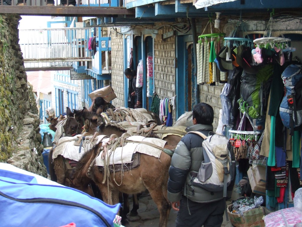
We look forward to running away, the time to distribute the loads on backpacks. The path is wide, in descent and all is OK. We walk in T-shirt and the weight of bags hardly is smelt. There are a lot of people on the road and we must have crossed in one hour the equivalent which passes by Makalu in a year.
Crossing of dashing villages with pleasant lodges alternating rain forests. That will not last, at least as for the vegetation …


2d day from Phakding to Namche Bazar (3384m) 10.4km in 7h10, ascent +751m

T inside at 6:15 am +9°C. Depart at 7:30
It makes a radiant sun again and it is sufficient to put us in a good mood.


We buy without losing too much of time our TIMS 2*2000Rs then our entrances to the park of Sagarmatha 2*3000Rs. It is better not to go without paying because we shall be checked several times by soldiers on the road before Namche.
If the TIMS has a debatable utility, the entrance of the park allows at least to clean the paths. 12 years ago, they were strewed with garbage. Today, they are really clean. Paths out of the main way are not, unfortunately, the object of the same attention …
Today is more difficult because it is necessary to face the terrible ascent leading to Namche. I hope not to arrive too late because it is market day. But bags decide on our speed of snails.
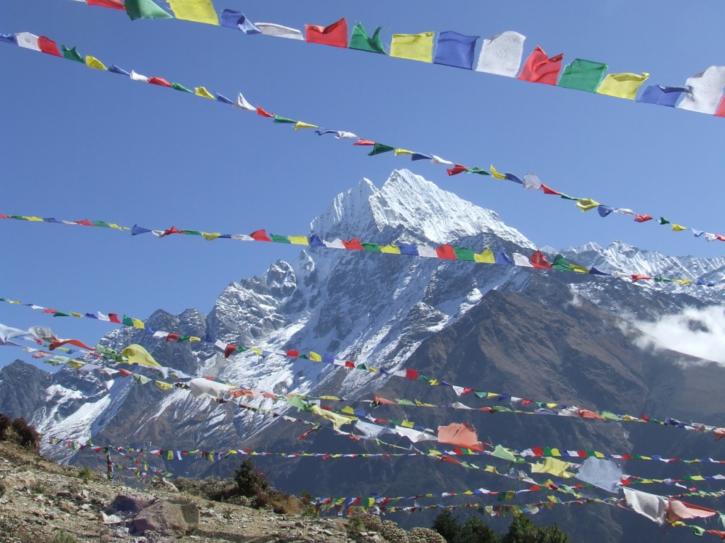
The beauty of mountains begins to appear through pine forests and we discover after a turn, the still distant silhouette of Everest.


In Namche, the market is still active when we arrive. We make a visit after being installed in one of the numerous lodges. Here the telephone always works ( Ncell) and will work until Gorakshep.
3rd day Acclimatization in Namche Bazar
The day is dedicated to the rest and to the small ballad in the neighborhood of Namche. We locate the path to Tengboche. We walk up in pastures overhanging the city until the lunch. Clouds arrive in afternoon and the mist goes up gradually from the low valleys to invade the city and disappear with night.


4th day from Namche Bazar to Tengboche 3857m, 11.3km in 6:10, ascent +473m

T=12°C inside at 6h.
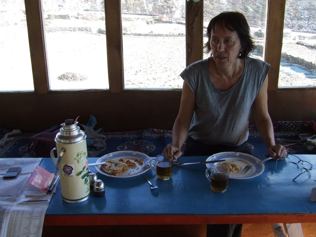
A complet blue sky is there and we take our time for the breakfast. It is the moment to take energy to face the ascents towards the high mountain. We standardized our orders, in front of the luxury of the offered menus: a small pot (1 liter!) of milk coffee for two, a pancake with honey for me and some porridge for Sylvie. In brief, a » ressuscitation kit » that we can only find in the touristic zones when we know that a meal, whatever it is in Nepal when it does not consist exclusively of Dahlbat is not a meal.
We will always pay attention to leave the convoys of mules or yaks on the valley side of the path. One French died, few weeks previously, pushed by the load of an animal. He fall in the ravine and his body was never found.

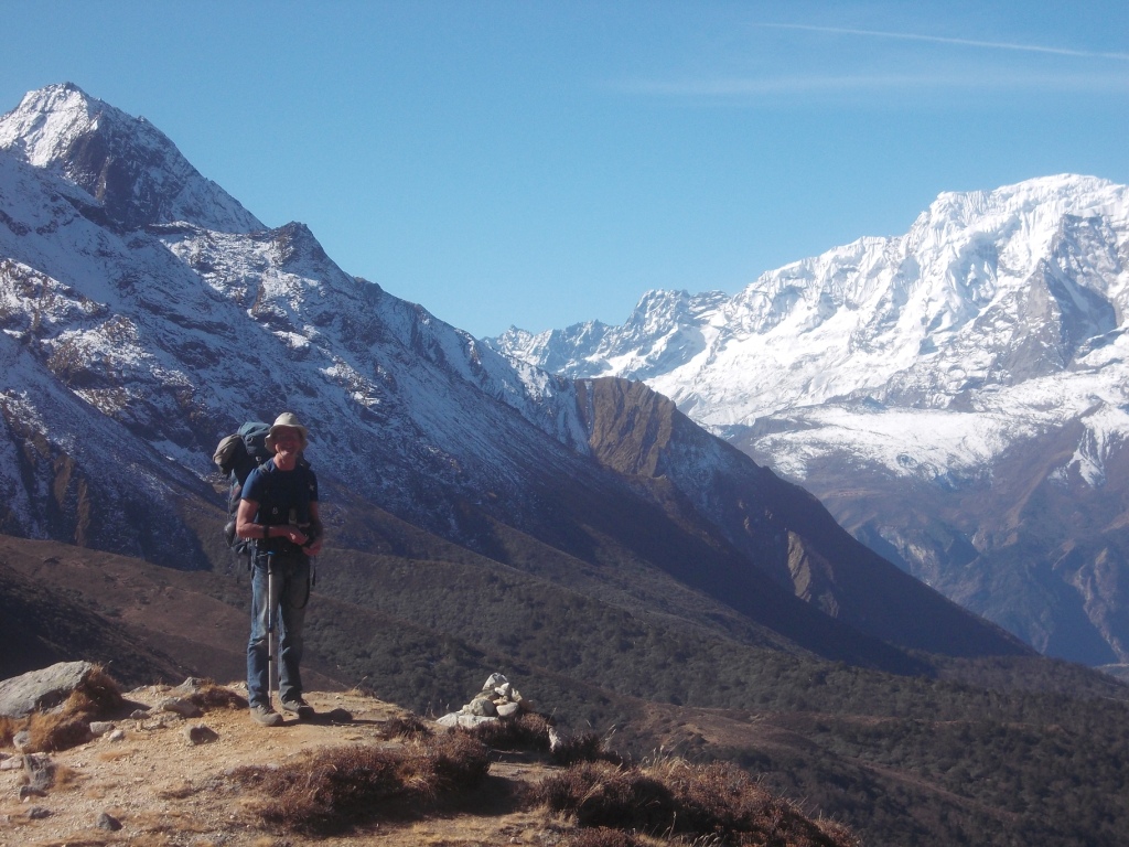
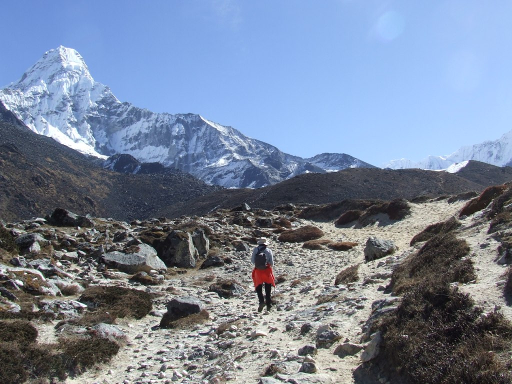
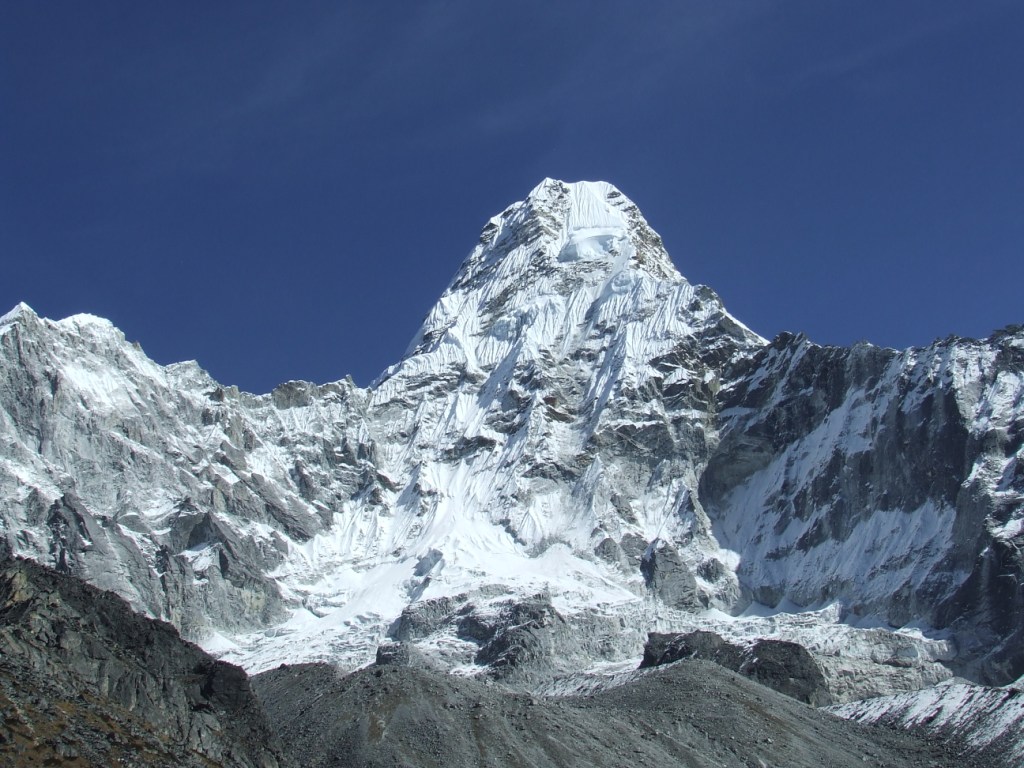
The Ama Dablam makes its first appearance at a bend of the path. We have to go at the foot of this magnificent mountain then by-pass it during about ten day.

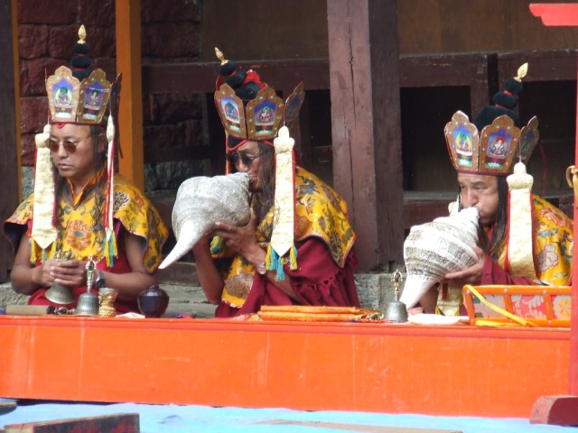
We arrive in Tengboche at 1:30 pm. This beautiful monastery, surrounded by dry stones lodges, welcomes us on a headland with magnificent panoramas that we can even admire from our bedroom. We attend Buddhist ceremonies in which we understand nothing after a copious lunch.
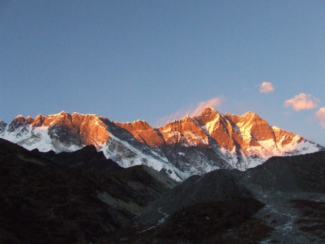
The waves of mist don’t manage to cross the hillsides we climbed in the morning and the sky remains bright for the show of crests on fire at sunset.

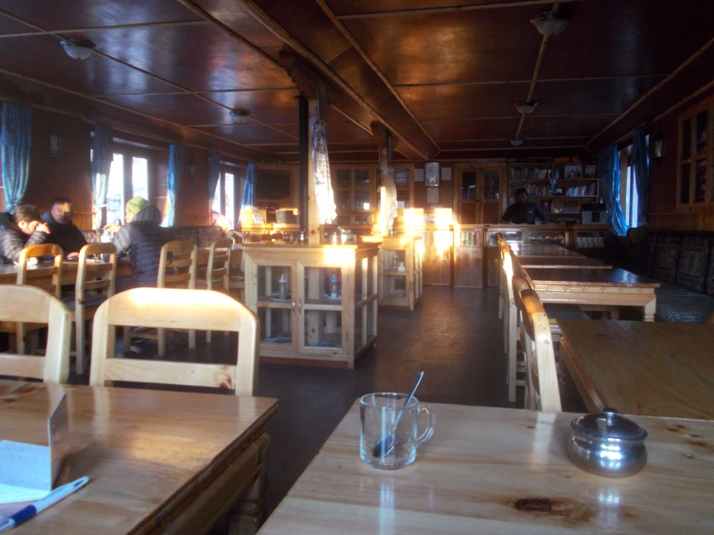
I count not less than 35 people in the dining room well warmed on the fire of dried yak dungs, in the evening. Our first parts of Rumi begin, ideal solution to spend pleasantly the time while waiting for the dinner.
5th day Acclimatization to Tengboche, chörten at 4183m
We have time and we give priority to acclimatization. The magic aspect of the place is an opportunity to spend the day pleasantly to rest. The headaches are not too present and managed with Ibuprofen.


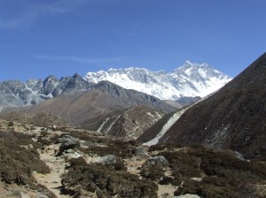
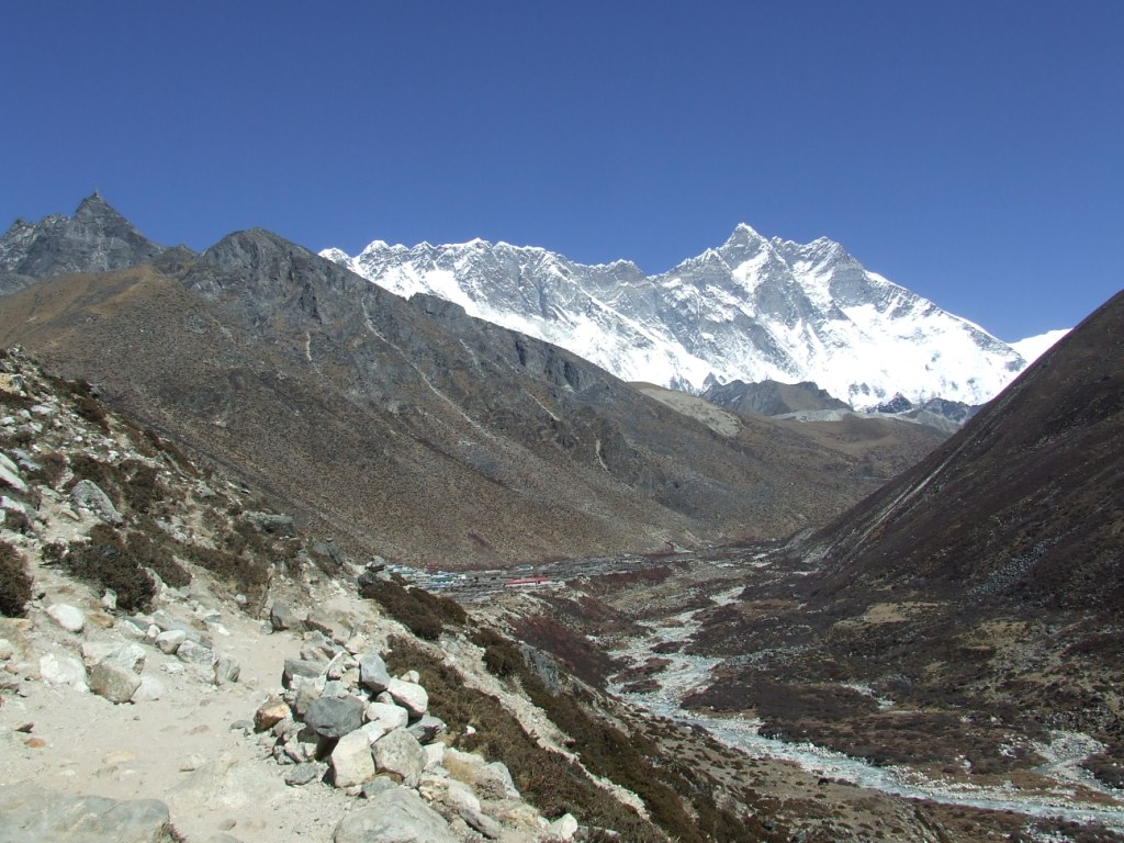
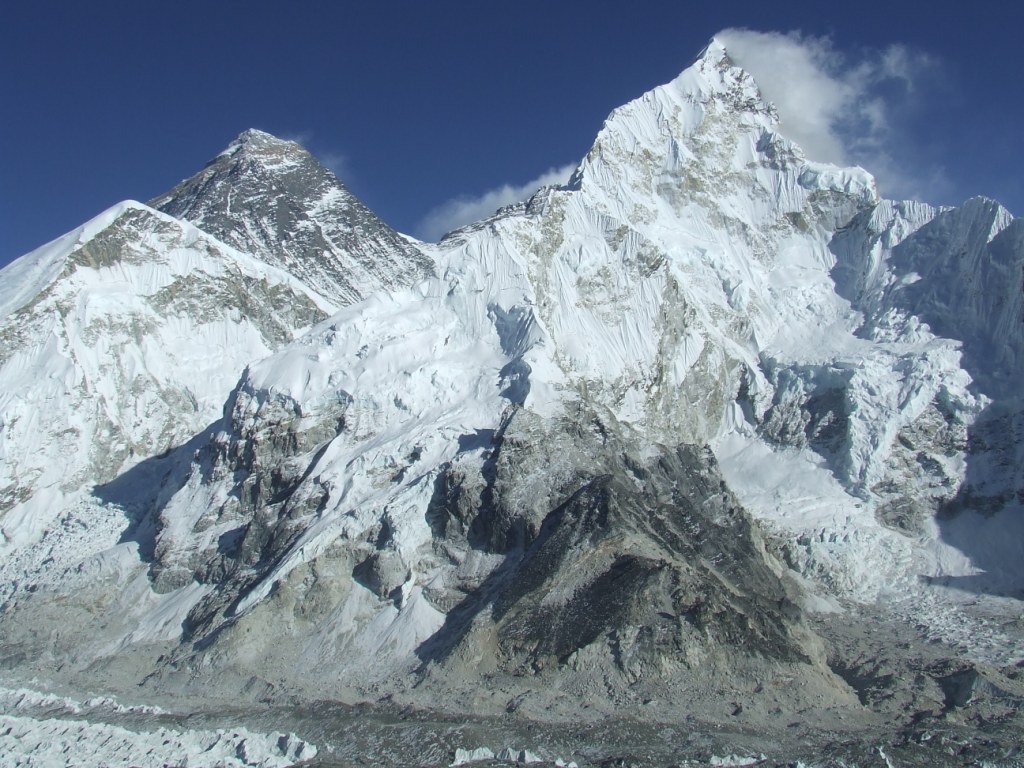
The morning is dedicated to look for and to follow the only path leading to mountains surrounding. I go to a small chörten combing a summit. It allows me to discover the glacier and the massif of Kangtega (6685m), Ama Dablam (6856m) as well as the massif of Nuptse (7861m), of Lhotse (8414m) and in the background, already, Everest (8848m).


6th day from Tengboche to Pangboche 3955m, 4.4km in 2:20, ascent +98m

T=+2°C inside at 6h.
We leave at 7:40 am. The rows of trekkers are already on the way. We have to learn to manage their doublings or crossings on sometimes narrow paths. Our stage is short and we continue the step with our quiet rhythm to protect the crew!

We cross Pangboche to settle down in the last lodge. It allows us to explore easily the path to go to the Base camp of Ama Dablam.
We take advantage of it to bathe in the torrent. The water has to approach 3 or 4°C. The sun-drying is a real happiness. The evening takes place together with Hervé, solitary trekker. He is the first one whom we meet without guide. It creates movements of solidarity.
7th day From Pangboche to CB of Ama Dablam 4572m, 6.2km in 3:20, ascent +617m
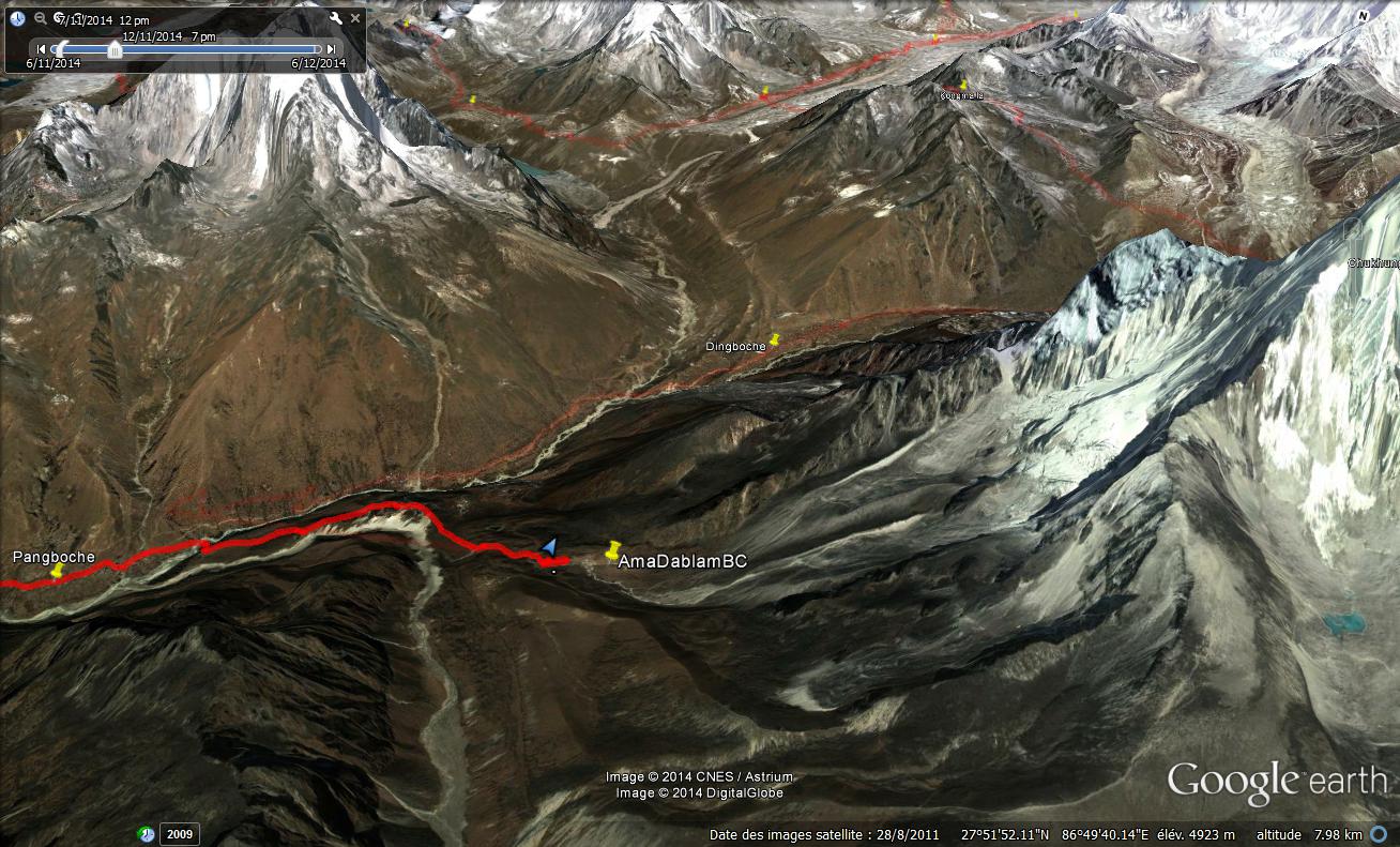
T=1°C inside at at 6h. We leave at 8:20 to arrive at 11:40 at the base camp. The ascent is rough and Sylvie has a persistent headache. It is not a good sign. The base camp has been certainly established at the bottom of a lake. Climbers’ numerous tents are installed there.

We settle down at some hundred meters aside to give way to the dream. Especially as the camp is downhill and doesn’t arrange the most beautiful view.
The weather is always very clear but the small ice-cold wind pierces us. We lunch with pancakes prepared in the morning in Pangboche and with sausage. This one causes an indigestion which cuts our legs in the afternoon and the evening, experience to be avoided!
We lie in the tent in which temperature brutally falls from 35 to 0°C at the time of the sunset. It is a long night of waits and interrupted sleeps.

8th day From CB of Ama Dablam to Pangboche, 6.2km in 1:45, made descent-617m
T=-4°C inside at 6h. We wait for the sun heating the tent to prepare the breakfast made of muesli, milk and cappuccino. The sky is a little bit milky this morning. We fold up the camp slowly to leave at about 10:45 am. We arrive at the lodge at 12:30 am, exhausted but headaches and nausea are practically erased. We have the afternoon to recover definitively from the food poisoning. The sun is again radiant.

I wash Sylvie’s hair with the water warmed on our stove. I try to shave myself and give up definitively this type of useless exercise up to the end of the trek. We shall see in KTM.
The evening takes place together with a group of Spanish, around the stove. I wake up at night with a headache and difficulties to breathe. The lack of oxygenation causes headaches. We are not still well acclimatized.
9th day from Pangboche to Dingboche 4339m, 5.9km in 3:45, ascent +384m

T= 0°C inside at 7h.
We leave late towards 9 am because we do not wish to join Chukhung today. The nighttime experience proved us that we are not still ready for the high heights.


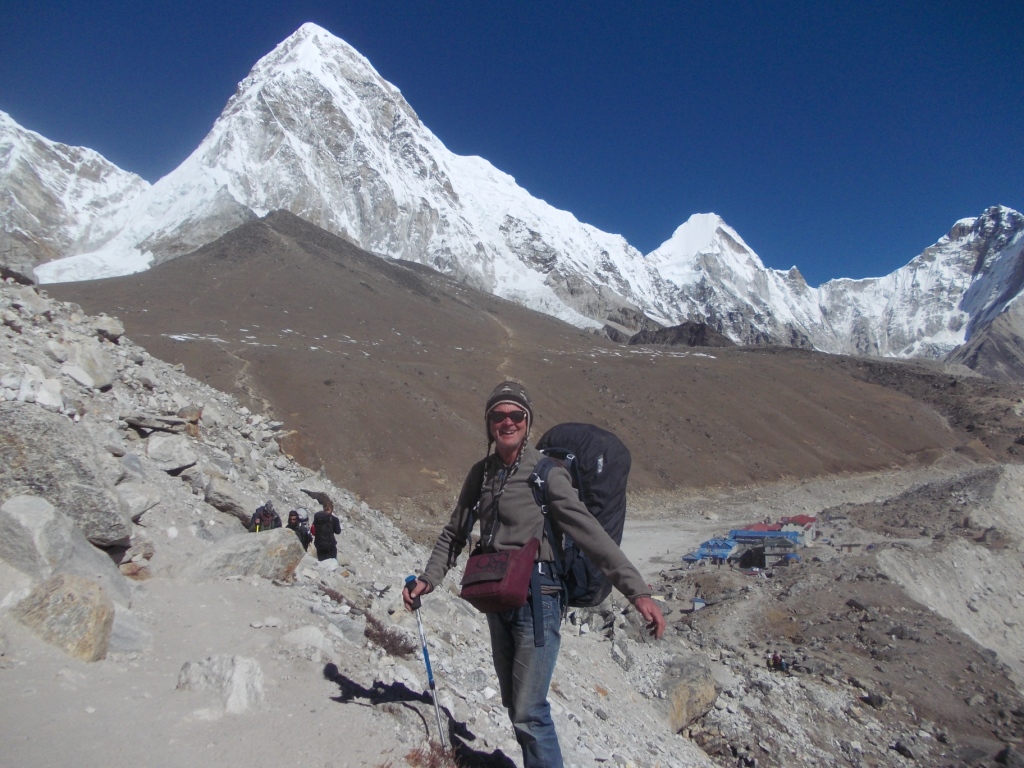
The ascent is progressive today and we take advantage of great panoramas. It is necessary to be careful to take the good fork because we abandon the big track which leads to the Everest base camp. Dingboche, where we stop at about 12:45 am, is now on the road of Island Peak and Renjo la, first of three passes which we want to climb.

I thought that the path would be deserted but that’s not the case. This is not any more the crowd but there are still some groups of walkers on the road. In Dingboche, shops allow a possible food supply.
We find a lodge which gives onto Island peak and Lhotse. The dining room is admirably situated, in overhang, to attend at sunset on Lhotse. The steak of yak is excellent. And the bedroom is free.


10th day From Dingboche to the Camp of Lhotse 4912m, 7.3km in 3 hours, ascent +572m

T=0°C inside at 6:30. Departure at 7:55. The ascent is continuous and soft. We arrive in Chukhung at about 10:50 to take a tea and to leave at about 11:30. It is necessary to us to grope to find the way towards Island peak. It becomes more confidential because mainly borrowed by the climbers.

We find at about 1 pm, at the middle way to the Base Camp of Island peak, a location with a view of the glacier of the Lhotse and the Ama Dablam. The sandy soil is frozen and a stone is needed to tap the pickets of the tent in the sand. There is not liquid water anymore here and it will be necessary to melt the snow for the meals. 
At the end of afternoon I climb on the moraine to attend at sunset. The sky hides itself more and more and the gilded brightness on summits are a little sieved.

Dinner of semolina, cheese, biscuits and chocolate.
11th day From the Camp of Lhotse to Chukhung 4726m, 2.2km ¾ an hour, descent -186m
T=-11°C inside at 7am. Awake at 8:30 am to try to benefit from of the sun, unfortunately absent.
The night was cold but the breath seems better. The sky is grey for the first time this morning. We leave only at 10:30 am because it takes time to make the breakfast: the jet of the stove is blocked and it is necessary to unsettle it to be able to light the fire.
Every picket sticks terribly on the frozen ground. It is necessary to dig a cone around each with the back of the blade of Opinel to unstick them from their gangues of ice-cold sand.
The descent on Chukhung is fast. We find a very nice « resort » which is not more expensive than a lodge … Because of cloudy weather, we cancel the ascent of Chukhung ri. It’s a pity because Yannick, met later, will tell us that the panorama at the top is extremely beautiful.

We go in afternoon in recognition of the path leading to Kongma la, first pass of our trip.
The sky gets free at the end of afternoon for a more magnificent sunset as unexpected on Lhotse and valley

12th day From Chukhung to the Camp of Khumbu (4906m), Kongma la 5514m, 9.3km in 9:40 am, ascent +180m

We get up a little earlier, at 5:30 am because the step will be long today. The acclimatization time is finished. The path towards the pass of Kongma is well drawn and rises regularly on its first part. The sun quickly join and warm us.


The last part is rough on the other hand because it is necessary to cross what appears to be the real cliff. Without GPS or the trace of the path (because snow for example), the progress would be unpredictable.

Arrived on the pass at about 1:10 pm, the view is great, with a totally crystal clear sky.

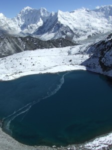
Some volutes arise from the top of Lhotse and an emerald green lake extends at our feet. We lunch on the pass in a hidden recess shielded from the wind.
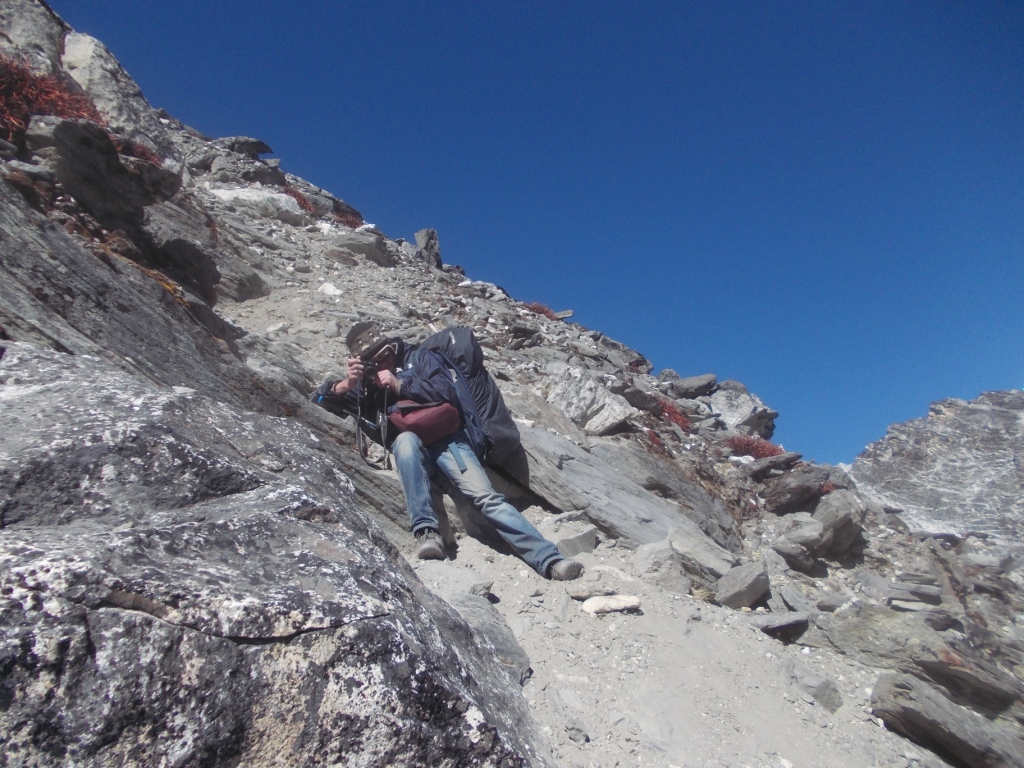
The descent is a vast scree, covered with ice in certain places. We left our Microspikes at the bottom of our bags and we are not proud of this lack of preparation. It is sometimes necessary us to go down on buttocks to avoid a fatal fall.


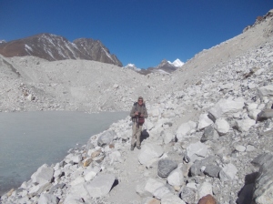
We arrive at about 4:10 at the foot of the impressive moraine of the Khumbu glacier. We hesitate to cross it because it is late. We do not want to take the risk of losing us on the back strewed with cracks and with iced lakes. We thus decide to settle the tent on a bed of icy sand already in the shade. Here, as in the first camp, we do not find a torrent for the water supply. It will be necessary to us to melt some snow to prepare the meal of semolina mixed in a Turkish chicken soup bought in a Namche shop. Here is the globalization lived on the ground!


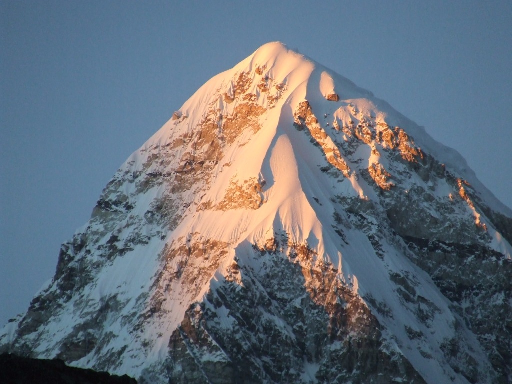
Beautiful sunset on Pumo ri (7165m). It is our new friend, having abandoned today the Ama Dablam.
We go to bed at about 6 pm after an uncomfortable Rumi party: the pieces of paper are unstable on sleeping bags and we have -12°C in the tent!
13th day From the Camp of Khumbu to Lobuche 4931m, 1.7km in 2 hours, ascent +25m

T=-3°C inside at 8:30am. We adopt the same tactics as in the first camp, waiting comfortably in our sleeping bags for the sun to come to lick the icy walls of the tent.
We are voluntarily lazy because the stage will be short today: we just have to cross the biggest glacier of the world.
We end quitly our breakfast when two fellows rush down from the pass. It has to be 10 am. Yannick and Fin left at 6 am this morning from Chukhung and are already at the foot of the moraine at the end of morning. They envy us to be able to settle where we want with the tent but they are 4 times faster than us. They hope to cross the glacier in 20 mn. They will spend 1 hour there by crossing without worrying about cairns. We will spend, us, 2 hours.


14th day from Lobuche to Gorakshep (5172m), Kala patar 5640m, 9km in 2:50 + KP, ascent +241m

There is not far from Lobuche to Gorakshep and it is necessary to become used again to the long organized rows of trekkeurs with their sticks clashing in rhythm. The Lobuche’s pass is a bottleneck in which the patience is not an option 😉


In Gorakshep, lodges are not lacking and the prices continue to increase. I negotiate 300Rs a room against 500. They will refund themselves easily on the meals. We find Yannick and Fin there who just come back from the Kala patar. What an energy! We lunch together before they come down towards Lobuche. As finer negotiators, they do not have to pay for their rooms (moreover, they never pay).
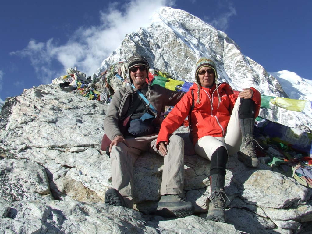
We leave at about 1 pm towards Kala Patar to arrive at the summit at about 3:15. Our objectf is to wait for the sunset there. My GPS indicates 5640m, in compliance with the point found on Google Earth. Yannick himself found this altitude. Nevertheless, the official height is only of 5545m there. I see a small hill, below, which could be the « former » Kala Patar. Strange. Maybe that the Nepalese State wants to avoid a classification in the trekking peaks list, worried of not killing the goose that lays the golden egg? You should not repeat it but it would be easy to him to collect 5000€/day by taxing the ascent. If this hypothesis is correct, the trek without compulsory guide in Nepal has beautiful days.
We wait two long hours that the sun accepts to lie down. The experience is irreplaceable but it is necessary to manage the cold.

Sylvie goes down half an hour before me and I catch up her at night. It is necessary to say that its fluorescent orange raincoat must be visible from the Moon. Always improvident, we forgot our headlight. We put ¾ hour to join the lodge.

15th day In Gorakshep. Round trip to CB Everest (5247m) 4.6km in 3:30

T=-1°C inside at 7:30am.
I leave only at 9:30 am towards the Everest’s base camp, letting Sylvie rest of her yesterday descent. One of its toenails exploded.
Without the backpack, I feel wings. I arrive there at about 11:20 am. There is some trekkers but no tent on the moraine. We planned initially to camp there but we preferred the comfort of the lodge … I do not regret the walk because the landscapes are very different from those who preceded. I have now to enter in as much to go on the back the glacier. It is a world of blocks of ice, so big as icebergs, as congealed in their fall towards the valley


The absence of tent is maybe understandable by the Sherpa’s strike begun in May, 2014, following the avalanche killing twelve of them and leaving their families in a total destitution. We have the right to risk our lives to accomplish our passions. Taking risk with people who make it for their surviving seems to me a little bit shocking.
16th day from Gorakshep to Dzongla 4831m, 11km in 6 hours, descent -341m

T=-1°C inside at 6:30am.
Bad news this morning: the manager of the lodge learns us that the government decided to close the airport of Lukla from 26 till 28 November because a summit of the SAARC [ 1 ] will take place to KTM. Our plane has to leave the 30th and we are at risk to have crowd to Lukla looking forward to return on KTM. Without mattering on the weather which can very well conjugate its efforts to stick thousands of trekkers several additional days. These news waste us the morale and will be confirmed in Lobuche and Gokyo.
The time is at the descent. We go now to the second pass which joins the valleys of Khumbu and Ngozumba.


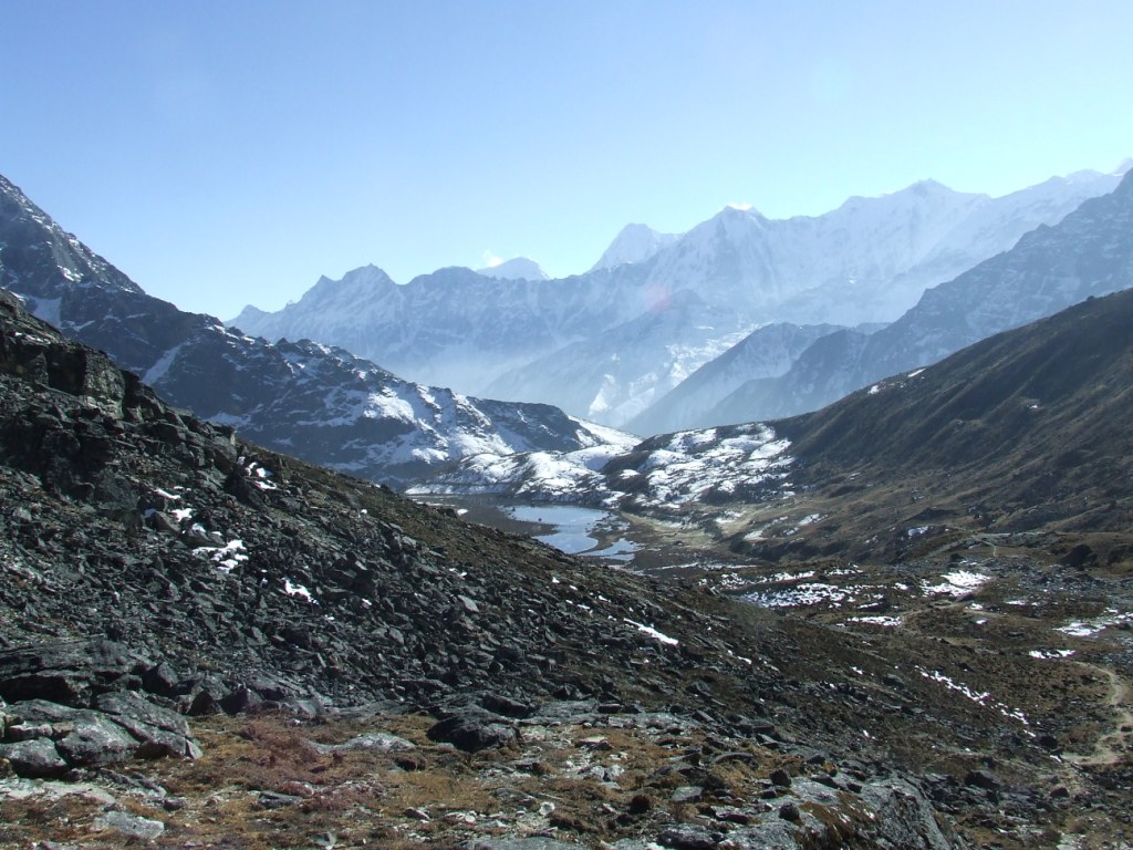
The descent towards Dzongla, by by-passing in height a magnificent lake, is soft. We abandoned, inLobuche, the main road which comes down towards Namche. In Dzongla, several lodges competes in spite of the low attendance of the path.
[1] SAARC = South Asian Association for Regional Cooperation. During this « summit » will be decided the construction of a hydroelectric dam, cofinanced by Nepal and India for a billion dollar amount. Sanjaya (Friends of Nature) was right, when in May, 2014, he was predicting that the » Gold of Nepal » is the hydroelectric strength to get in mountains and to distribute on all the Indian subcontinent. He dreamed even, I remember, about an electric car for all the Nepalese.
We better understand why Lukla is a mousetrap (appendix 2): the airport of Kathmandu includes on the same place the domestic and international parts. It is not possible to manage simultaneously these two types of flights. When it is really necessary to make land international flights (case of the SARC meeting), it is necessary to cancel all or part of the domestic flights. What is made here by the government in its big wisdom! 😉
17th day from Dzongla to Dragnag (4717m), Cho la 5369m, 9.1km in 8:30, descent -120m

T=-5°C inside at 5:30.
We leave at 6:45 am for a new hard walking. We took out our microspikes this time! We move again in a great environment and under a sky of azure. After a 45° slope , we arrive on the glacier. Crampons are very efficient on the ice and we feel safe.


The sight on the pass is also magnificent and numerous clouds form when we arrive at about 11:15. We lunch of toasts of county and of chocolate… The cold wind pierces us as in Kongma la.


The Ngozumba glacier has nothing to envy to that of Khumbu. It will be necessary to us to cross it tomorrow.
The descent is vertiginous as the ascent but less stable with big stones which ask only to come down with us. It is necessary, in the continuation, to go back up a small unforeseen pass which nevertheless peaks at 5150m, before joining Dragnag, already in the shade, at 3:15 pm.


With days and especially with nights, the spirit of the trek has changed. It was initially to balance a comfortable part in lodges with an autonomous, uncomfortable part allowing to enjoy mountains, isolated in the most extraordinary places. Although the conditions are not harder than around Dhaulagiri or in Makalu, we lose the courage to install the tent in the big cold, to dinner briefly while the steak of yak and a well burning stove wait for us at some kilometers … This is how we gradually abandon settling in the base camp of Cho Oyu …
We spend the evening with Didier, retired Breton professor. He walks in inverse sens with a friend and without guide.
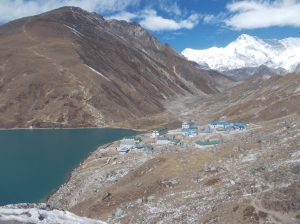
18th day From Dragnag to Gokyo 4758m, 4km in 3:20, ascent +47m

T=-4°C inside at 7h
We leave at 8:10 am by following the foot of the mountain northward to join the path which crosses the Ngozumba’s glacier. The track is correctly marked on the ground and we scrupulously follow cairns. From time to time we hear the fall of stones on the ice already warmed by the sun.


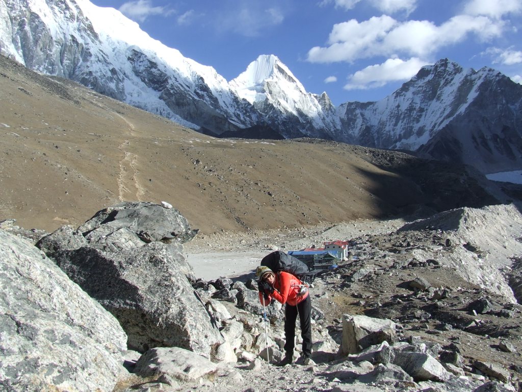
The ascents and the descents on the back of the glacier are more tiring than we had planned. The very good weather of the morning covers gradually. We arrive at 11:30 at Namaste lodge recommended by Didier: the cooking is there excellent. Coincidence or mark of good forks, we find Yannick and Fin there.

We shall not forget the Yack Sizler vegetables French fries.
On phone, Yeti Airlines’s Tulsa reassures us. The airport reopens 28 and the closure will have no incidence on the boarding of November 30th. Maybe.
We take the luxury of a hot shower afternoon!
19th day In Gokyo. Round trip towards Cho Oyu 4965m, 8.8km in 3:30

The breath was difficult this night, with the headache that goes with it. Everything is back to normal again with some ibuprofen.
T =-5°C inside at 7am.
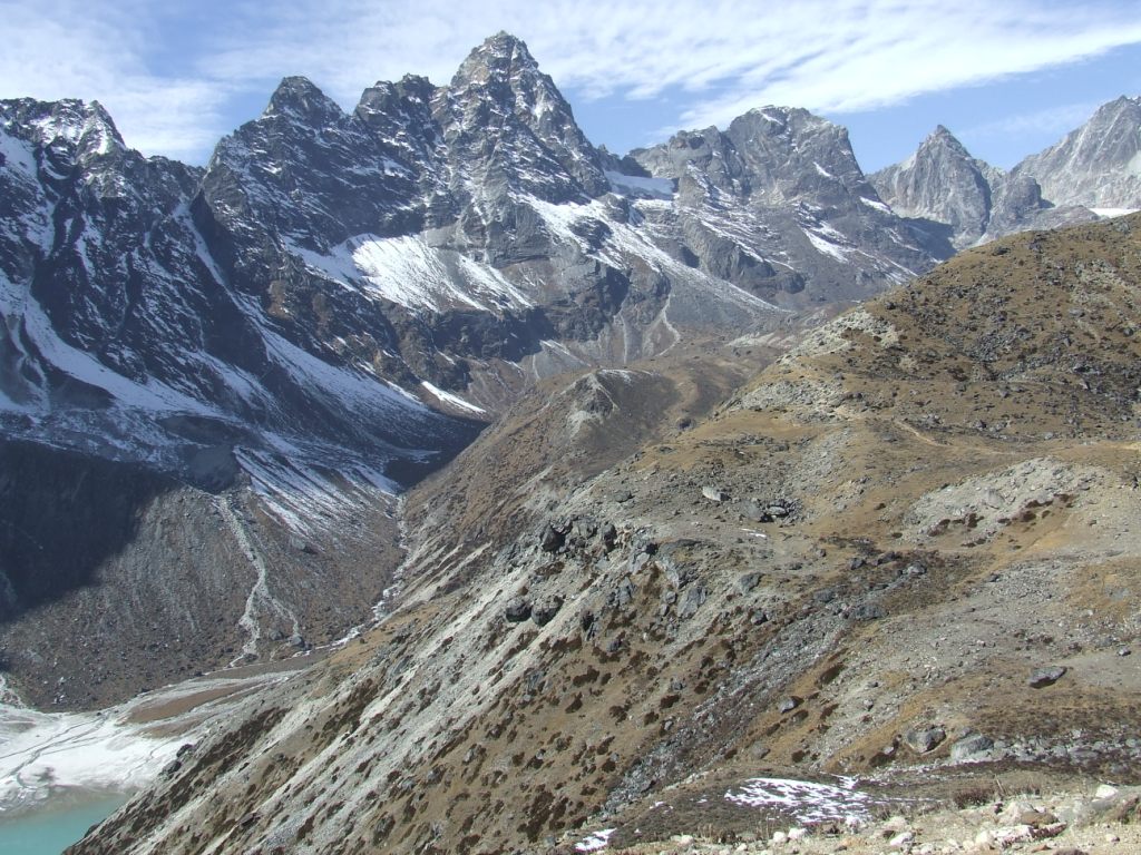
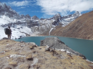
I pass a verbal contract with Sylvie: we shall walk towards Cho Oyu during 2 hours, no more … The sky is particularly clear this morning. We exceed of a kilometer the 4th lake without being able to see the Everest on the right because we miss a small additional kilometer… We discover to the left Cho Oyu (8188m) and to the right Gyachung Kang (7952m).


On the way back, we meet Arnaud and Christine. We’ll meet in Namaste Lodge!
20th day From Gokyo to Lumde (4400m), Renjo la 5366m, 11.5km in 9:40 am, descent -358m

T=-4°C inside at 5h30. It will be tiring today because we have to cross our third and last pass, Renjo la. We leave at 7:20 am to reach the pass at 12:30. We suffer in the ascent but microspikes are again very useful. We take advantage of it to cut the tortuous path by crossing the ice surfaces.


We lunch on the pass where the sights are again magnificent. We perceive Makalu (at the back on the right of Lhotse) at the foot of which I was in May. This time and contrary to the Kala Patar’s point of view, Everest is the highest, also seemingly.


The descent is also hard. It is because, probably, of the accumulation of fatigue since the start of the trek. On the road, before the big descent towards Lumde, there are magnificent places to establish a camp at the edge of a torrent

21th day From Lumde to Namche Bazar (3384m), 19.1km in 7 hours, descent -1016m

T=-1°C inside at 8h. We took our time in the breakfast with Arnaud and Christine. They walk faster than us but we meet now every evening in the same lodges.
I had planned a stage to Thame but we continue towards Namche. It allows us to win one day to manage the departure of Lukla which risks to be difficult.
We go from the mineral and clear world to the world of forests and mists. By coming down, the weather covers itself and we go into the clouds which hang on to the hillsides of the mountain.


We arrive in Namche at nightfall. The circle is completed.
22nd day From Namche to Phakding (2633m), 10.4km in 6:20, descent -751m
The sky is grey on Namche and it will stay until Phakding. The valley below seems plunged into the twilight of a Tolkien’s tale. We phone to try to leave one day earlier Lukla.


23rd day From Phakding to Lukla (2857m), 7.5km in 3 hours, ascent +224m
The sky remains grey all day long. We have an important feeling of cold here, more than in high height. No plane landed or took off today. We shall see good tomorrow.
At the end of the trek.
Appendix 1: list of the GPS points
Coordonnées réelles Khumbu 2014
You can see the complete spreadsheet with time schedule, ascents, possibility of organizing a new trek etc. by the tab Autonomy Tools / tableur spreadsheet Excel
The site doesn’t accept .kmz files. The file will be sent on Wikiloc by this page on the right side.
Appendix 2: the mousetrap of Lukla
To go out of Khumbu, there are several solutions. To take the plane, it is seemingly the simplest and the fastest: in hardly half an hour, you do the route to Kathmandu in a twin-engine plane, like Indiana Jone. Statistics: a crash a year, it is sufficieent to avoid it.
You can otherwise lengthen your trek of 5 days by returning by Jiri, knowing that it will be necessary to add 11 hours or more of bus to join KTM. No statistics concerning buses.
Finally, the legend says that you can also pass by a village named « Salery ». The trek Lukla-Salery takes only 2 to 3 days. A jeep would take you then towards Kathmandu in 17 hours on a path which really seems no suitable for vehicules on the map. The investigation does not allow us to determine where arrives this hypothetical jeep and people interviewed in Kathmandu are at least perplexed.
The helicopter which can take off in a little less demanding conditions of visibility that the plane is the last option, but it is much more expensive. The prices rise without limit when planes do not take off any more. 400, 500, 700 USD. Business is business.
Because it is necessary to know that planes and helicopters move only at sight, that they have to cross over high passes because Lukla is surrounded with monsters with snowy summits.
It is also necessary to know that the weather in Kathmandu is very different from that of Lukla: when it is possible to envisage a take-off in the early hours in Lukla because there is still no wind and because night mists are dissolved with the cold, Kathmandu often soaks in a thick fog. When the fog gets up finally in Kathmandu, winds got up on passes and the mist already invades the tarmac of Lukla.
In these two situations, the persons in charge of control towers, if they do not drink the tea, forbid any take-off.
In brief, Lukla is a mousetrap.
If you decide, nevertheless, to return to Kathmandu by plane, there are three golden rules to be respected.
1. Buy a ticket for the first morning flight. It gives you priority in front of the troops of flight of the day.
2. Remain Zen and leave politely pass before youfor check in, the organized groups supervised by corrupted guides.
3. Ask Saint Claire so that the weather does not degrade before you embarked on the liberator zinc.
