
Du 6 au 29 novembre 2014

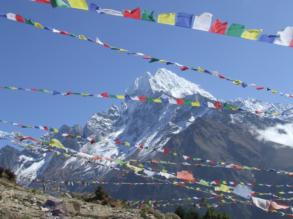
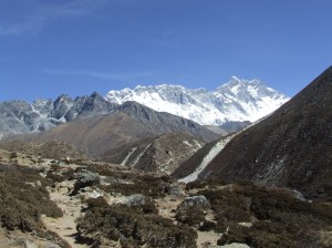
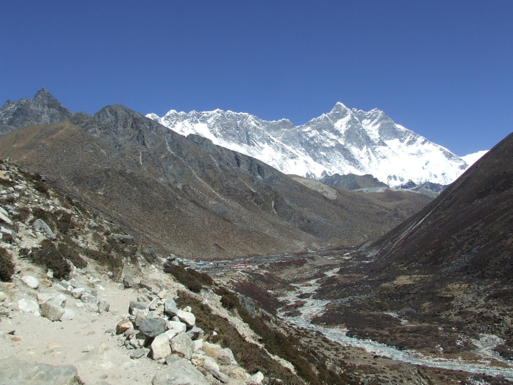
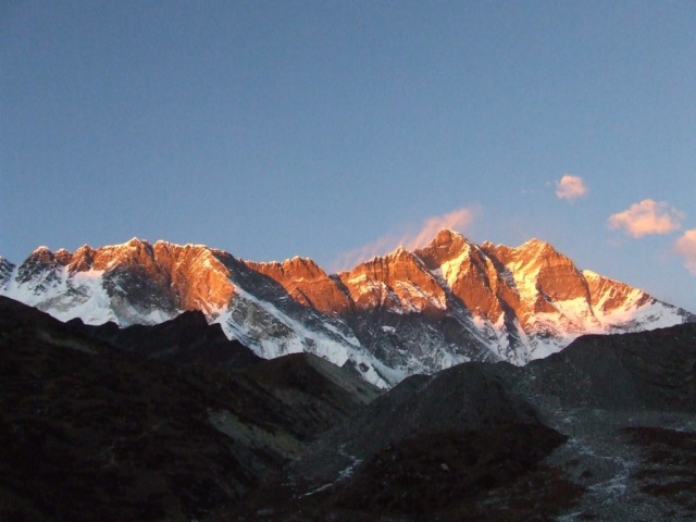
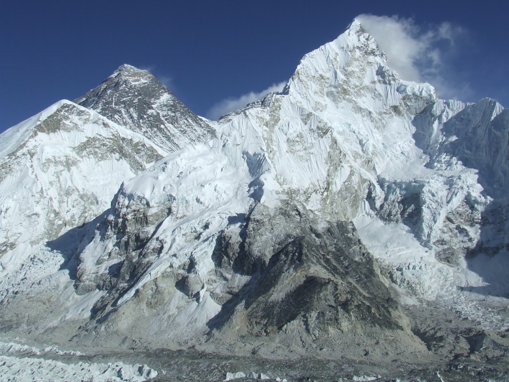
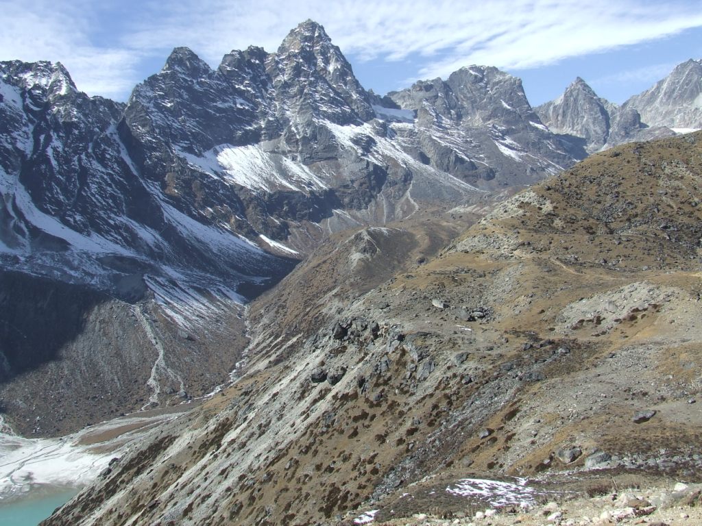
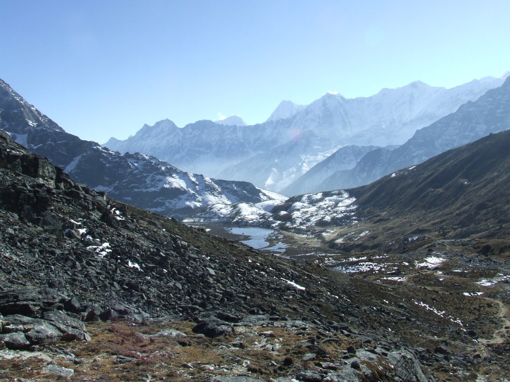
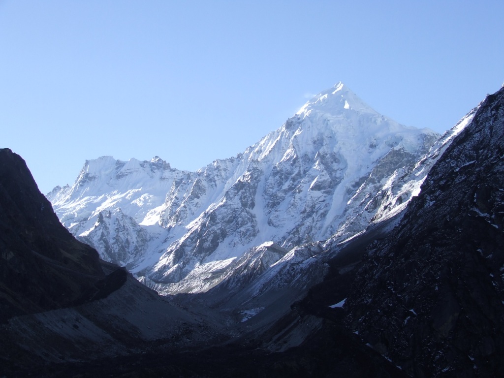
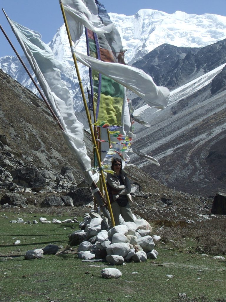
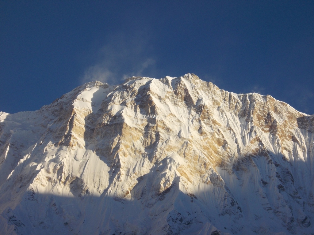
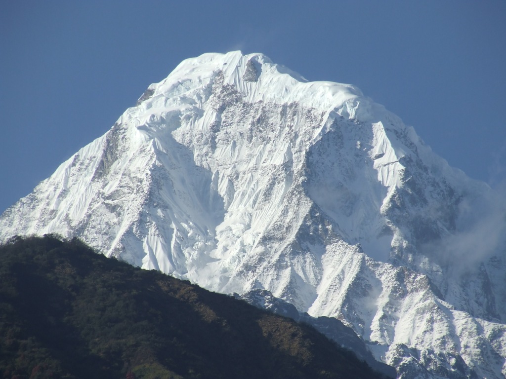
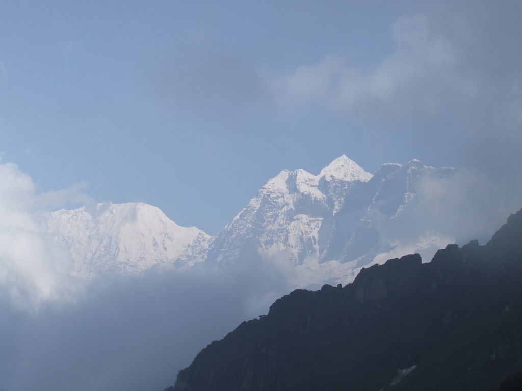
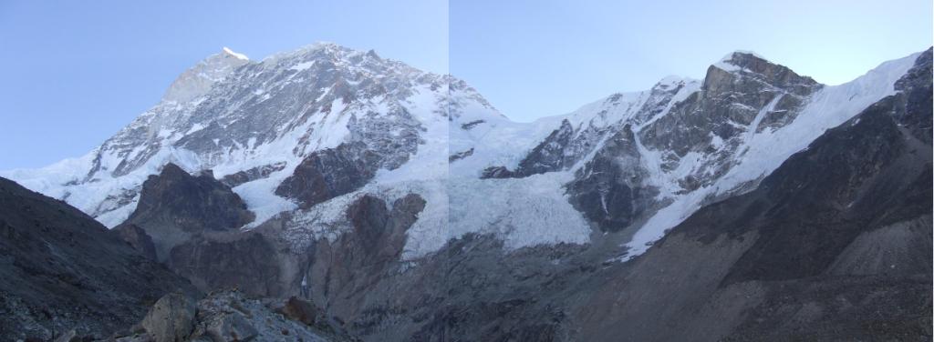
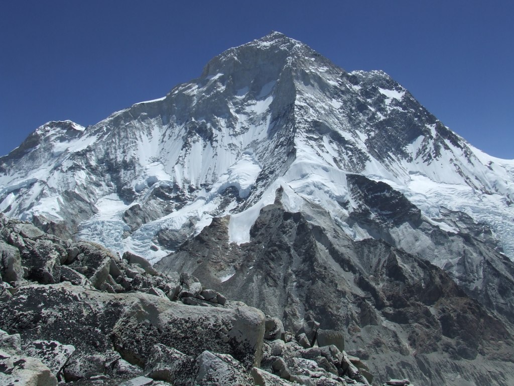
Lhotse et Everest vus du Kalapatar
(vous pouvez agrandir les photos en cliquant dessus)
1. Impressions générales :
Boz51 (Voyages Forum) nous avait donné l’envie d’effectuer ce trek avec son article et ses photos de fin 2013. Qu’il en soit remercié !
Si les vallées du Solu Khumbu sont très fréquentées, elles n’en sont pas moins dangereuses. Les hélicoptères sont innombrables qui vont chercher les touristes insouciants souffrant du mal des montagnes parce qu’ils ont monté trop vite.
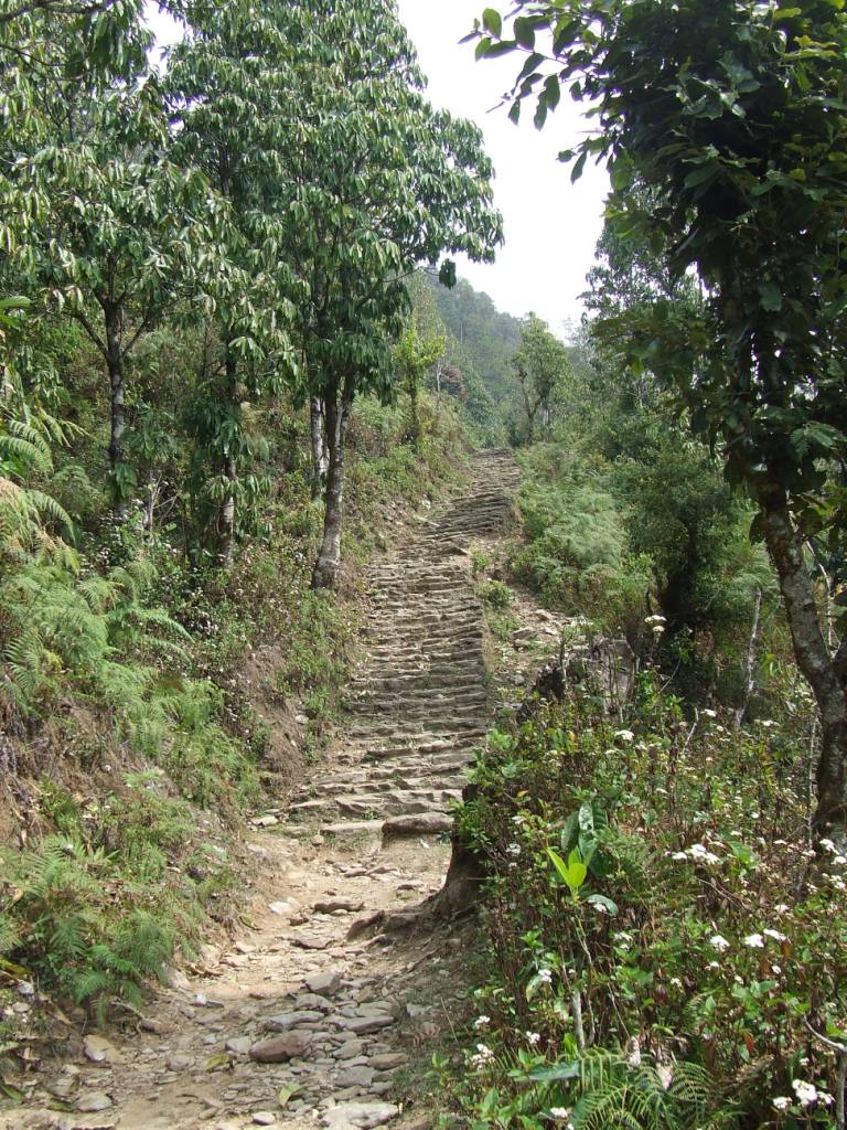
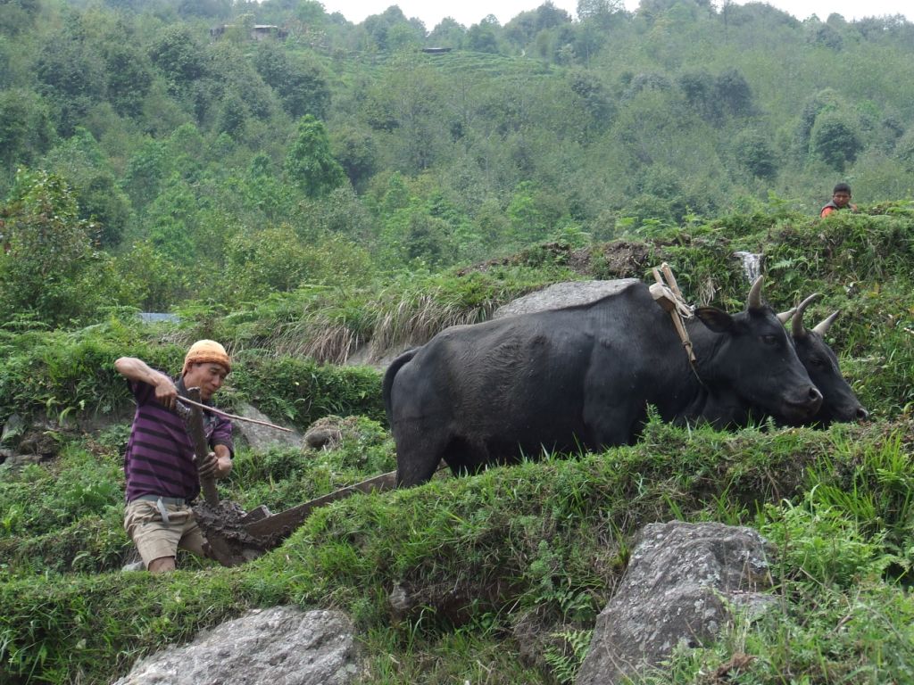
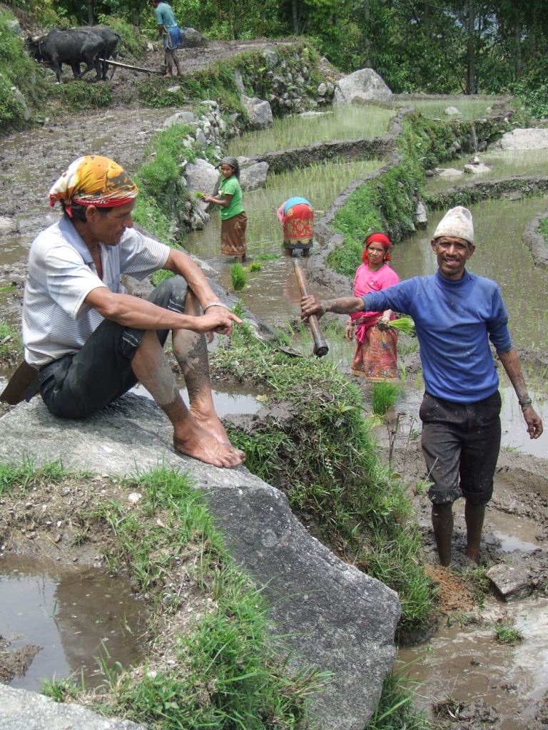
Prendre les chemins de traverse par les 3 cols (Kongma, Cho et Renjo la) permet de profiter au maximum de la beauté des montagnes tout en évitant la promiscuité de ces longues files de randonneurs cliquetant leurs bâtons de marche en cadence, commandés par un « guide » en tête et un autre en queue… Ils ne peuvent, par bonheur, que marcher dans les vallées pour rester entiers.
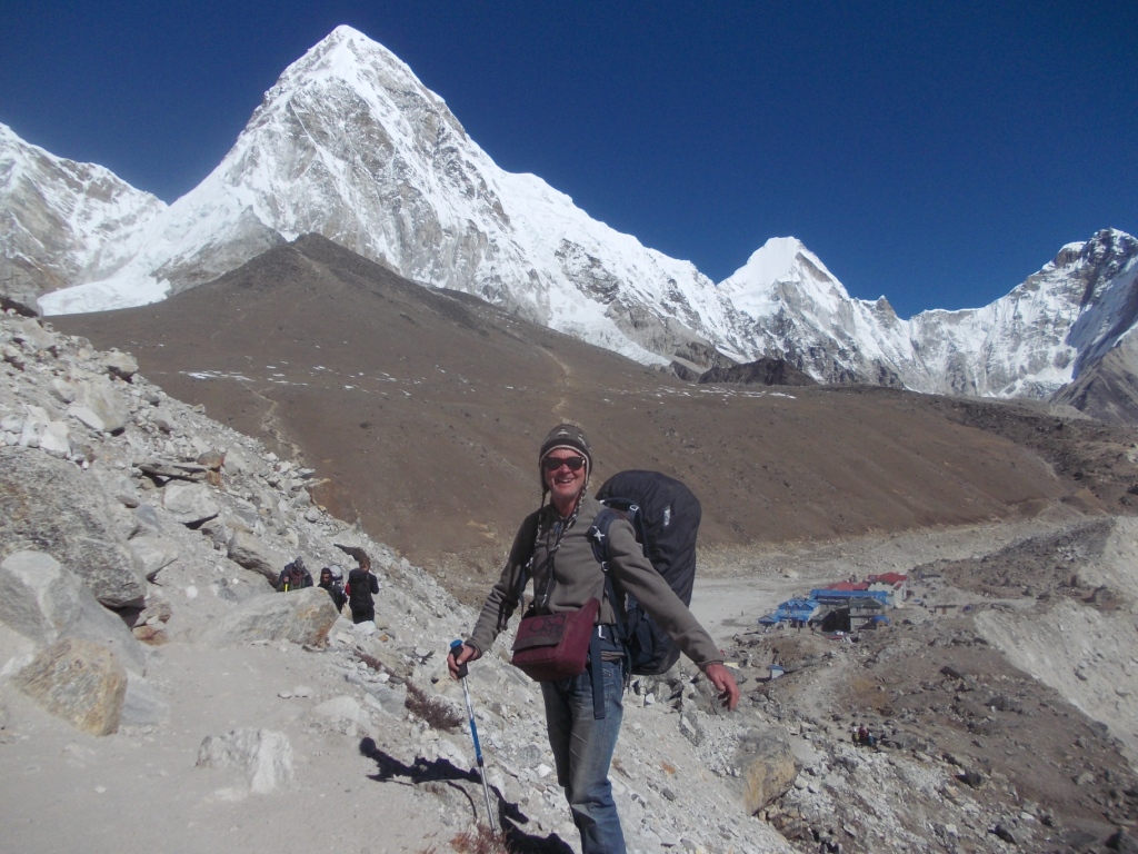
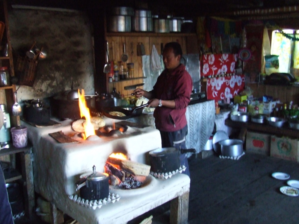
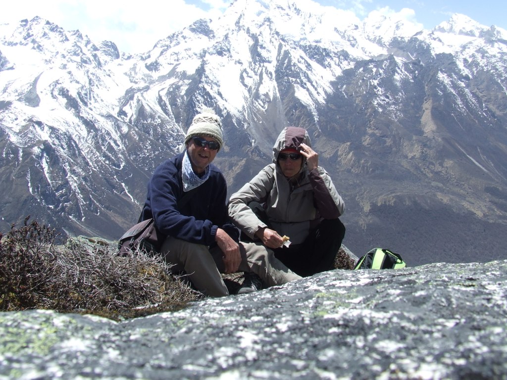
Trois cols à plus de 5300m, un petit sommet à 5640m et 170km en 23 jours dont 10 à plus de 4500m, ça use. Surtout que nous portons 18kg et 14kg sur le dos. Tente, nourriture, réchaud pour être autonomes. L’autonomie se paie au prix fort ici. Les nombreux lodges, au confort certain, sur les chemins principaux, rendront la décision de plus en plus difficile de planter notre tente sous des températures hivernales (-10 à -20°C la nuit)
Mais quel temps ! Un soleil éblouissant à perte de journées, pendant tout le trek. De quoi presque se lasser des couchers de soleil quotidiens sur nos monstres préférés… Nous avons eu de la chance quand nous pensons au drame du 14 octobre[1]. La montagne reste maîtresse de nos destins.
Et puis, ne négligeons pas un avantage d’être nombreux sur ces plus belles montagnes du monde. Nous avons rencontré des hommes et des femmes animés de la même passion, avec qui nous avons passé des soirées formidables à reconstruire, à la hâte, le Monde.
Le Népal reste étonnamment en dehors du monde malgré des abords parfois très modernes : par exemple téléphoner en France instantanément à 5180m d’altitude, face au Toit du Monde. En même temps, l’aéroport de Lukla est un baraquement insalubre (et celui de Kathmandu ne vaut pas mieux) dans lequel nous attraperons un gros rhume à attendre un avion incertain.
Enfin, cet endroit est artificiellement développé depuis qu’Edmond Hillary, premier homme à vaincre l’Everest en 1953 avec Tengzing Norgay , en a fait un lieu de pèlerinage pour tous ceux qui veulent avoir vu, une fois dans leur vie, le Toit du Monde. Ce n’est pas là que nous découvrirons la vie authentique des népalais. On ne peut pas tout avoir.
[1] Le 14 octobre 2014, en moins de 24 heures, un cyclone, né dans le golfe du Bengale, a déversé plus de 150 cm de neige sur les massifs des Annapurna. Totalement prévisible et totalement imprévu, il a tué d’un coup plus de 40 marcheurs dont la moitié de « guides » insouciants et de porteurs, ensevelis sous les avalanches au niveau de la Thorung la, en particulier.
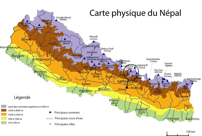
2. Situation:

3. Agenda:
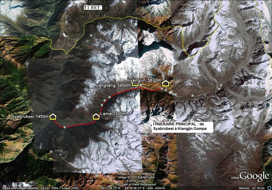
4. Etapes :

5. Altitude :

6. Dénivelés quotidiens :

7. Matériels embarqués:
Nous prévoyons 5 jours d’autonomie en nourriture avec un ravitaillement partiel par les lodges, soit 3.8kg composés de saucisson, semoule, pain type Wasa, comté, muesli, lait lyophilisé, chocolat, fruits secs, barres de céréales, palets bretons, spiruline (10g/j) sur tout le trek.
Chaussures : LOWA – Tibet pro gtx. Les miennes commencent à souffrir sérieusement après le Dhaulagiri et le Makalu
Sacs à dos : Osprey exos 58, Gregory Wander 70
Tente : Easton Kilo (plus d’espace que la précédente mais moins facile à monter: on fait vriller la tringle longitudinale en carbone sans comprendre pourquoi)
Réchaud : MSR XGK EX avec 500ml d’essence achetée à KTM. On redescendra avec 300ml.
Matelas: Thermarest Néoair XLIT
Sacs de couchage: Valandré Bloody Mary
Nous emportons pour la première fois des crampons Microspike Kahtoola qui s’avéreront très pratiques d’utilisation et utiles lors du passage des Cho et Renjo la.
8. Accès et coûts :
Nous avons pris des billets Air India via Go Voyages (629€ par personne). Un retard programmé la veille du retour nous a fait rater la correspondance pour Paris. Air India a été correct en nous installant dans l’hôtel de la zone internationale à ses frais. Par contre, Go Voyages a été en dessous de tout en nous informant d’une modification d’horaires sans nous indiquer les changements !
Le billet KTM Lukla Aller retour est acheté 330USD par email chez Yéti Air (Tara Air = filiale). C’est un coût élevé pour un service catastrophique. La compagnie n’est que partiellement responsable car ce sont les aéroports de KTM et Lukla qui dysfonctionnent totalement. J’ai préféré rentrer en hélicoptère (coût 500USD, vol Tara Air retour en cours de remboursement) car Sylvie, séparée sur un autre vol avait pu rentrer sur KTM alors que je restais à Lukla avec mon avion en panne ! Voir l’Annexe2 « Lukla, la souricière »
Compter une dépense quotidienne pour deux de 3000 à 5000 Rs (25 à 42€) selon l’altitude du lodge, comprenant le petit déjeuner, le déjeuner et le diner avec une chambre correcte et non chauffée (ce n’est pas une option).
Une publicité particulière pour le lodge Namaste à Gokyo dont la cuisine est excellente sans parler du service !
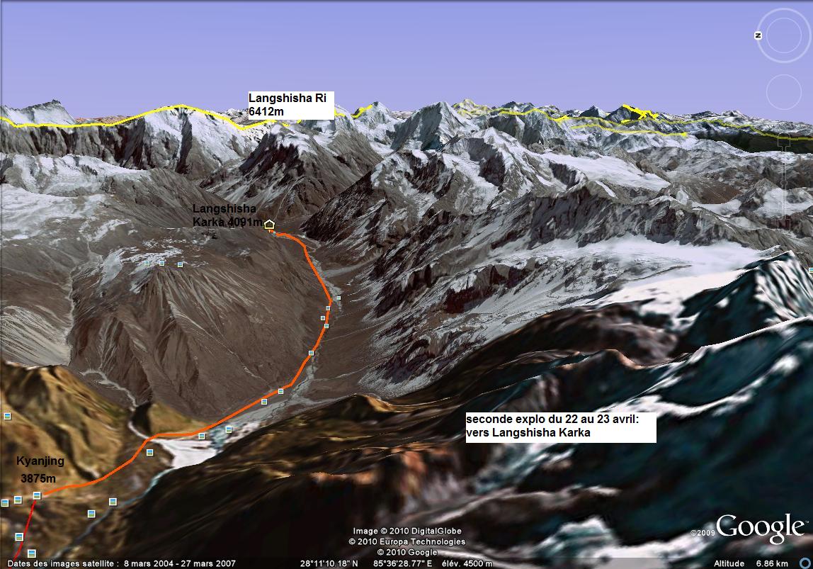
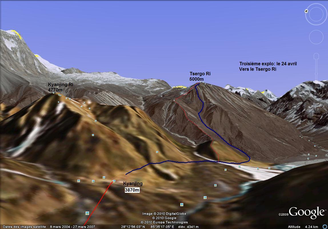
9. Points GPS (Garmin Etrex Vista H) et tracés :
Ils sont listés dans l’Annexe 1. Ils indiquent les points par lesquels nous sommes passés. Nous ne prétendons pas que ce soient les meilleurs ou uniques chemins pour arriver aux étapes, en particulier lors de la traversée des glaciers puisqu’ils bougent! Les altitudes indiquées par le GPS sont proches de celles indiquées par Google Earth
Le GPS est un confort pour ce type de trek. Il n’est pas indispensable. Il permet d’évaluer la distance restant pour parvenir à l’étape et de se rassurer quand le chemin s’efface un peu. Il faut dire que les conditions climatiques étaient très favorables. Certains passages des trois cols ou des deux glaciers dans le brouillard auraient nécessité l’usage du GPS pour un minimum de sécurité.
10. Le trek au jour le jour
1er jour De Lukla à Phakding (2633m) 7.5km en 3.5 heures, dénivelé -224m

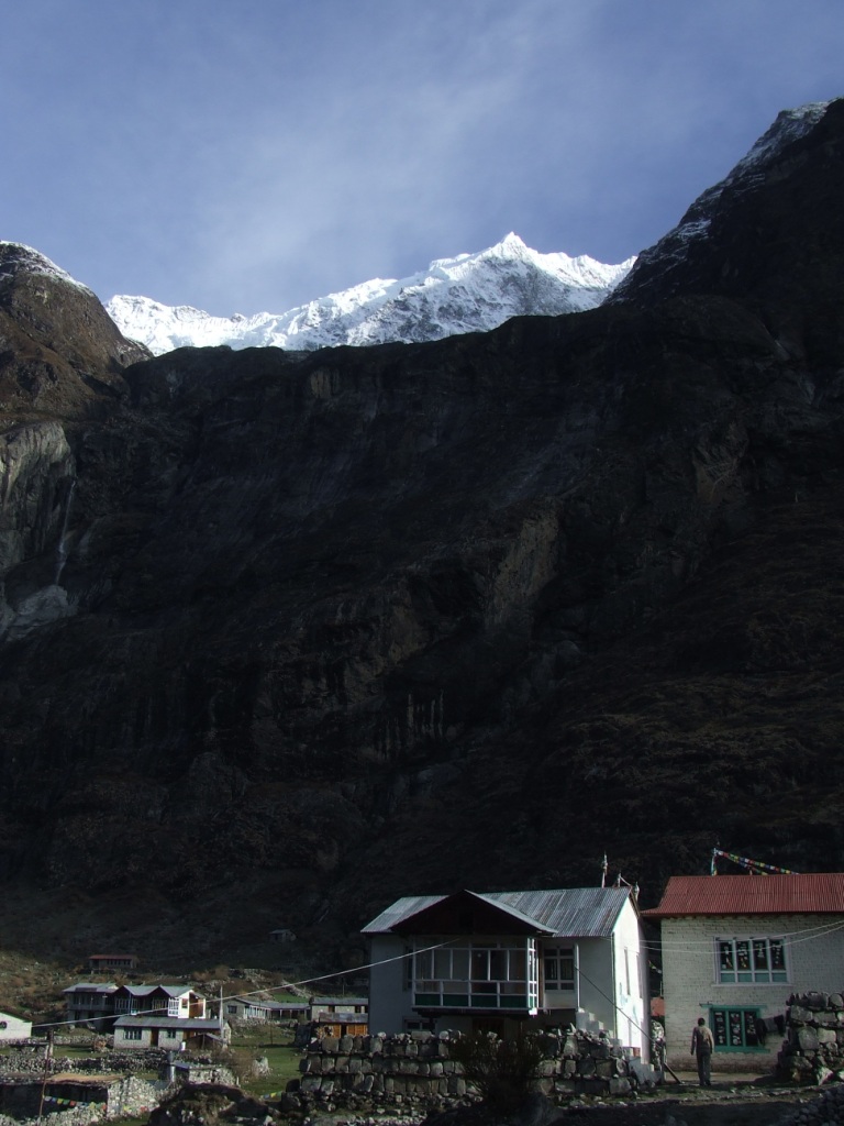
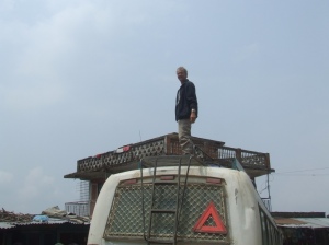
Bien que cela paraisse bizarre, nous sommes partis avant l’heure de l’aéroport de KTM. Il faut dire qu’à Lukla, c’est l’enfer. A peine un avion a déversé à la hâte son lot de marcheurs frais qu’il se remplit de trekkeurs épuisés pour filer chercher son envol sur la curieuse piste pentue et si courte ! Les hurlements des moteurs lancés à peine puissance, avant le décollage, sont entrecoupés du bruit des pâles des hélicoptères qui prennent leurs envols ou atterrissent sur un petit terrain juste à côté.


Il fait beau à Lukla et ce doit être un événement car l’activité fébrile de l’aéroport cache mal l’inactivité probable des jours précédents, due au brouillard, au vent ou à l’âge du capitaine.
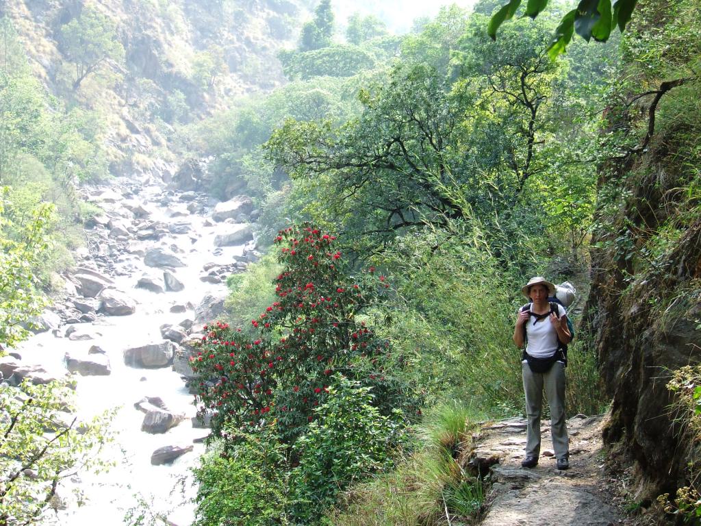
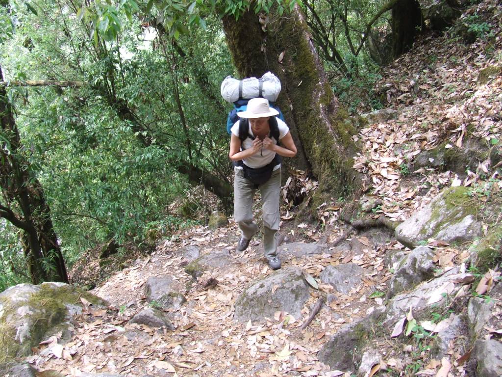
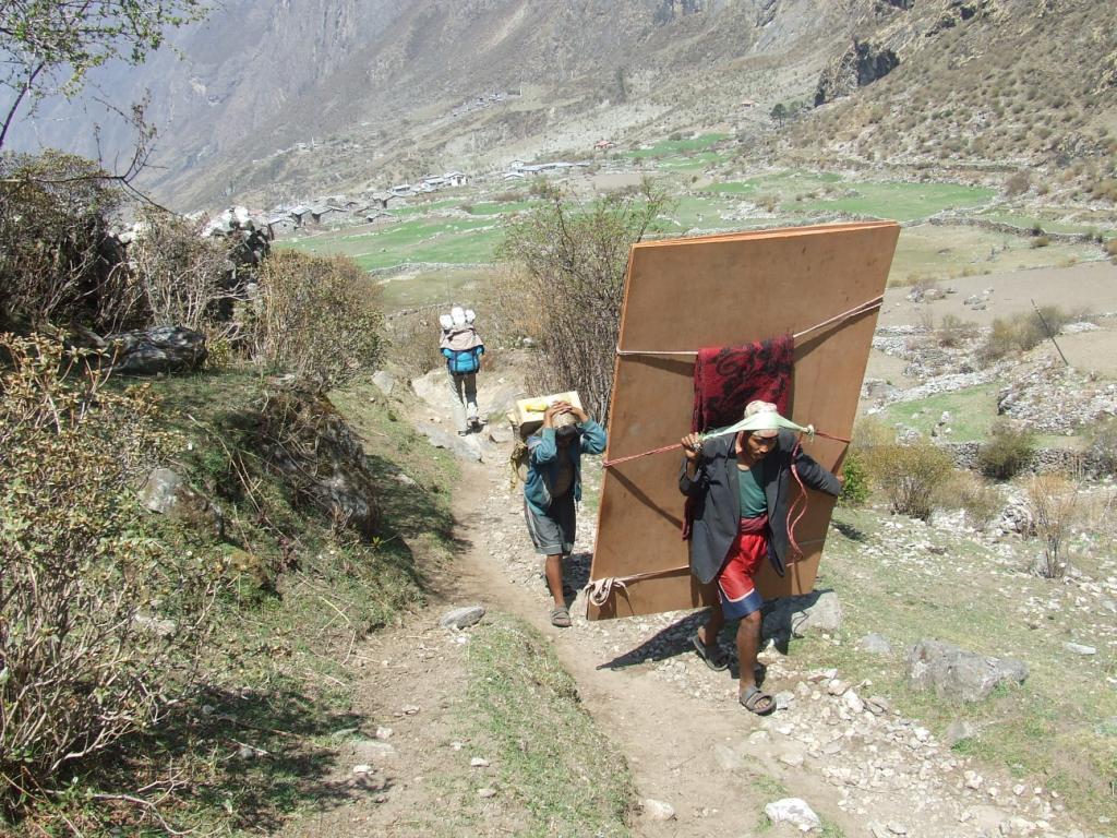
Nous avons hâte de nous enfuir, le temps de répartir les charges des sacs à dos. Le chemin est large, en descente et il fait bon. Nous marchons en tee shirts et le poids des sacs se fait à peine sentir. Il y a du monde sur la route et nous devons avoir croisé en une heure la quantité équivalente qui passe par le Makalu en une bonne année.
Traversée de villages pimpants garnis de lodges avenants alternant les forêts tropicales. Ca ne durera pas, au moins pour ce qui est de la végétation…


2ème jour de Phakding à Namche Bazar (3384m) 10.4km en 7h10, dénivelé +751m

T intérieur au réveil à 6h15 +9°C. Départ à 7h30
Il fait un soleil radieux de nouveau et il n’en faut pas plus pour nous mettre de bonne humeur.


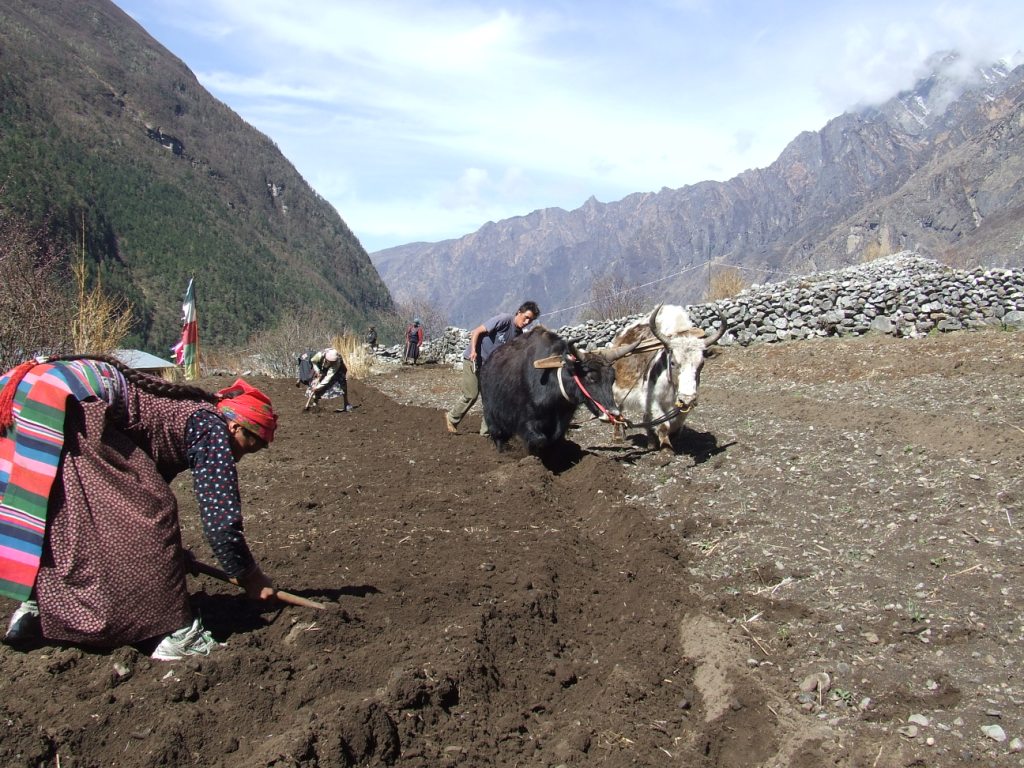
Nous achetons sans trop perdre de temps nos TIMS 2*2000Rs puis nos entrées dans le parc de Sagarmatha 2*3000Rs. Il vaut mieux ne pas resquiller car nous serons contrôlés plusieurs fois par des militaires sur la route avant Namche.
Si le TIMS a une utilité discutable, l’entrée du parc permet au moins de nettoyer les chemins. Il ya 12 ans, ils étaient parsemés de détritus. Aujourd’hui, ils sont réellement propres. Les chemins s’écartant de la voie principale ne font malheureusement pas l’objet de la même attention…
La journée est plus difficile car il faut affronter la terrible montée menant à Namche. J’espère ne pas arriver trop tard car c’est jour de marché. Mais les sacs décident de notre allure d’escargots.
La beauté des montagnes commence à apparaître au travers des pinèdes et nous découvrons au détour d’un virage, la silhouette encore éloignée de l’Everest.


A Namche, le marché est encore en place quand nous arrivons. Nous y faisons un petit tour après nous être installés dans un des nombreux lodges. Ici le téléphone fonctionne toujours (Ncell) et fonctionnera jusqu’à Gorakshep.
3ème jour Acclimatation à Namche Bazar
La journée est consacrée au repos et à une petite ballade aux environs de Namche. Nous repérons le chemin pour aller à Tengboche. Nous nous promenons dans les pâturages surplombant la ville pour rentrer déjeuner. Le temps se couvre dans l’après midi. La brume monte progressivement des basses vallées pour envahir la ville et disparaître avec la nuit.


4ème jour de Namche Bazar à Tengboche (3857m), 11.3km en 6h10, dénivelé +473m

T=12°C au lever à 6h.
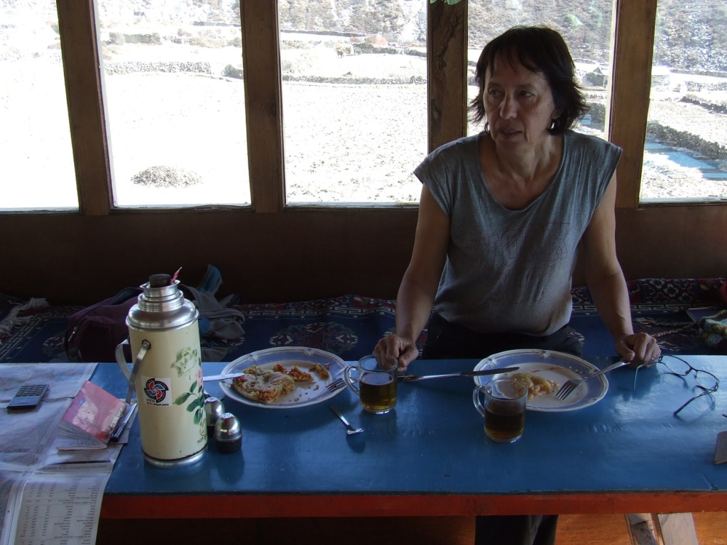
Le grand ciel bleu est au rendez-vous et nous prenons notre temps pour le petit déjeuner. C’est le moment pour se mettre en forme afin d’affronter les montées vers la haute montagne. Nous avons normalisé nos commandes devant le luxe des menus offerts : un small pot (1 litre !) de café au lait pour deux, un pancake au miel pour moi et du porridge pour Sylvie. Bref, le « ressuscitation kit » qu’on ne peut trouver que dans les zones de forte affluence touristique quand on sait qu’un repas, quel qu’il soit au Népal lorsqu’il n’est pas composé exclusivement de Dahlbat n’est pas un repas.
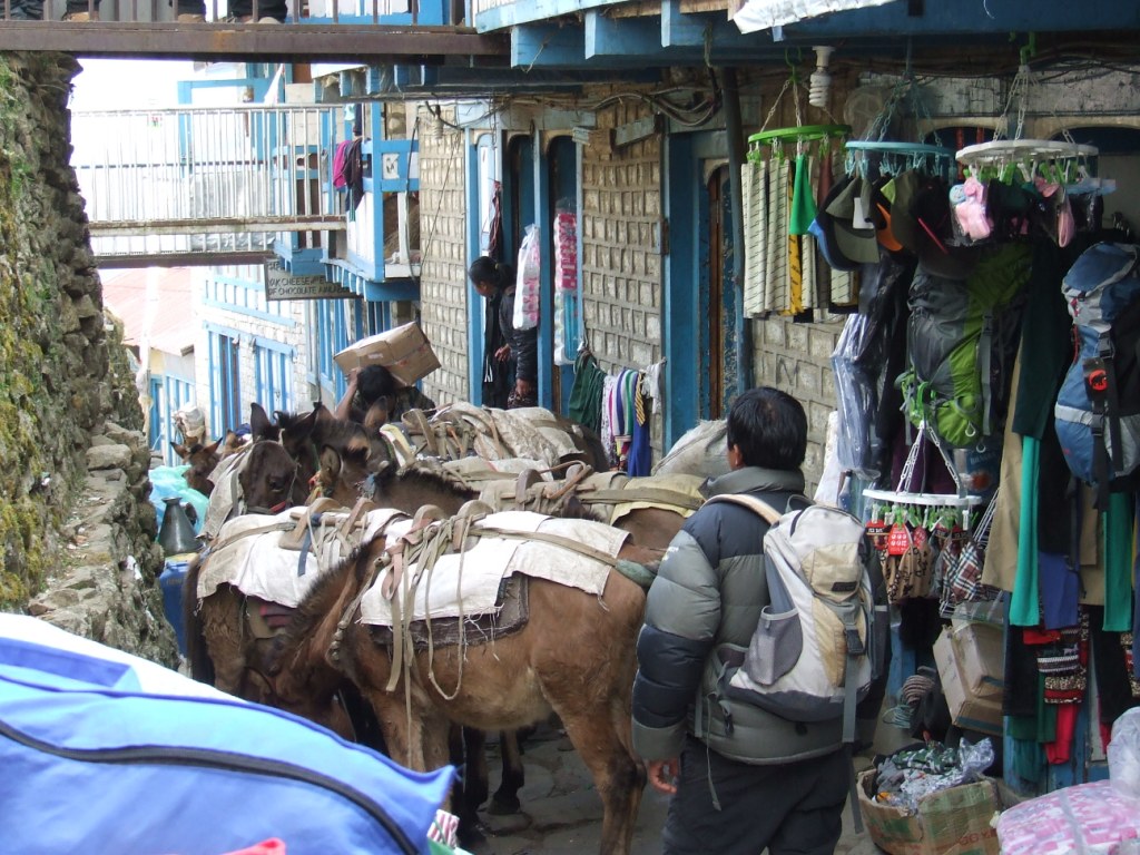
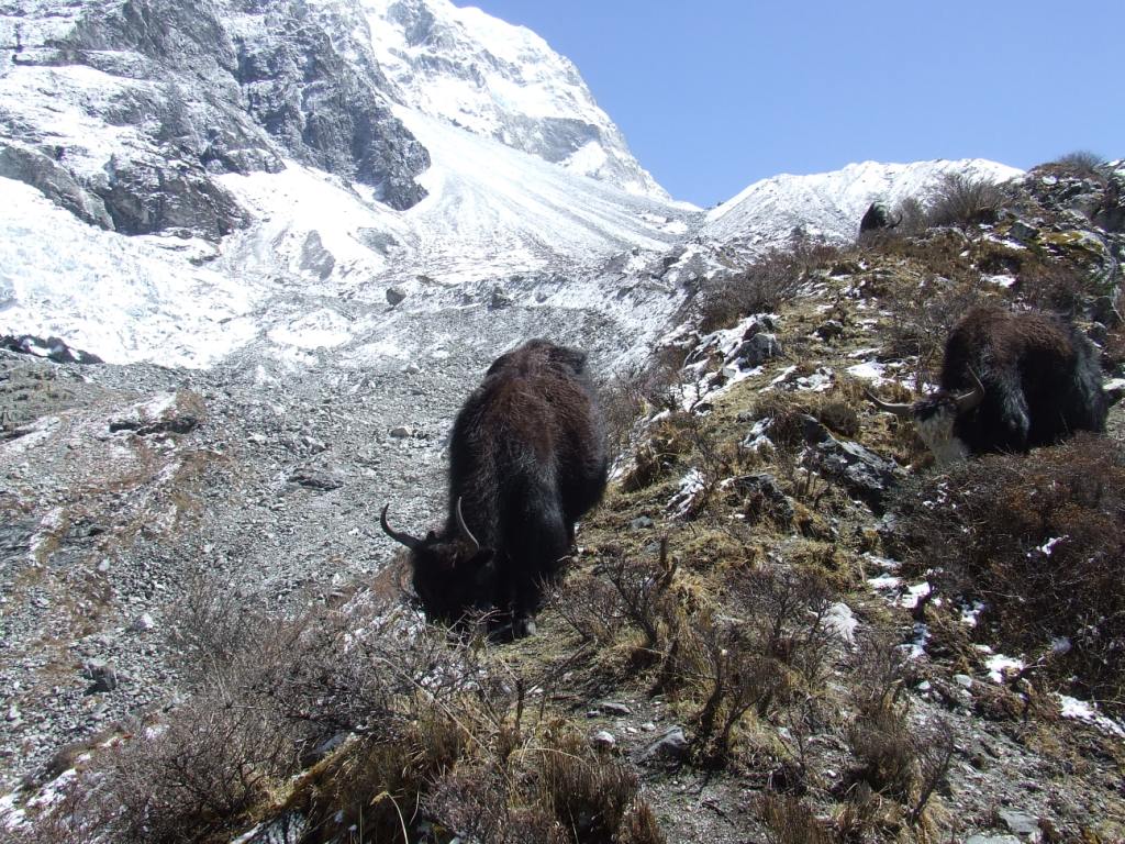
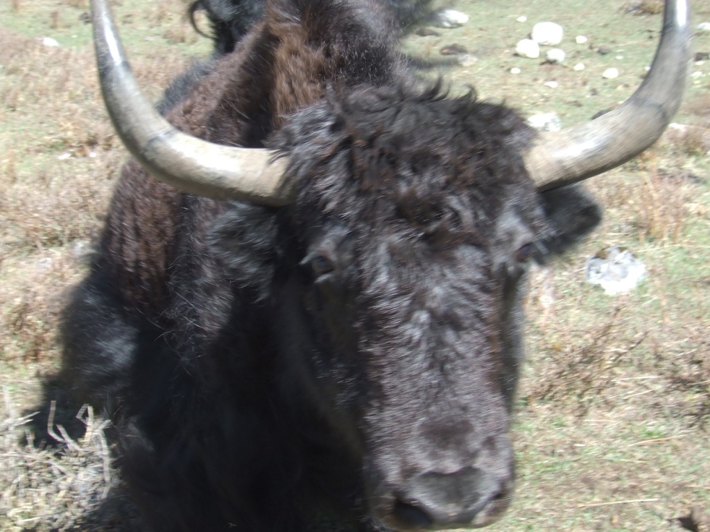
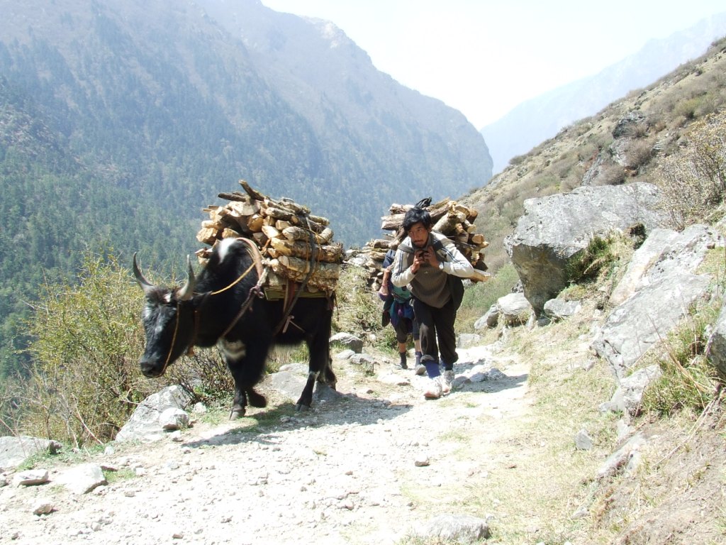
Nous ferons toujours attention de laisser les convois de mulets ou de yacks du côté versant du chemin. Un français est mort, peu de semaines auparavant, bousculé par le chargement d’un animal. Il est tombé dans le ravin et son corps n’a pas été retrouvé.

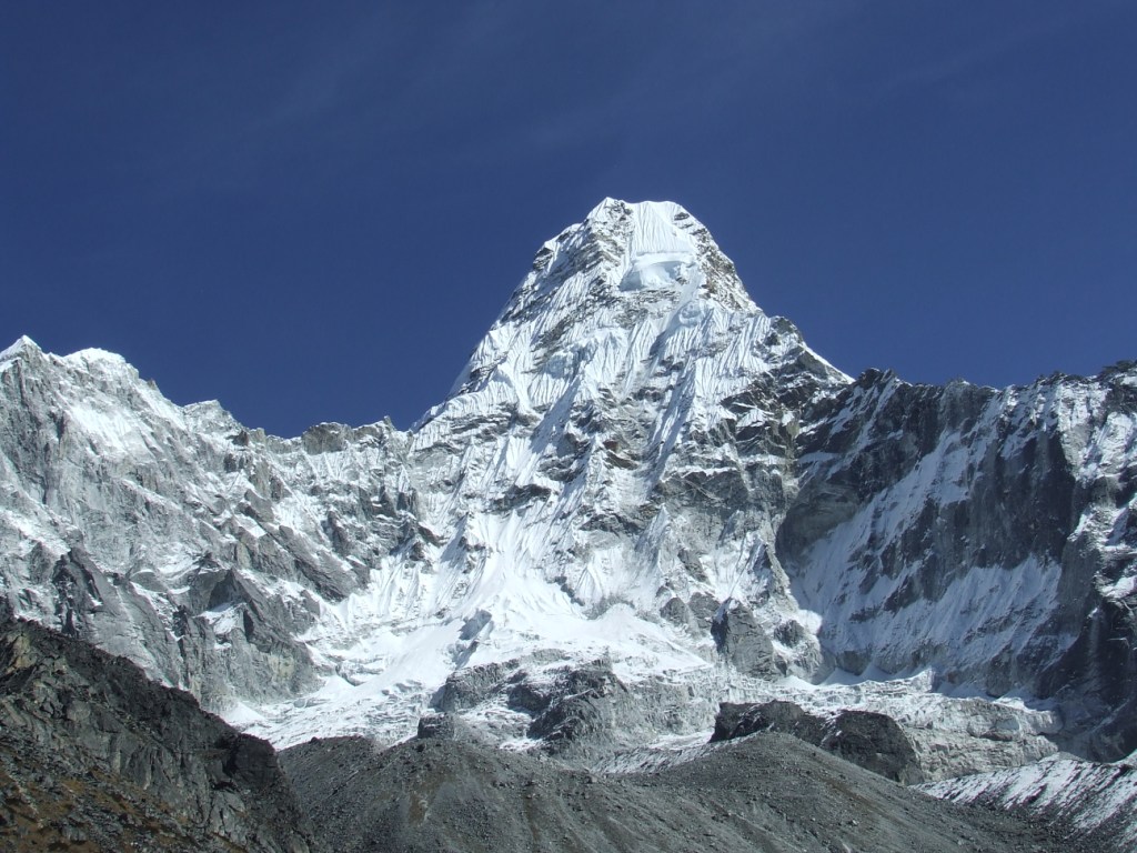
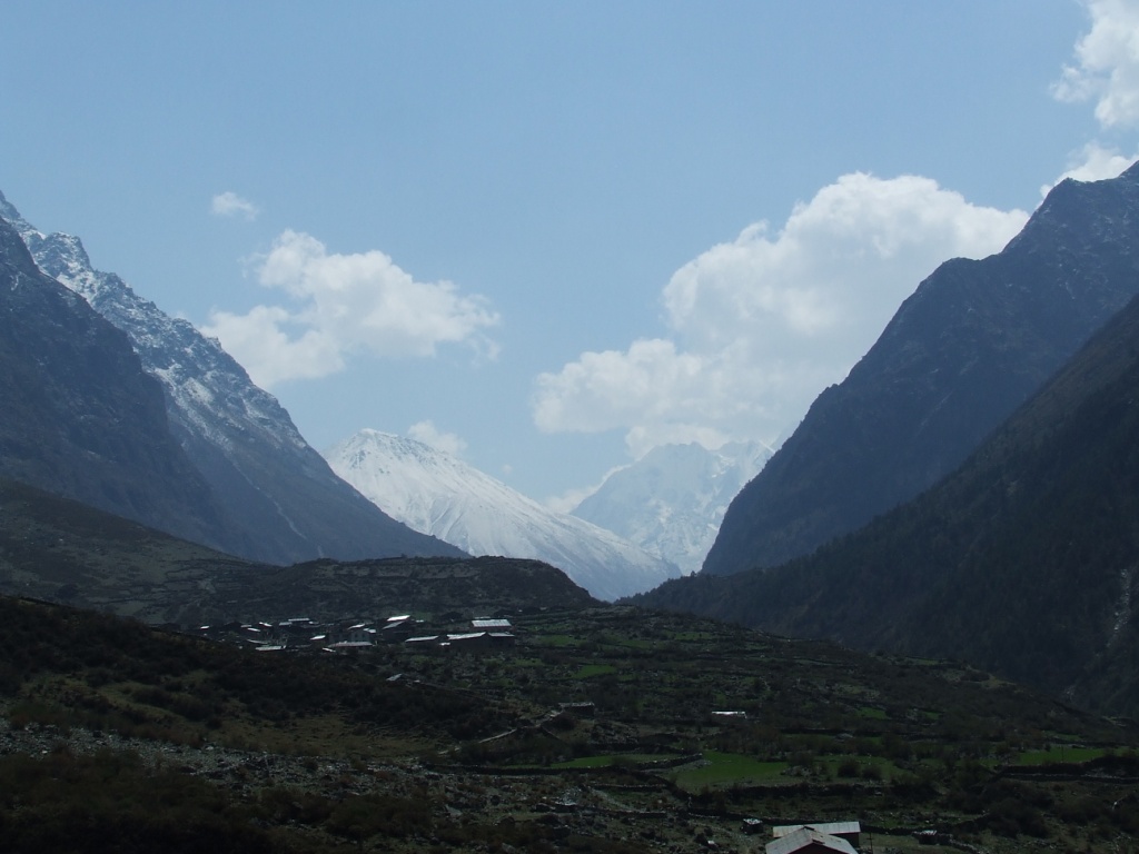
L’Ama Dablam fait sa première apparition à un détour du chemin. Nous devons nous rendre au pied de cette magnifique montagne puis la contourner pendant une dizaine de jour.

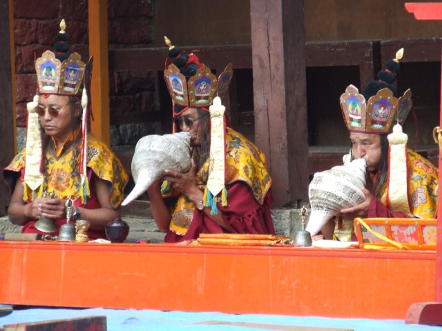
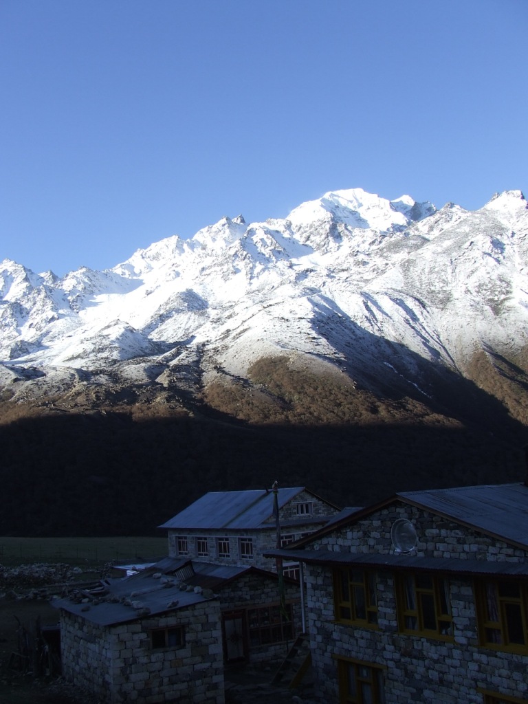
Nous arrivons à Tengboche à 13h30. Ce beau monastère, entouré de lodges en pierres sèches, nous accueille sur un promontoire aux panoramas superbes que nous pouvons même admirer de notre chambre. Nous assistons à des cérémonies bouddhistes auxquelles nous ne comprenons rien après un déjeuner copieux.
La nappe de brume n’arrive pas à franchir les coteaux que nous avons gravis dans la matinée et le ciel reste lumineux pour le spectacle des crêtes en feu au coucher du soleil.

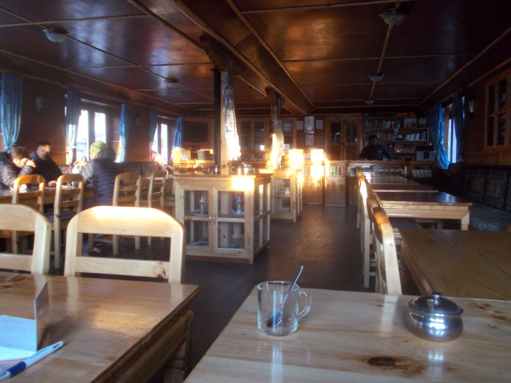
Je ne dénombre pas moins de 35 personnes dans la salle à manger bien chauffée au feu de bouses de yack séchées, dans la soirée. Nos premières parties de Rumi commencent, solution idéale pour passer agréablement le temps en attendant le diner.
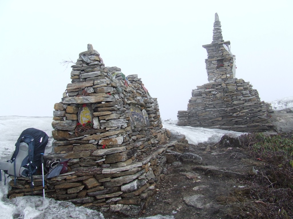
5ème jour Acclimatation à Tengboche, chörten à 4183m
Nous avons du temps et nous cherchons l’acclimatation à l’altitude en priorité. L’aspect magique du lieu est une opportunité pour passer la journée agréablement à nous reposer. Les migraines sont peu présentes et gérées à l’Ibuprofène.


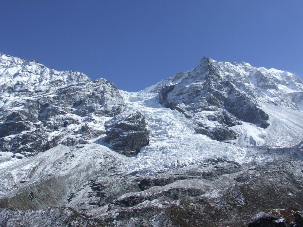
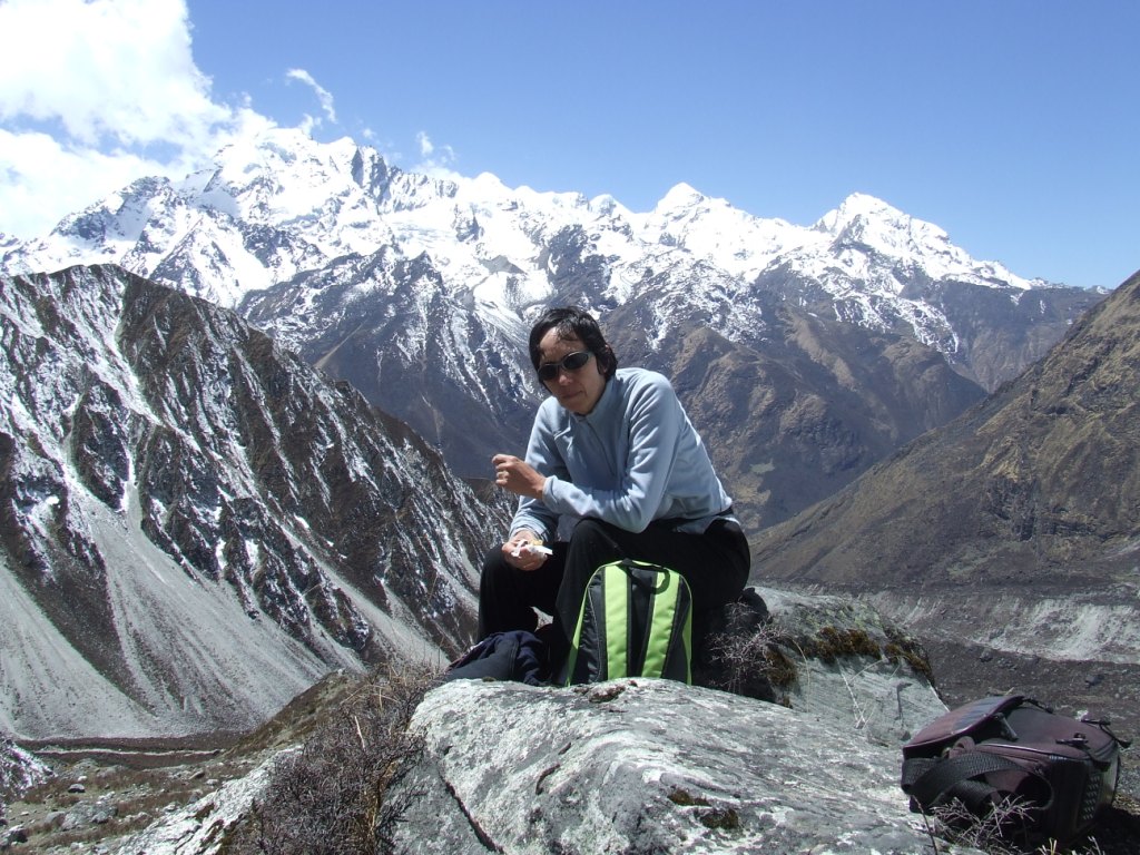
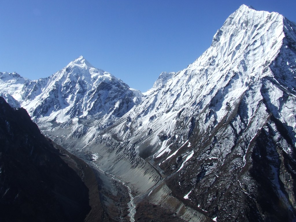
Le matin est consacré à rechercher et emprunter le seul chemin menant aux montagnes alentour. Je me rends à un petit chörten coiffant un sommet. Cela me permet de découvrir le glacier et le massif du Kangtega (6685m), l’Ama Dablam (6856m) ainsi que le massif du Nuptse (7861m), du Lhotse (8414m) et en arrière plan, déjà, l’Everest (8848m).


6ème jour de Tengboche à Pangboche (3955m), 4.4km en 2h20, dénivelé +98m

T=+2°C au levé à 6h.
Nous partons à 7h40. Les files de trekkeurs sont déjà en route. Nous devons apprendre à gérer leurs doublements ou croisements sur des chemins parfois étroits. Notre étape est courte et nous continuons la marche à notre rythme tranquille pour préserver l’équipage !

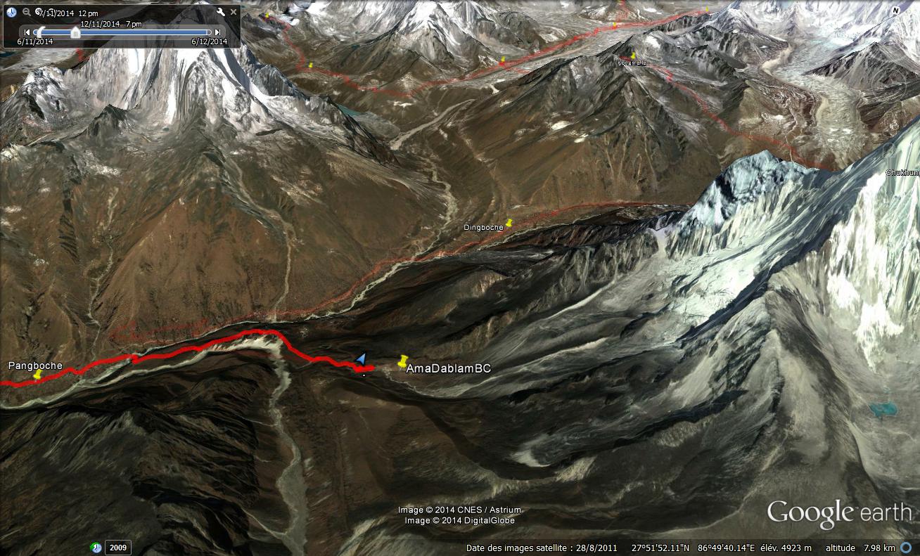
Nous traversons Pangboche pour nous installer dans le dernier lodge. Cela nous permet d’explorer facilement le chemin pour aller au Camp de Base de l’Ama Dablam.
On en profite pour se baigner dans le torrent. L’eau doit approcher les 3 ou 4°C. Le séchage au soleil est un vrai bonheur. La soirée se passe en compagnie d’Hervé, trekkeur solitaire. Il est bien le premier que nous rencontrons sans guide. Cela crée des mouvements de solidarité.
7ème jour de Pangboche au CB de l’Ama Dablam (4572m), 6.2km en 3h20, dénivelé +617m
T=1°C au lever à 6h. Nous partons à 8h20 pour arriver à 11h40 au camp de base. La montée est rude et Sylvie a un mal de tête persistant. Ce n’est pas bon signe. Le camp de base lui-même doit être un fond de lac bien plat. De nombreuses tentes d’alpinistes y sont installées.

Nous nous installons à quelques centaines de mètres à l’écart pour laisser place au rêve. D’autant plus que le camp est un peu en renfoncement et ne dispose pas de la plus belle vue.
Il fait toujours aussi beau mais le petit vent glacé a vite fait de nous transpercer. Nous déjeunons de pancakes préparés le matin à Pangboche et de saucisson. Celui-ci provoque une indigestion qui nous coupe les jambes l’après midi et la soirée, expérience malheureuse à ne pas renouveler !
Nous restons couchés dans la tente qui passe brutalement de 35 à 0°C au moment du coucher du soleil. C’est une longue nuit d’attentes et de sommeils entrecoupés.

8ème jour du CB de l’Ama Dablam à Pangboche, 6.2km en 1h45, dénivelé -617m
T=-4°C au réveil à 6h. Nous attendons que le soleil donne sur la tente pour aller préparer le petit déjeuner de muesli au lait et cappuccino. Le ciel est un peu laiteux ce matin. Nous replions le camp doucement pour partir vers 10h45. Nous arrivons au lodge à 12h30, épuisés mais les maux de tête et nausées sont pratiquement effacés. Nous avons l’après midi pour nous remettre définitivement de l’intoxication alimentaire. Le soleil est de nouveau radieux.

Je lave les cheveux de Sylvie avec l’eau chauffée sur notre réchaud. J’essaie de me raser et renonce définitivement à ce type d’exercice inutile pour la durer du trek. On verra à KTM.
La soirée se passe en compagnie d’un groupe d’espagnols, autour du poêle à bouses. Je me réveille la nuit avec une migraine et des difficultés pour respirer. Le manque d’oxygénation provoque les maux de tête. Nous ne sommes pas encore bien acclimatés.
9ème jour de Pangboche à Dingboche (4339m), 5.9km en 3h45, dénivelé +384m

T= 0°C au lever à 7h.
Nous partons tard vers 9heures car nous ne souhaitons pas rejoindre Chukhung aujourd’hui. L’expérience de la nuit nous prouve que nous ne sommes pas encore au point pour les hautes altitudes.


La montée est progressive aujourd’hui et nous profitons d’un panorama de plus en plus grandiose. Il nous faut prendre garde de prendre la bonne bifurcation car nous abandonnons la grande voie qui mène au camp de base de l’Everest. Dingboche, où nous nous arrêtons vers 12h45, est maintenant sur la route de l’Island Peak et du Renjo la, premier des trois cols que nous voulons gravir.

Je pensais que le chemin serait désormais désert mais il n’en est rien. Ce n’est plus la foule mais il y a encore quelques groupes de marcheurs sur la route. A Dingboche, des commerces permettent un éventuel approvisionnement en nourriture.
Nous trouvons un lodge qui donne sur l’Island peak et le Lhotse. La salle à manger est admirablement située, en surplomb, pour assister au coucher du soleil sur le Lhotse. Le steak de yack est excellent et nous redonne des forces. Quant à la chambre, elle est gratuite.


10ème jour de Dingboche au Camp du Lhotse (4912m), 7.3km en 3h, dénivelé +572m

T=0°C au lever à 6h30. Départ à 7h55. La montée est continue et douce. Nous arrivons à Chukhung vers 10h50 pour un prendre un thé et repartir vers 11h30. Il nous faut tâtonner pour trouver le chemin vers l’Island peak. Il devient plus confidentiel car majoritairement emprunté par les grimpeurs.

Nous trouvons vers 13 heures, à mi chemin du CB de l’Island peak, un emplacement avec vue sur le glacier du Lhotse et l’Ama Dablam. Le sol sablonneux est gelé et il faut un caillou pour enfoncer les piquets de la tente dans le sable. Il n’y a plus d’eau liquide ici et il faudra faire fondre la neige pour les repas.
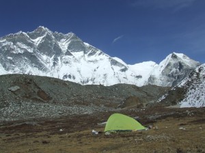

Je monte en fin d’après midi sur la moraine pour assister au coucher du soleil. Le ciel se voile de plus en plus et les éclats dorés sur les sommets sont un peu tamisés.

Diner de semoule agrémentée d’un cube bouillon, fromage, palets bretons et chocolat.
11ème jour du Camp du Lhotse à Chukhung (4726m), 2.2km en ¾ d’heure, dénivelé -186m
T=-11°C au réveil à 7h. Lever à 8h30 pour essayer de bénéficier des rayons du soleil, malheureusement absents.
La nuit a été froide mais la respiration semble meilleure. Le ciel est pour la première fois gris ce matin. Nous ne partons qu’à 10h30 car il faut du temps pour faire le petit déjeuner : Le gicleur du réchaud est bouché et il faut le démonter pour pouvoir allumer le feu.
Chaque piquet colle terriblement au sol gelé. Il faut creuser un cône tout autour de chacun avec le dos de la lame de l’Opinel pour les décoller de leurs gangues de sable glacé.
La descente sur Chukhung est rapide. Nous trouvons un « resort » fort sympathique qui ne coûte pas plus cher qu’un lodge… Du fait du temps bouché, nous annulons la montée au Chukhung ri. C’est dommage car Yannick, rencontré plus tard, nous dira que le spectacle en haut est de toute beauté.

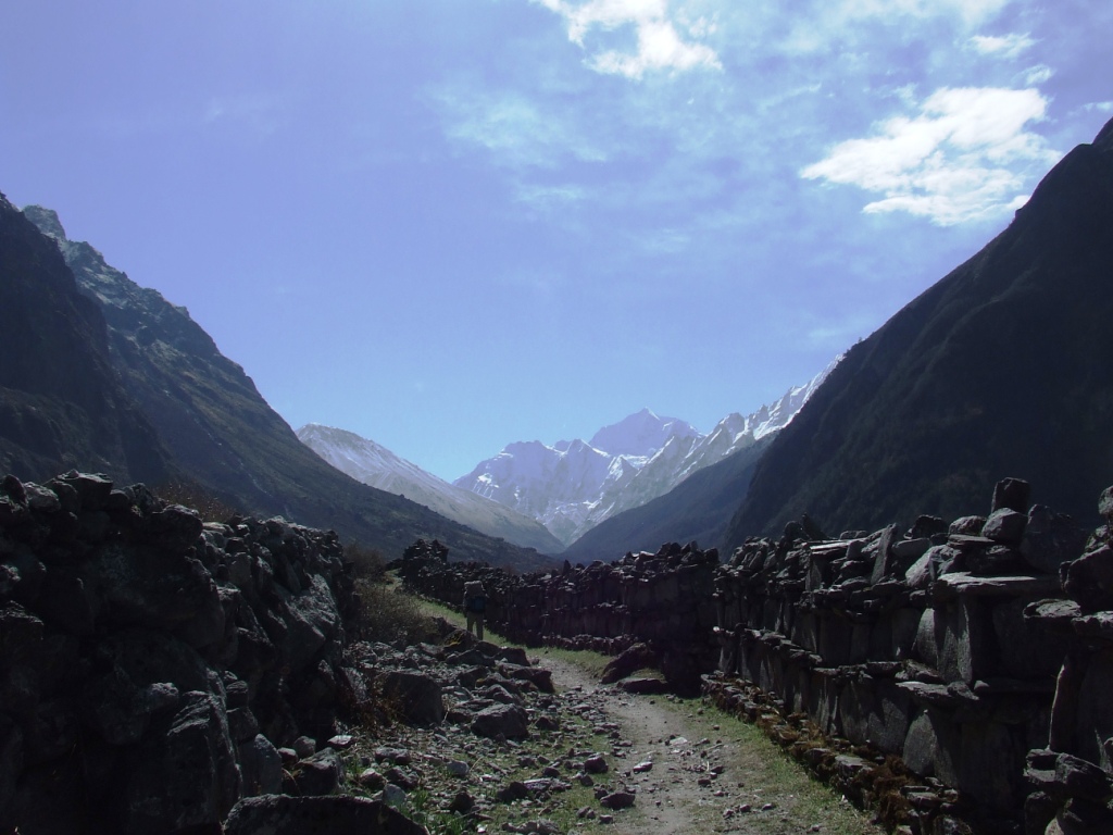
Nous partons dans l’après midi en reconnaissance du chemin menant à la Kongma la, première passe de notre périple.
Le ciel se dégage en fin d’après midi pour un d’autant plus superbe coucher de soleil qu’inattendu sur le Lhotse et la vallée

12ème jour de Chukhung au Camp du Khumbu (4906m), Kongma la (5514m), 9.3km en 9h40, dénivelé +180m

Nous nous levons un peu plus tôt, à 5h30 car la marche sera longue aujourd’hui. Le temps de l’acclimatation est achevé. Le chemin vers la passe de Kongma est bien tracé et monte régulièrement sur sa première partie. Le soleil a vite fait de nous rejoindre et de nous réchauffer.


La dernière partie est rude par contre car il nous faut franchir ce qui paraît être une vraie falaise. Sans tracé GPS ou physique, la progression serait aléatoire.

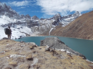
Arrivés sur le col lui-même vers 13h10, le spectacle est grandiose, avec un ciel totalement limpide.

Quelques volutes se forment au sommet du Lhotse et un lac d’un vert émeraude s’étend à nos pieds. Nous déjeunons sur la passe elle-même dans un recoin à l’abri du vent.
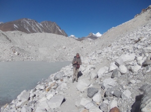
La descente est un vaste pierrier tapissé de glace à certains endroits. Nous avons laissé nos Microspikes au fond de nos sacs et nous ne sommes pas fiers de cette impréparation. Il nous faut parfois descendre sur les fesses pour éviter une chute fatale.


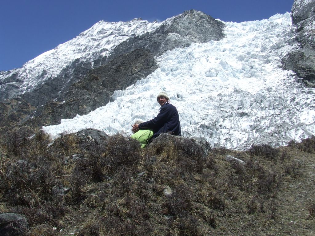
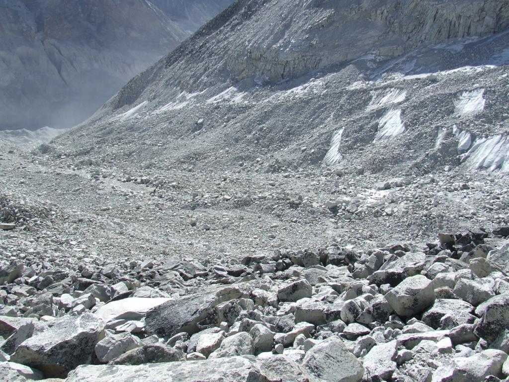
Nous arrivons vers 16h10 au pied de l’imposante moraine du glacier du Khumbu. Nous hésitons à la franchir car il est tard. Nous ne voulons pas prendre le risque de nous perdre sur son dos parsemé de crevasses et de lacs glacés. Nous décidons donc d’installer la tente sur un lit de sable gelé déjà à l’ombre. Ici comme au premier campement, nous ne trouvons pas de torrent pour l’approvisionnement en eau. Il nous faudra fondre de la neige pour préparer le repas de semoule mélangé à une soupe au poulet turque achetée à Namche bazar. Voilà la mondialisation vécue sur le terrain !


Beau coucher de soleil sur le Pumo ri (7165m). C’est notre nouvel ami après avoir abandonné l’Ama Dablam.
Nous nous couchons vers 6 heures après une partie de Rumi peu confortable : les pièces de papier sont instables sur les duvets… et il fait -12°C dans la tente.
13ème jour du Camp du Khumbu à Lobuche (4931m), 1.7km en 2h, dénivelé +25m

T=-3°C au lever à 8h30. Nous adoptons la même tactique qu’au premier camp en attendant confortablement dans nos duvets que le soleil vienne lécher les parois gelées de la tente.
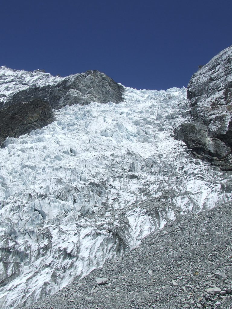
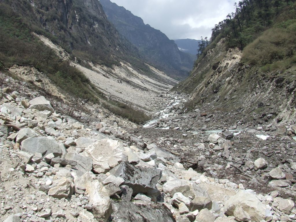
Nous traînons volontairement car l’étape sera courte aujourd’hui : il s’agit de traverser le plus grand glacier du monde.
Nous terminons à peine notre petit déjeuner lorsque deux gaillards déboulent de la passe. Il doit être 10 heures. Yannick et Fin sont partis à 6h ce matin de Chukhung et sont déjà au pied de la moraine en fin de matinée. Ils nous envient de pouvoir nous installer où nous voulons avec la tente mais ils sont aussi 4 fois plus rapides que nous. Ils espèrent traverser le glacier en 20 mn. Ils y passeront 1 heure pleine en traversant sans se préoccuper des cairns. Nous mettrons quant à nous 2 heures.


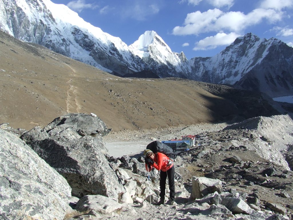
14ème jour de Lobuche à Gorakshep (5172m), Kala patar (5640m), 9km en 2h50 + KP, dénivelé +241m

Il n’y a pas loin de Lobuche à Gorakshep et il nous faut nous habituer de nouveau aux longues files organisées de trekkeurs aux bâtons cliquetant en rythme. La passe de Lobuche est un goulot d’étranglement dans lequel la patience n’est pas une option.


A Gorakshep, les lodges ne manquent pas et les prix continuent d’augmenter. Je négocie 300Rs une chambre à 500. Ils se rattraperont sans difficulté sur les repas. Nous y retrouvons Yannick et Fin qui redescendent tout juste du Kala patar. Quelle énergie ! Nous déjeunons ensemble avant qu’ils ne redescendent vers Lobuche. Plus fins négociateurs, ils n’ont pas payer pour leurs chambres (d’ailleurs, ils ne paient jamais).
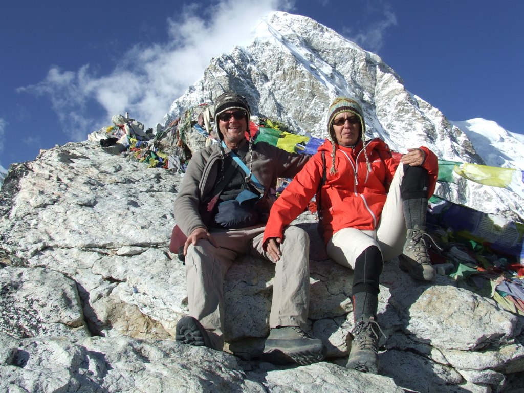
Nous partons vers 13h vers le Kala Patar pour arriver au sommet vers 15h15. Notre objectf est d’y attendre le coucher du soleil. Mon GPS indique 5640m, conforme au point relevé sur Google Earth. Yannick lui-même a relevé cette altitude à 10m près. Pourtant, l’altitude officielle n’y est que de 5545m. Je vois une petite colline en contrebas qui pourrait être l’« ancien » Kala Patar. C’est bizarre. Peut-être que l’Etat népalais veut éviter un classement dans la liste des trekking peaks, soucieux de ménager la poule aux œufs d’or ? Il ne faut pas le répéter mais il lui serait facile de collecter 5000€/jour en taxant la montée. Si cette hypothèse est juste, le trek sans guide obligatoire au Népal a de beaux jours.
Nous attendons deux longues heures que le soleil daigne se coucher. L’expérience est irremplaçable mais il nous faut gérer le froid.

Sylvie descend une petite ½ heure avant moi et je la rattrape dans la nuit. Il faut dire que son imperméable orange fluo doit être visible de la Lune. Toujours imprévoyants, nous avons oublié nos frontales. Nous mettons ¾ heure pour rejoindre le lodge.

15ème jour à Gorakshep. Aller retour au CB Everest (5247m) 4.6km en 3h30

T=-1°C au lever à7h30.
Je pars seul à 9h30 vers le camp de base de l’Everest, laissant Sylvie se reposer de sa descente d’hier. Un de ses ongles de doigts de pieds a explosé.
Sans le sac à dos, je me sens des ailes. J’y arrive vers 11h20. Il y a quelques trekkeurs mais aucune tente n’est plantée sur la moraine. Nous prévoyions initialement d’y camper mais nous avons préféré le confort du lodge… Je ne regrette pas la promenade car les paysages sont très différents des ceux qui ont précédé. Il s’agit d’entrer autant dans le glacier que sur son dos. C’est un monde de blocs de glace aussi gros que des icebergs comme figés dans leur chute vers la vallée.


L’absence de tente s’explique peut-être par la grève déclenchée par les Sherpa en mai 2014, à la suite de l’avalanche tuant une douzaine d’entre eux et laissant leurs familles dans un dénuement total. C’est un droit de risquer sa vie pour assouvir ses passions. Entraîner avec soi des individus qui le font pour survivre me semble choquant.
16ème jour de Gorakshep à Dzongla (4831m), 11km en 6h, dénivelé -341m

T=-1°C au lever à 6h30.
Mauvaise nouvelle ce matin : le gérant du lodge nous apprend que le gouvernement a décidé de fermer l’aéroport de Lukla du 26 au 28 novembre car un sommet du SARC[1] se déroulera à KTM. Notre avion doit partir le 30 et il risque d’y avoir foule à Lukla dans l’attente d’un retour sur KTM. Sans compter sur la météo qui peut très bien conjuguer ses efforts pour coincer des milliers de trekkeurs plusieurs jours supplémentaires. Cette nouvelle nous gâche le moral. Elle sera confirmée à Lobuche et Gokyo.
L’heure est à la descente. Nous nous dirigeons maintenant vers la seconde passe qui joint les vallées du Khumbu et du Ngozumba.


La descente vers Dzongla, en contournant en hauteur un lac superbe, est douce. Nous avons abandonné à Lobuche la route principale qui descend vers Namche. A Dzongla, plusieurs lodges se font concurrence malgré la faible fréquentation du chemin.
[1] SARC = South Asian Association for Regional Cooperation. Au cours de ce « sommet » sera décidée la construction d’un barrage hydroélectrique, cofinancée par le Népal et l’Inde pour un montant d’un milliard de dollars. Sanjaya (Friends of Nature) avait raison, lorsqu’en mai 2014, il prédisant que l’ « Or du Népal » étaient la force hydroélectrique à capter dans les montagnes et à distribuer sur tout le sous-continent indien. Il rêvait même, je me souviens, d’une voiture électrique pour tous les népalais.
On comprends mieux pourquoi Lukla est une souricière (annexe 2): l’aéroport de Kathmandu comprend sur un même lieu les parties domestique et internationale. Il n’est pas possible de gérer simultanément ces deux types de vols. Lorsqu’il faut vraiment faire atterrir des vols internationaux (cas évident de la réunion du SARC), il faut annuler tout ou partie des vols domestiques. C’est ce que fait ici le gouvernement dans sa grande sagesse!
17ème jour de Dzongla à Dragnag (4717m), Cho la (5369m) 9.1km en 8h30, dénivelé -120m

T=-5°C au lever à 5h30.
Nous partons à 6h45 pour une nouvelle marche éprouvante. Nous avons sorti nos microspikes cette fois-ci ! Nous nous déplaçons de nouveau dans un environnement grandiose et sous un ciel d’azur. Après une pente à 45°, nous arrivons sur le glacier. Les crampons sont très efficaces sur la glace et nous nous sentons en sécurité.


Le spectacle sur la passe est aussi magnifique et de nombreux cumulus se forment lorsque nous arrivons vers 11h15. Nous y déjeunons de biscottes, de comté et de chocolat Aldi… Le vent froid nous transperce comme à Kongma la.


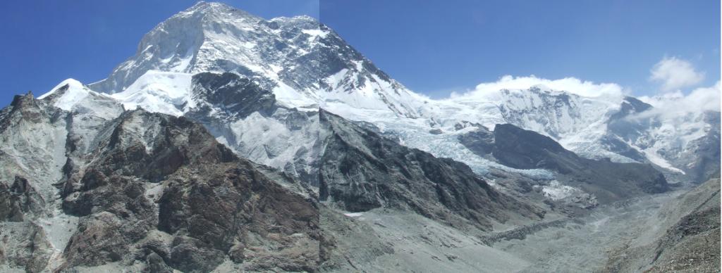
Le glacier du Ngozumba n’a rien à envier à celui du Khumbu. Il nous faudra le traverser demain.
La descente est aussi vertigineuse que la montée mais moins stable avec des gros cailloux qui ne demandent qu’à descendre avec nous. Il nous faut, à la suite, remonter un petit col imprévu qui culmine quand même à 5150m avant de rejoindre Dragnag, déjà dans l’ombre, à 15h15.


Avec les jours et surtout avec les nuits, l’esprit du trek a changé. Il était question initialement d’équilibrer une partie confortable en lodges avec une partie autonome, inconfortable mais permettant de jouir des montagnes, isolés dans les endroits les plus extraordinaires. Bien que les conditions ne soient pas plus dures qu’autour du Dhaulagiri ou dans le Makalu, nous perdons le courage d’installer la tente dans le grand froid, diner succinctement alors que le steak de yack et un poêle bien brûlant nous attendent à quelques kilomètres… C’est ainsi que nous renonçons progressivement à nous installer au camp de base du Cho Oyu…
Nous passons la soirée avec Didier, professeur breton à la retraite. Il marche dans l’autre sens avec un ami et sans guide.
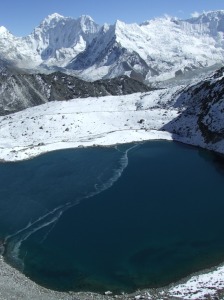
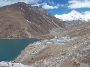
18ème jour de Dragnag à Gokyo (4758m), 4km en 3h20, dénivelé +47m

T=-4°C au lever à 7h
Nous partons à 8h10 en longeant le pend de la montagne vers le nord afin de rejoindre le chemin qui traverse le glacier du Ngozumba. Il est bien marqué sur le sol et nous suivons scrupuleusement les cairns. De temps en temps nous entendons la chute des pierres sur la glace déjà réchauffée par le soleil.


Les montées et les descentes sur le dos du glacier sont plus fatigantes que nous avions prévu. Le très beau temps de la matinée se couvre progressivement. Nous arrivons à 11h30 au Namaste lodge conseillé par Didier : la cuisine y est excellente. Coïncidence ou repère des bonnes fourchettes, nous y retrouvons Yannick et Fin.

Nous n’oublierons pas le Sizler de Yacks légumes frites.
Au téléphone, Tulsa de Yéti Airlines nous rassure. L’aéroport se rouvre le 28 et la fermeture n’aura pas d’incidence sur l’embarquement du 30 novembre. Soi disant.
On se paie le luxe d’une douche chaude l’après midi !
19ème jour à Gokyo. Aller retour vers le Cho Oyu (4965m), 8.8km en 3h30

La respiration a été difficile cette nuit, avec la migraine qui va avec. Tout rentre dans l’ordre avec de l’ibuprofène.
T=-5°C au lever à 7h.
Je passe un contrat verbal avec Sylvie : nous marcherons vers le Cho Oyu pendant 2 heures, pas plus… Le ciel est particulièrement clair ce matin. Nous dépassons d’un kilomètre le 4ème lac sans pouvoir apercevoir l’Everest sur la droite car il nous manque un petit kilomètre supplémentaire… Nous découvrons à gauche le Cho Oyu (8188m) et à droite le Gyachung Kang (7952m).


Sur le chemin du retour, nous croisons Arnaud et Christine. Nous nous retrouverons au Namaste !
20ème jour de Gokyo à Lumde (4400m), Renjo la (5366m), 11.5km en 9h40, dénivelé -358m

T=-4°C au lever à 5h30. La journée sera fatigante aujourd’hui car nous devons franchir notre troisième et dernier col, Renjo la. Nous partons à 7h20 pour atteindre le col à 12h30. Nous souffrons dans la montée mais les microspikes sont de nouveau très utiles. Nous en profitons pour couper le chemin tortueux en traversant les surfaces gelées.


Nous déjeunons au col où la vue est de nouveau superbe. Nous apercevons le Makalu (au fond à droite du Lhotse) au pied duquel je me trouvais en mai. Cette fois et à l’inverse du point de vue du Kala Patar, l’Everest est le plus haut, également en apparence.


La descente est aussi éprouvante. Cela est du, probablement, à l’accumulation de fatigue depuis le départ du trek. Sur la route, avant la grande descente vers Lumde, il y a des endroits magnifiques pour établir un campement au bord d’un torrent.

21ème jour de Lumde à Namche Bazar (3384m), 19.1km en 7h, dénivelé -1016m

T=-1°C au lever à 8h. Nous avons pris notre temps au petit déjeuner avec Arnaud et Christine. Ils marchent plus vite que nous mais nous nous retrouvons tous les soirs dans les mêmes lodges.
J’avais prévu une étape à Thame mais nous continuons vers Namche. Cela nous permet de gagner une journée pour gérer le départ de Lukla qui risque d’être difficile.
Nous passons du monde minéral et clair au monde des forêts et des brumes. En descendant, le temps se couvre et nous rentrons dans les nuages qui s’accrochent aux coteaux de la montagne.


La nuit est en train de tomber quand nous arrivons à Namche. La boucle est bouclée.
22ème jour de Namche à Phakding (2633m), 10.4km en 6h20, dénivelé -751m
Le ciel est gris sur Namche et le restera jusqu’à Phakding. La vallée en contrebas semble plongée dans la pénombre d’un conte de Tolkien. Nous téléphonons pour essayer de partir un jour plus tôt de Lukla.


23ème jour de Phakding à Lukla (2857m), 7.5km en 3h, dénivelé +224m
Le ciel reste gris toute la journée. Nous avons une impression de froid plus importante ici qu’en haute altitude. Aucun avion n’a atterri ou décollé aujourd’hui. Nous verrons bien demain.
Fin du trek.
Annexe 1 : Liste des points GPS
Coordonnées réelles Khumbu 2014
Voir le tableur complet avec agenda, dénivelés, possibilité d’organiser son propre trek etc. par l’onglet Autonomie Outils/Tableur spreadsheet Excel
Le site n’accepte pas les fichiers en .kmz. Le tracé se trouve sur Wikiloc, accessible à partir de cette page, sur le côté droit.
Annexe 2 : La souricière de Lukla
Pour sortir du Khumbu, il y a plusieurs solutions. Prendre l’avion , c’est en apparence la plus simple et la plus rapide : en à peine une demi heure, vous faites le trajet jusqu’à Kathmandu dans un bimoteur digne d’Indiana Jone. Statistiques : un crash par an, il suffit de l’éviter.
Vous pouvez sinon allonger votre trek de 5 jours en revenant par Jiri, sachant qu’il faudra additionner 11 heures de bus bien frappées pour rejoindre KTM. Pas de statistiques concernant les bus.
Enfin, la légende dit que vous pouvez aussi passer par un village nommé « Salery ». Le trek Lukla – Salery ne prend que 2 à 3 jours. Une jeep vous emmènerait ensuite vers Kathmandu en 17 heures sur un chemin qui n’a vraiment pas l’air carrossable sur la carte. L’enquête ne nous permet pas déterminer où arrive cette jeep hypothétique et les gens interviewés à Kathmandu sont pour le moins perplexe.
Reste l’hélicoptère qui peut voler dans des conditions de visibilité un peu moins exigeantes que l’avion, mais c’est beaucoup plus cher. Les prix montent sans limite lorsque les avions ne décollent plus. 400, 500, 700 USD. Business is business.
Car il faut savoir qu’avions et hélicoptères ne se déplacent qu’à vue, qu’ils ont à franchir des cols élevés dés le décollage puisque Lukla est entourée de monstres aux sommets enneigés.
Il faut aussi savoir que la météo à Kathmandu est très différente de celle de Lukla : Quand il est possible d’envisager un décollage au petit matin à Lukla parce qu’il n’y a pas encore de vent et que les brumes de la nuit se sont dissoutes avec le froid, Kathmandu baigne souvent dans un brouillard à couper au couteau. Quand le brouillard se lève enfin à Kathmandu, les vents se sont levés sur les cols et la brume envahit déjà le tarmac de Lukla.
Dans ces deux situations, les responsables des tours de contrôle, s’ils ne boivent pas le thé, interdisent tout décollage.
Bref, Lukla est une souricière.
Si vous décidez malgré tout de revenir à Kathmandu en avion, il reste trois règles d’or à respecter.
- Acheter un billet pour le premier vol du matin. Il vous rend prioritaire devant les cohortes de vol de la journée.
- Rester Zen et laisser poliment passez devant vous à l’enregistrement les groupes encadrés de guides graisseurs de pattes.
- Prier Sainte Claire pour que le temps ne se dégrade pas avant que vous ayez embarqué dans le zinc libérateur.
Une aventure vraie pour illustrer le processus:


 The spreadsheet « GPS » without data


